Download
Preview
Add to list
More
7.8 km
~2 hrs 47 min
739 m
Loop
“The Halls Fell, Blencathra, and Scales Tarn Loop is a moderately challenging, breathtaking 8 km trail in England's Lake District.”
Starting near Westmorland and Furness, England, the Halls Fell, Blencathra, and Scales Tarn Loop is a captivating 8 km (5 miles) loop trail with an elevation gain of approximately 700 meters (2,300 feet). This trail offers a medium difficulty rating, making it suitable for moderately experienced hikers.
Getting There
To reach the trailhead, you can drive or use public transport. If driving, head towards the village of Scales, which is easily accessible from the A66 road. For those using public transport, the nearest significant landmark is the town of Keswick. From Keswick, you can take a local bus service to Scales, which is a short ride away.
Trail Overview
The trail begins near the village of Scales, where you can find parking options. As you start your hike, you'll immediately notice the lush greenery and rolling hills characteristic of the Lake District. The initial part of the trail is relatively gentle, allowing you to warm up before the more challenging sections.
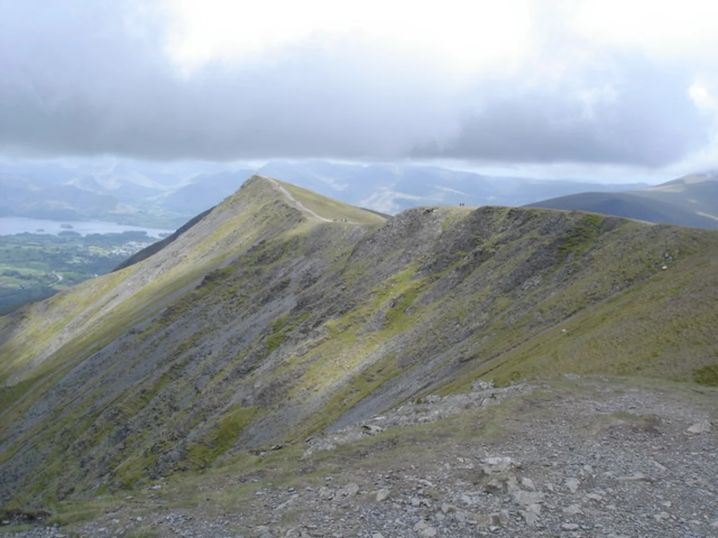
Halls Fell Ridge
Approximately 2 km (1.2 miles) into the hike, you'll reach Halls Fell Ridge. This section is known for its rocky terrain and requires careful footing. The ridge offers stunning panoramic views of the surrounding fells and valleys. As you ascend, you'll gain about 300 meters (1,000 feet) in elevation, making this one of the more strenuous parts of the hike.
Blencathra Summit
Continuing along the ridge, you'll eventually reach the summit of Blencathra, also known as Saddleback. At an elevation of 868 meters (2,848 feet), Blencathra is one of the most iconic peaks in the Lake District. The summit provides breathtaking views of the Northern Fells and, on a clear day, you can see as far as the Scottish Borders. This is a great spot to take a break and enjoy the scenery.
Scales Tarn
From the summit, the trail descends towards Scales Tarn, a picturesque glacial lake nestled in a natural amphitheater. The descent is steep and rocky, so take your time and watch your step. Scales Tarn is approximately 5 km (3.1 miles) into the hike and sits at an elevation of around 500 meters (1,640 feet). The tarn is a serene spot, perfect for a short rest and some photography.
Return to Scales
The final leg of the loop takes you back towards Scales. This section is less demanding, with a gradual descent through grassy meadows and along well-trodden paths. You'll pass through areas rich in flora and fauna, including heather, wildflowers, and possibly sightings of red squirrels and various bird species.
Historical Significance
The region around Blencathra has a rich history, with evidence of ancient settlements and Roman roads. The name "Blencathra" itself is derived from the Old Norse language, meaning "Devil's Peak," reflecting the mountain's rugged and imposing nature. Local folklore is filled with tales of mythical creatures and legendary figures, adding an element of mystique to your hike.
Navigation
For navigation, it's highly recommended to use the HiiKER app, which provides detailed maps and real-time updates to ensure you stay on track. The trail is well-marked, but having a reliable navigation tool can enhance your hiking experience and provide peace of mind.
This loop trail offers a blend of challenging ascents, stunning vistas, and serene natural beauty, making it a must-visit for any hiking enthusiast exploring the Lake District.

What to expect?
Activity types
Comments and Reviews
User comments, reviews and discussions about the Halls Fell, Blencathra and Scales Tarn Loop - Scales, England.
5.0
average rating out of 5
1 rating(s)