Download
3D Flyover
Add to list
More
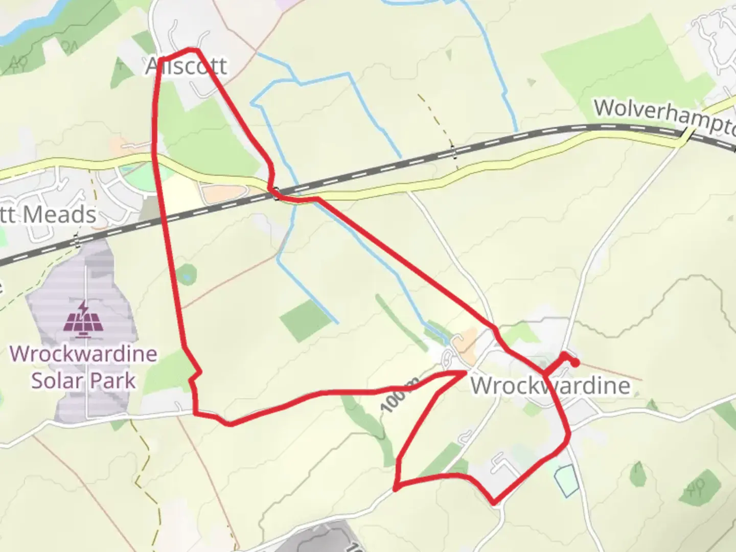
5.3 km
~1 hrs 10 min
64 m
Loop
“Meandering through rolling fields and centuries-old landmarks, the Wrockwardine loop is a tapestry of history and countryside charm.”
Nestled on the western edge of Telford, the Wrockwardine loop offers a scenic 5 km (about 3.1 miles) circuit with a gentle elevation gain of roughly 100 metres (328 feet), making it a rewarding yet manageable outing for most hikers. The trailhead is conveniently located near the historic village of Wrockwardine, just northwest of Telford, with the nearest significant landmark being St. Peter’s Church, a centuries-old parish church that marks the heart of the village.
Getting There
For those arriving by public transport, Telford Central railway station is the nearest major stop, with regular bus services (such as the Arriva Midlands 11 or 12) connecting to Wrockwardine village. If driving, parking is available near St. Peter’s Church (Wrockwardine, Telford TF6 5DG), which serves as a practical starting point for the loop.
Trail Overview and Navigation
The loop begins on quiet village lanes before transitioning to well-trodden footpaths and bridleways that weave through open farmland, gentle hills, and small patches of woodland. The route is clearly marked, but carrying a navigation tool like HiiKER is recommended, especially where the path crosses fields or merges with other local trails.
Landmarks and Points of Interest
St. Peter’s Church, dating back to the Norman period, is a highlight at the start and end of the loop. The churchyard offers views across the Shropshire countryside, and the building itself is a fine example of medieval architecture. About 1.5 km (0.9 miles) into the walk, the trail skirts the edge of Wrockwardine Hall, a Georgian manor house set among mature trees. Further along, at approximately 3 km (1.9 miles), you’ll pass near the site of the old Roman road, Watling Street, which once connected London to Wroxeter and Chester—remnants of this ancient route are still visible in the landscape.
Nature and Wildlife
The trail traverses a patchwork of arable fields, hedgerows, and small copses. In spring and summer, look for wildflowers along the verges and listen for skylarks and yellowhammers in the open fields. Mature oak and ash trees line sections of the path, providing habitat for woodpeckers and nuthatches. Roe deer are occasionally spotted at dawn or dusk, especially near the woodland edges.
Terrain and Trail Conditions
Expect a mix of gravel tracks, grassy paths, and short stretches of quiet country lane. After rain, some field crossings can become muddy, so waterproof boots are advisable. The elevation gain is gradual, with the highest point offering broad views toward The Wrekin, a prominent hill to the south that dominates the local skyline.
Historical Significance
Wrockwardine itself is steeped in history, with records dating back to the Domesday Book. The area was once a key crossing point for Roman and medieval travelers, and the agricultural landscape has changed little over the centuries. The village’s name is thought to derive from Old English, meaning “enclosure by the winding river,” a nod to the nearby River Tern.
This loop is ideal for those seeking a blend of rural tranquility, historical intrigue, and gentle exercise, all within easy reach of Telford’s urban amenities.

Comments and Reviews
User comments, reviews and discussions about the Wrockwardine, England.
average rating out of 5
0 rating(s)