Download
Preview
Add to list
More
4.8 km
~1 hrs 18 min
207 m
Out and Back
“Explore the dramatic gritstone escarpments and panoramic views of The Roaches trail in Staffordshire.”
Starting near Staffordshire, England, this approximately 5 km (3.1 miles) out-and-back trail offers a moderate challenge with an elevation gain of around 200 meters (656 feet). The trailhead is conveniently located near the village of Upper Hulme, which can be accessed by car or public transport. If driving, you can park at the designated parking area near the Roaches Gate. For those using public transport, the nearest train station is in Leek, from where you can take a local bus or taxi to Upper Hulme.
Trail Overview
The Roaches trail is renowned for its dramatic gritstone escarpments and panoramic views over the Staffordshire countryside. As you begin your hike, the initial section is a gentle ascent through a mix of heathland and rocky outcrops. The path is well-marked and maintained, making navigation straightforward. For precise navigation, consider using the HiiKER app, which provides detailed maps and real-time updates.
Key Landmarks and Points of Interest
Hen Cloud
Approximately 1 km (0.6 miles) into the hike, you'll encounter Hen Cloud, a prominent rocky outcrop that offers stunning views. This is a popular spot for rock climbers, so you might see some in action. The climb to the top of Hen Cloud is optional but rewarding, adding an extra 50 meters (164 feet) of elevation gain.
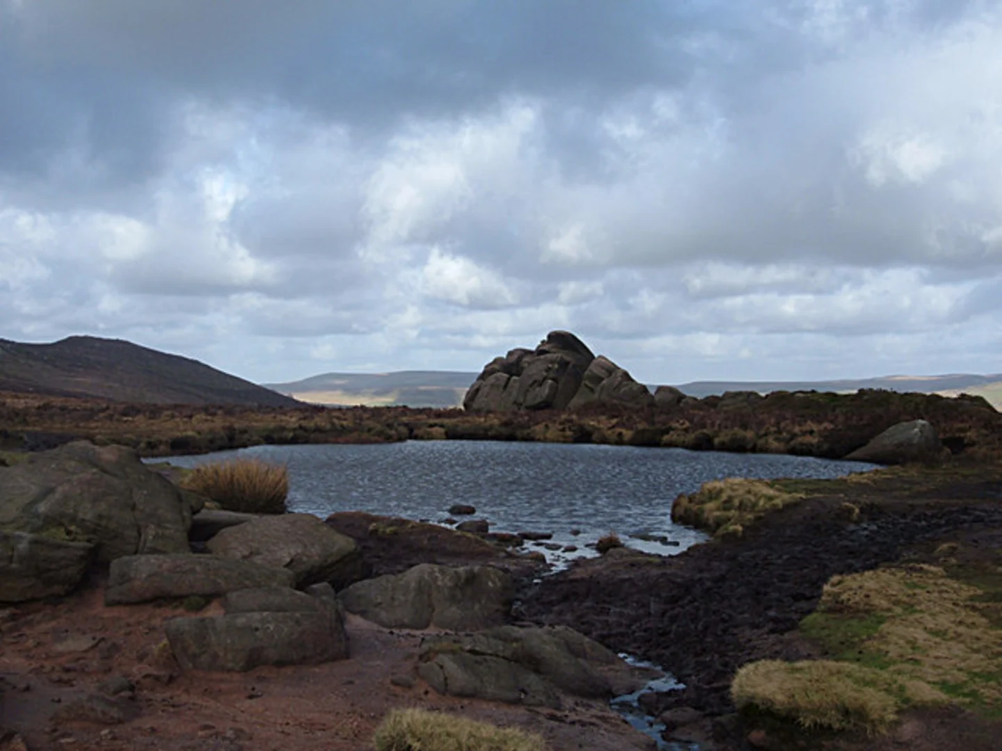
Doxey Pool
Continuing along the trail, around the 2 km (1.2 miles) mark, you'll come across Doxey Pool, a small, mysterious body of water nestled among the rocks. Local legend has it that the pool is bottomless and inhabited by a mermaid. It's a great spot for a short break and some photos.
The Roaches Ridge
As you proceed, the trail follows the ridge of The Roaches, offering expansive views of the surrounding landscape, including Tittesworth Reservoir to the east. The ridge is about 3 km (1.9 miles) from the start and is the highest point of the hike, providing a perfect vantage point for panoramic photography.
Flora and Fauna
The Roaches is a haven for wildlife enthusiasts. Keep an eye out for peregrine falcons, which nest in the cliffs, and red grouse in the heathland. The area is also home to a variety of wildflowers, especially in the spring and summer months, including heather and bilberry.
Historical Significance
The Roaches has a rich history, with evidence of human activity dating back to the Bronze Age. The area was also used for military training during World War II, and remnants of this can still be seen in the form of old bunkers and training grounds. The gritstone formations themselves are millions of years old, shaped by ancient geological processes.
Final Stretch
The return journey follows the same path, allowing you to take in the views from a different perspective. The descent is relatively easy, but be mindful of loose rocks and uneven terrain. The entire hike typically takes around 2-3 hours, depending on your pace and the number of stops you make.
Getting There
To reach the trailhead, if you're driving, set your GPS to Upper Hulme, Staffordshire. There is a small car park near the Roaches Gate. For public transport users, take a train to Leek and then a local bus or taxi to Upper Hulme. The nearest significant landmark for navigation purposes is the Roaches Tea Rooms, a popular spot for refreshments before or after your hike.

What to expect?
Activity types
Comments and Reviews
User comments, reviews and discussions about the The Roaches, England.
5.0
average rating out of 5
2 rating(s)