Download
Preview
Add to list
More
25.2 km
~6 hrs 12 min
706 m
Loop
“Sweep across moorland, ancient ramparts, and purple heather for a day rich in vistas and history.”
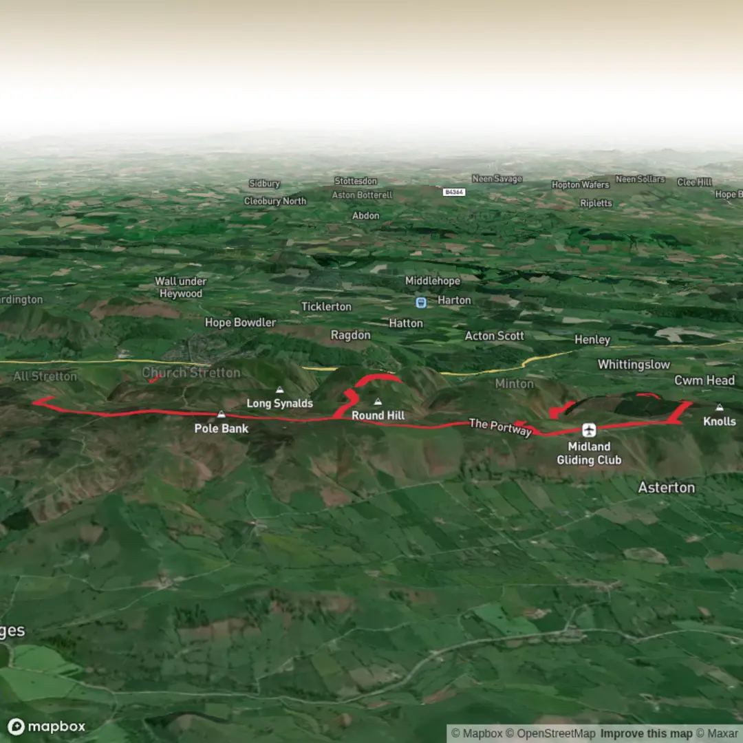
Starting from the car park near the summit of the Burway, just outside Church Stretton in Shropshire, this 25 km (about 15.5 miles) loop with roughly 700 metres (2,300 feet) of elevation gain offers a classic exploration of the Long Mynd and its surrounding valleys. The trailhead is easily accessible by car, with parking available at the Burway car park. For those using public transport, Church Stretton railway station is the nearest stop, with regular trains from Shrewsbury and Hereford; from the station, it’s a short taxi ride or a steep walk up to the Burway.
Initial Ascent and Pole Bank
The route begins with a steady climb along the open moorland, quickly gaining elevation as you head towards Pole Bank, the highest point on the Long Mynd at 516 metres (1,693 feet). The ascent is gradual but sustained, with wide views opening up over the Shropshire Hills Area of Outstanding Natural Beauty. On clear days, you can see as far as the Brecon Beacons and the Malvern Hills. The summit is marked by a trig point and a toposcope, making it a popular spot for a rest and photos.
Broadhill Dale and the Heart of the Mynd
Descending from Pole Bank, the trail drops into Broadhill Dale, a secluded valley known for its heather moorland and the occasional sighting of wild ponies and red grouse. The path here can be boggy after rain, so waterproof boots are recommended. The dale is rich in birdlife, especially during spring and summer, when skylarks and meadow pipits are abundant. The landscape is shaped by centuries of sheep grazing, and you’ll pass several ancient boundary stones and earthworks.
Bodbury Hill and Historic Features
Climbing out of Broadhill Dale, the route ascends Bodbury Hill, a lesser-known but striking summit with panoramic views back across the Mynd and down into the Stretton Valley. Bodbury Hill is notable for its Iron Age hillfort, with visible earth ramparts that once protected a prehistoric settlement. This area is steeped in history, with evidence of Bronze Age burial mounds and medieval trackways crisscrossing the hillsides. Take time to explore the ramparts and imagine the strategic importance of this vantage point in ancient times.
Navigation and Trail Conditions
The loop is well-trodden but crosses open moorland and remote valleys where paths can be faint or disappear in bracken during summer. Carry a detailed map and use HiiKER for reliable navigation, as weather can change rapidly and visibility may drop. There are few waymarks, so confidence with map-reading is essential, especially in mist or low cloud.
Flora, Fauna, and Seasonal Highlights
Throughout the hike, expect to see a mosaic of heathland, bilberry patches, and gorse. In late summer, the hills are carpeted in purple heather. Red kites and buzzards are often seen soaring overhead, and the area is home to rare butterflies such as the small heath. In autumn, the valleys glow with golden bracken, and the crisp air makes for invigorating walking.
Access and Facilities
There are no facilities on the route itself, so bring sufficient water and food for the day. The nearest shops, pubs, and toilets are in Church Stretton, which also serves as a good base for accommodation. Mobile signal can be patchy on the higher ground, so plan accordingly.
This loop offers a blend of challenging terrain, sweeping views, and a deep sense of history, making it a rewarding day out for well-prepared hikers.

Surfaces
Unknown
Asphalt
Ground
Unpaved
Gravel
Dirt
Grass
Wood
Concrete
Comments and Reviews
User comments, reviews and discussions about the Pole Bank, Broadhill Dale and Bodbury Hill Loop, England.
average rating out of 5
0 rating(s)