Download
Preview
Add to list
More
8.0 km
~1 hrs 44 min
84 m
Loop
“Explore Cropredy's historical charm, serene canals, and scenic farmland on this accessible 8 km loop trail.”
Starting near the charming village of Cropredy in Oxfordshire, England, the Round Cropredy Walk and Oxford Canal Walk is an 8 km (approximately 5 miles) loop trail with no significant elevation gain, making it accessible for most hikers. The trailhead is conveniently located near the village, which can be reached by car or public transport. If driving, you can park near the Cropredy Village Hall. For those using public transport, Cropredy is accessible via bus services from Banbury, which is well-connected by train to major cities like London and Birmingham.
Trail Overview
The trail begins in the picturesque village of Cropredy, known for its historical significance, particularly the Battle of Cropredy Bridge during the English Civil War in 1644. As you start your hike, you'll pass through the village's quaint streets, lined with traditional stone cottages and the 13th-century St. Mary the Virgin Church, a notable landmark worth a visit.
Oxford Canal Section
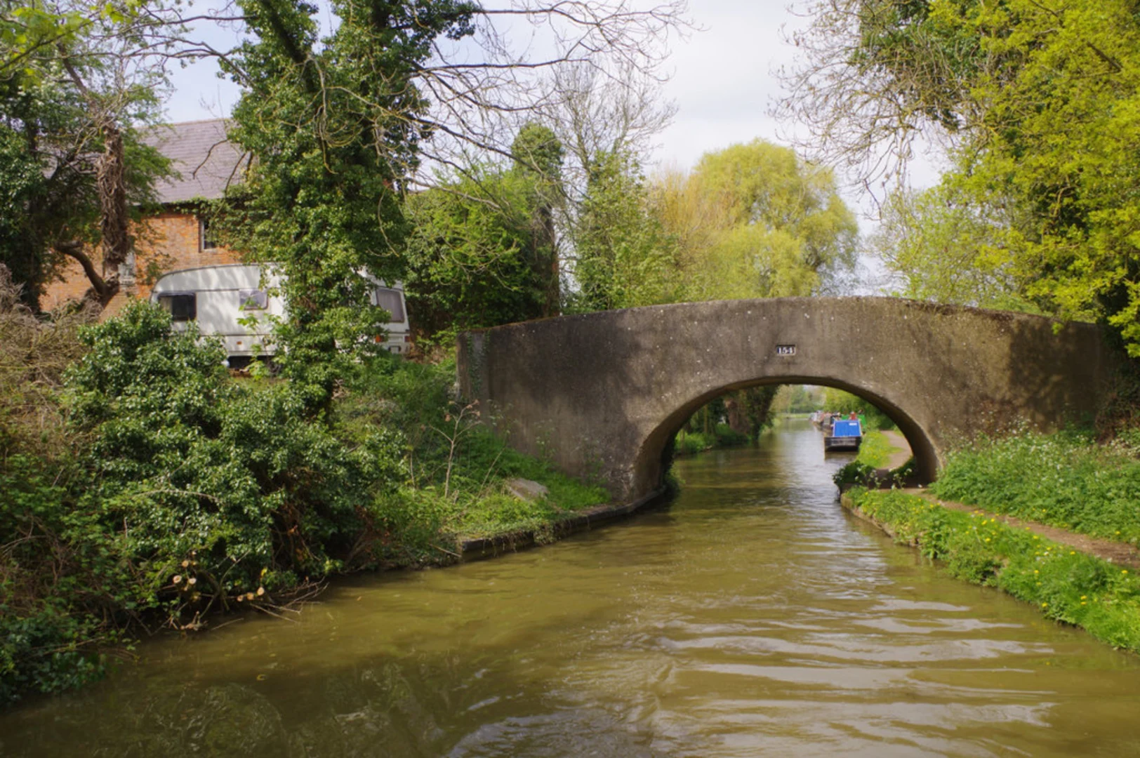
Approximately 2 km (1.2 miles) into the hike, you'll join the Oxford Canal towpath. This section of the trail is particularly scenic, offering serene views of the canal, narrowboats, and the surrounding countryside. The canal, completed in the late 18th century, was a crucial waterway for transporting goods between Oxford and Coventry. Today, it provides a peaceful setting for walkers and boaters alike.
As you follow the towpath, keep an eye out for various species of waterfowl, including ducks, swans, and herons. The canal's banks are also home to a variety of wildflowers, especially vibrant in the spring and summer months.
Fields and Farmland
Leaving the canal behind, the trail takes you through open fields and farmland. This part of the hike offers a different kind of beauty, with expansive views of the rolling Oxfordshire countryside. Depending on the season, you might see fields of wheat, barley, or rapeseed in full bloom. The farmland is also a habitat for local wildlife such as rabbits, foxes, and various bird species.
Historical Landmarks
As you loop back towards Cropredy, you'll pass several historical landmarks. One notable site is the Cropredy Bridge, where the aforementioned battle took place. The bridge itself is a modest structure, but its historical significance adds a layer of depth to your hike. Informational plaques provide context about the battle and its impact on the region.
Navigation and Safety
Given the trail's moderate difficulty, it's suitable for most hikers, including families with children. However, it's always wise to be prepared. Use the HiiKER app for accurate navigation and to stay on track. The trail is well-marked, but having a reliable navigation tool ensures you won't miss any turns or points of interest.
Getting There
For those driving, set your GPS to Cropredy Village Hall, located on Station Road, Cropredy, Banbury OX17 1PQ. If you're taking public transport, catch a train to Banbury and then a bus to Cropredy. The bus journey is short, and services run regularly.
This trail offers a delightful mix of historical intrigue, natural beauty, and peaceful canal-side walking, making it a rewarding experience for any hiker.

What to expect?
Activity types
Comments and Reviews
User comments, reviews and discussions about the Round Cropredy Walk and Oxford Canal Walk, England.
4.63
average rating out of 5
8 rating(s)