Download
Preview
Add to list
More
7.0 km
~1 hrs 48 min
247 m
Loop
“Explore Thrunton Wood's 7 km trail for stunning views, historical intrigue, and a moderate hiking challenge.”
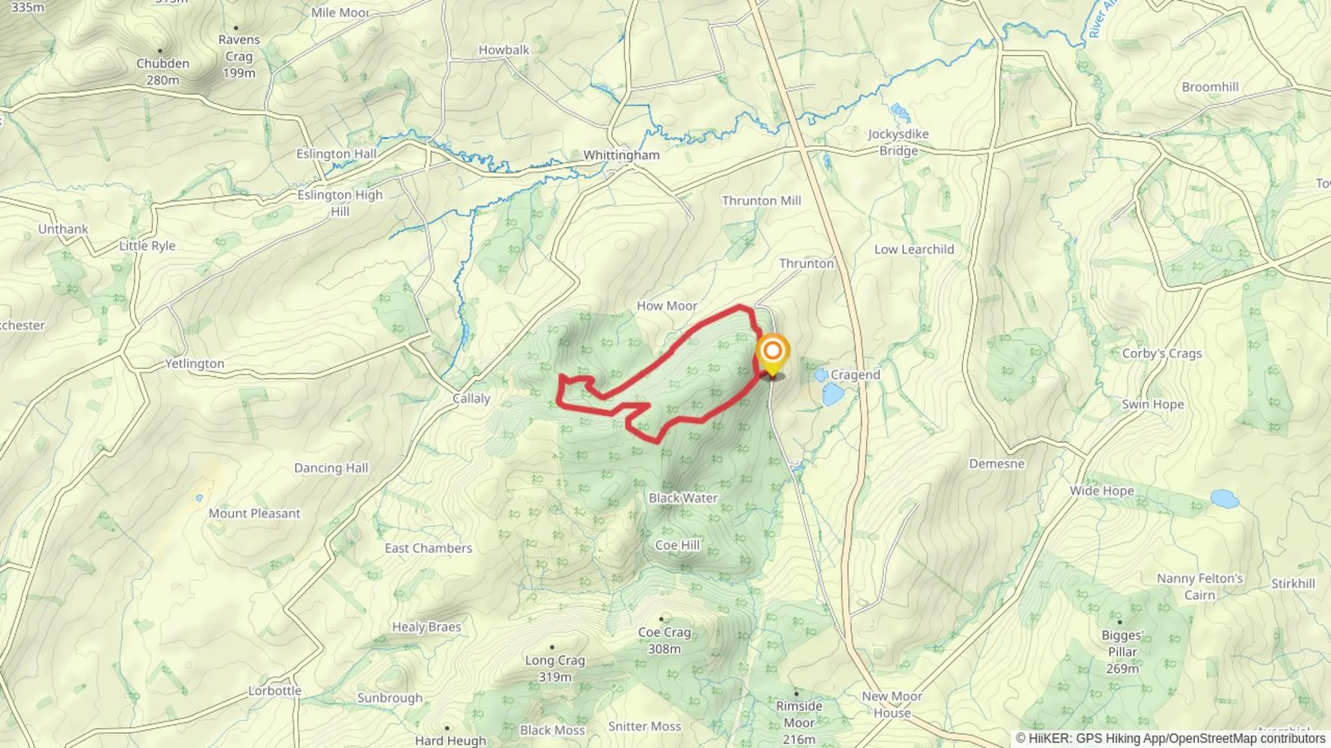
Starting near Northumberland, England, the Thrunton Wood trail is a delightful 7 km (4.3 miles) loop with an elevation gain of approximately 200 meters (656 feet). This medium-difficulty trail offers a mix of natural beauty, historical intrigue, and a moderate challenge suitable for most hikers.
Getting There
To reach the trailhead, you can drive or use public transport. If driving, set your GPS to Thrunton Wood Car Park, located off the A697 near the village of Thrunton. For those using public transport, the nearest significant landmark is Alnwick, where you can catch a bus or taxi to the trailhead.
Trail Overview
The trail begins at the Thrunton Wood Car Park, where you will find ample parking and basic facilities. From here, the path quickly immerses you in a dense forest of conifers and mixed woodland. The initial section is relatively flat, making it a good warm-up for the more challenging parts ahead.
Key Sections and Landmarks
The Climb
Around the 1.5 km (0.9 miles) mark, you will start to notice a gradual incline. This section takes you through a series of switchbacks, gaining elevation steadily. The climb is not overly strenuous but will get your heart rate up. Keep an eye out for the diverse flora, including ferns and wildflowers, which add a splash of color to the green canopy.
Thrunton Crag
At approximately 3 km (1.9 miles), you will reach Thrunton Crag, one of the most significant landmarks on the trail. This rocky outcrop offers panoramic views of the surrounding countryside, including the Cheviot Hills in the distance. It's a perfect spot for a break and some photography. The elevation gain to this point is about 150 meters (492 feet).
Historical Significance
The area around Thrunton Wood has a rich history. During World War II, the woods were used for military training exercises. You might come across remnants of old bunkers and training grounds, adding a layer of historical intrigue to your hike.
Wildlife and Nature
Thrunton Wood is home to a variety of wildlife. Keep an eye out for red squirrels, deer, and a plethora of bird species, including woodpeckers and owls. The diverse ecosystem makes it a haven for nature enthusiasts.
Navigation
The trail is well-marked, but it's always a good idea to have a reliable navigation tool. HiiKER is an excellent app for this purpose, providing detailed maps and real-time tracking to ensure you stay on course.
The Descent
After enjoying the views from Thrunton Crag, the trail begins to descend. This section is less steep but can be slippery, especially after rain, so watch your footing. The descent takes you through more mixed woodland, eventually looping back to the starting point.
Final Stretch
The last 1.5 km (0.9 miles) of the trail are relatively flat and easy, allowing you to cool down as you make your way back to the car park. This section is a great opportunity to reflect on the hike and enjoy the serene environment.
Practical Tips
- Wear sturdy hiking boots, as the trail can be uneven and slippery.
- Bring water and snacks, especially if you plan to take breaks at Thrunton Crag.
- Check the weather forecast before heading out, as conditions can change rapidly.
By following this guide, you'll be well-prepared to enjoy the Thrunton Wood trail, a perfect blend of natural beauty, moderate challenge, and historical significance.

What to expect?
Activity types
Comments and Reviews
User comments, reviews and discussions about the Thrunton Wood, England.
5.0
average rating out of 5
6 rating(s)