Download
Preview
Add to list
More
10.8 km
~2 hrs 31 min
221 m
Loop
“Explore Yorkshire Dales' beauty and history with the moderate Muker to Gunnerside Loop trail.”
Starting near the picturesque village of Muker in North Yorkshire, England, the Muker to Gunnerside Loop is a delightful 11 km (approximately 6.8 miles) trail that offers a moderate challenge with an elevation gain of around 200 meters (656 feet). This loop trail is perfect for those looking to experience the natural beauty and historical richness of the Yorkshire Dales.
Getting There
To reach the trailhead, you can drive to Muker, which is accessible via the B6270 road. There is a small car park in the village where you can leave your vehicle. If you prefer public transport, the nearest major town is Richmond, from where you can catch a bus to Muker. The bus service is relatively infrequent, so be sure to check the schedule in advance.
Trail Overview
The trail begins in Muker, a charming village known for its traditional stone cottages and vibrant wildflower meadows. As you set off, you'll follow a well-marked path that initially takes you through these meadows, which are particularly stunning in late spring and early summer when the flowers are in full bloom.
Historical Significance
As you hike, you'll encounter remnants of the area's rich history. The trail passes through several old lead mining sites, which were once a significant part of the local economy. Look out for the old stone buildings and mining equipment that dot the landscape, offering a glimpse into the past.
Key Landmarks and Nature
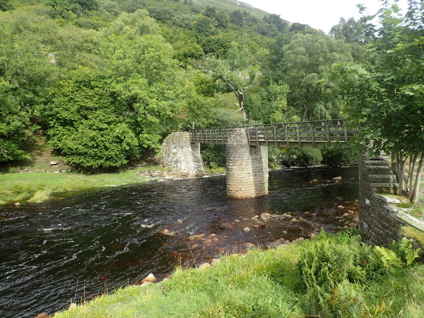
About 3 km (1.9 miles) into the hike, you'll reach the River Swale. The trail follows the river for a short distance, providing beautiful views of the water and the surrounding countryside. This section is relatively flat and offers a peaceful respite before the trail begins to ascend.
At approximately 5 km (3.1 miles), you'll start a gentle climb towards the village of Gunnerside. The ascent is gradual but steady, gaining about 100 meters (328 feet) in elevation over the next 2 km (1.2 miles). Along the way, you'll pass through Gunnerside Gill, a narrow valley that is home to a variety of wildlife, including birds of prey and small mammals.
Gunnerside Village
Upon reaching Gunnerside, take some time to explore this quaint village. Gunnerside is known for its well-preserved stone houses and the Gunnerside Methodist Chapel, which dates back to the 18th century. There are also a couple of traditional pubs where you can rest and enjoy a meal or a drink.
Return to Muker
The return leg of the loop takes you back towards Muker, following a different route that offers new perspectives of the landscape. This section of the trail is mostly downhill, making for a pleasant and easy walk back to the starting point. You'll pass through more meadows and farmland, with the opportunity to see sheep and other livestock grazing.
Navigation
For navigation, it's highly recommended to use the HiiKER app, which provides detailed maps and real-time tracking to ensure you stay on the right path. The trail is well-marked, but having a reliable navigation tool can enhance your hiking experience and provide peace of mind.
Final Stretch
As you approach Muker, you'll descend gently back into the village, completing the loop. The entire hike typically takes around 3-4 hours, depending on your pace and how much time you spend exploring the villages and landmarks along the way.
This trail offers a perfect blend of natural beauty, historical interest, and moderate physical challenge, making it an excellent choice for hikers of all levels.

What to expect?
Activity types
Comments and Reviews
User comments, reviews and discussions about the Muker to Gunnerside Loop, England.
4.57
average rating out of 5
7 rating(s)