Download
Preview
Add to list
More
17.4 km
~4 hrs 23 min
539 m
Point-to-Point
“Starting in Keld, the 17 km Keld to Reeth Walk offers scenic beauty, historical landmarks, and moderate challenge.”
Starting near the picturesque village of Keld in North Yorkshire, England, the Keld to Reeth Walk spans approximately 17 km (10.5 miles) with an elevation gain of around 500 meters (1,640 feet). This point-to-point trail is estimated to be of medium difficulty, making it suitable for moderately experienced hikers.
Getting There
To reach the trailhead in Keld, you can either drive or use public transport. If driving, Keld is accessible via the B6270 road. For those relying on public transport, the nearest major town with bus services is Richmond. From Richmond, you can take a bus to Keld, although services may be infrequent, so it's advisable to check the latest schedules.
Trail Overview
The trail begins in Keld, a charming village known for its traditional stone buildings and scenic waterfalls. As you set off, you'll be greeted by the serene beauty of the Yorkshire Dales National Park. The initial part of the trail takes you through lush meadows and along the River Swale, offering a gentle start with minimal elevation gain.
Key Landmarks and Elevation
At around the 3 km (1.9 miles) mark, you'll encounter the first significant ascent, climbing approximately 150 meters (492 feet) as you make your way towards the village of Muker. Muker is renowned for its well-preserved stone barns and hay meadows, which are particularly stunning in late spring and early summer when wildflowers are in full bloom.
Continuing on, the trail meanders through the Swaledale Valley, offering panoramic views of rolling hills and dry stone walls. At approximately 8 km (5 miles), you'll reach the highest point of the trail, gaining another 200 meters (656 feet) in elevation. This section provides breathtaking vistas of the surrounding dales and is a perfect spot for a rest and some photography.
Historical Significance
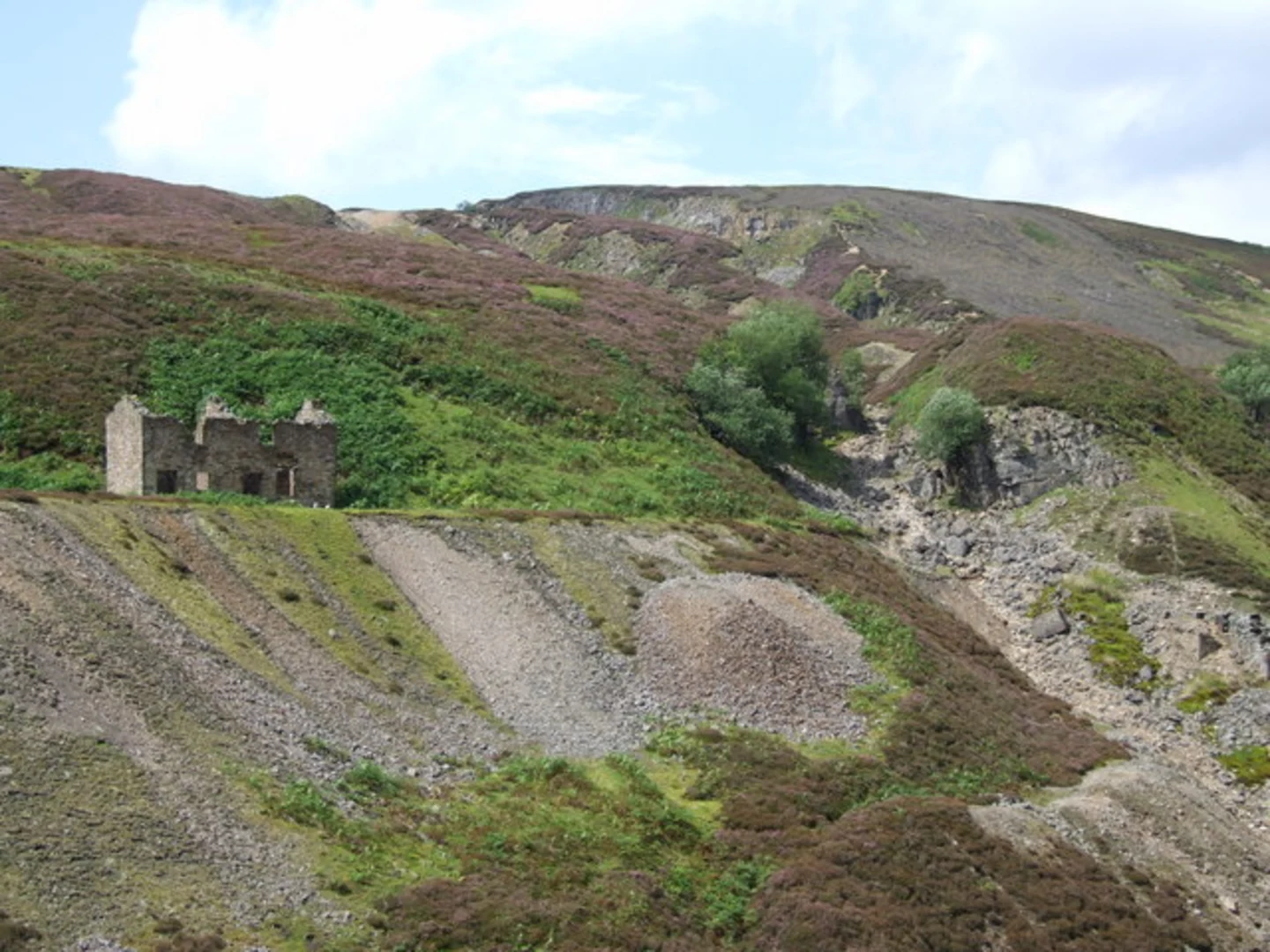
The region is steeped in history, with evidence of ancient lead mining activities. As you hike, you'll come across remnants of old mine shafts and buildings, particularly around the Gunnerside area, which is about 10 km (6.2 miles) into the hike. These historical landmarks offer a glimpse into the industrial past of the Yorkshire Dales.
Wildlife and Nature
The trail is a haven for wildlife enthusiasts. Keep an eye out for red squirrels, which are native to the area, as well as a variety of bird species such as curlews and lapwings. The diverse flora includes heather moorlands and ancient woodlands, providing a rich tapestry of natural beauty.
Final Stretch to Reeth
As you descend towards Reeth, the trail becomes more forgiving. The final 5 km (3.1 miles) are relatively flat, allowing you to enjoy the tranquil scenery without much physical exertion. Reeth itself is a historic market town with a charming village green, perfect for relaxing after your hike. The town offers several pubs and cafes where you can unwind and reflect on your journey.
Navigation
For navigation, it's highly recommended to use the HiiKER app, which provides detailed maps and real-time updates to ensure you stay on track.
Whether you're drawn by the natural beauty, historical intrigue, or the challenge of the hike, the Keld to Reeth Walk offers a rewarding experience for all who venture along its path.

What to expect?
Activity types
Comments and Reviews
User comments, reviews and discussions about the Keld to Reeth Walk, England.
4.0
average rating out of 5
2 rating(s)