Download
Preview
Add to list
More
6.4 km
~1 hrs 38 min
212 m
Loop
“Explore history and nature on the scenic, moderately challenging 6 km Bank Top Kilns and Ana Cross Loop.”
Starting near North Yorkshire, England, the Bank Top Kilns and Ana Cross Loop is a captivating 6 km (approximately 3.7 miles) trail with an elevation gain of around 200 meters (656 feet). This loop trail is rated as medium difficulty, making it suitable for moderately experienced hikers.
Getting There To reach the trailhead, you can drive or use public transport. If driving, head towards the village of Hutton-le-Hole, which is a convenient starting point. For those using public transport, the nearest significant bus stop is in Pickering, from where you can take a local taxi or a connecting bus to Hutton-le-Hole.
Trail Overview The trail begins near the picturesque village of Hutton-le-Hole, known for its charming stone cottages and the Ryedale Folk Museum. As you set off, you'll be greeted by rolling moorlands and expansive views of the North York Moors National Park.
Key Landmarks and Points of Interest
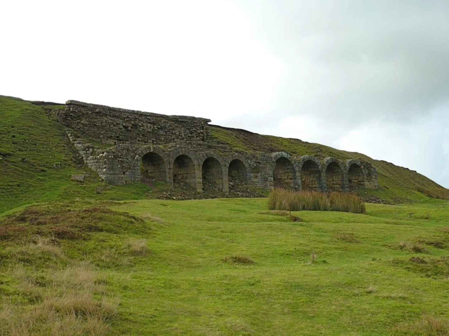
#### Bank Top Kilns Approximately 2 km (1.2 miles) into the hike, you'll encounter the Bank Top Kilns. These historical lime kilns were once used for producing lime for agricultural and building purposes. The kilns are a fascinating glimpse into the industrial past of the region, and the surrounding area is dotted with remnants of this bygone era.
#### Ana Cross Continuing on, around the 4 km (2.5 miles) mark, you'll reach Ana Cross. This ancient stone cross stands as a significant landmark on the moors. Believed to date back to medieval times, Ana Cross served as a waymarker for travelers crossing the moors. The cross offers panoramic views of the surrounding landscape, making it a perfect spot for a rest and some photography.
Nature and Wildlife The trail traverses through diverse habitats, including heather moorland and mixed woodlands. Keep an eye out for local wildlife such as red grouse, curlews, and occasionally, deer. The moorlands are particularly vibrant in late summer when the heather is in full bloom, painting the landscape in shades of purple.
Navigation and Safety Given the open moorland terrain, it's essential to have a reliable navigation tool. HiiKER is recommended for its detailed maps and trail information. The trail is generally well-marked, but weather conditions can change rapidly, so be prepared with appropriate clothing and gear.
Elevation and Terrain The trail features a steady elevation gain of around 200 meters (656 feet), with some steeper sections near Ana Cross. The terrain is a mix of grassy paths, rocky sections, and occasional muddy patches, especially after rain. Good hiking boots with ankle support are advisable.
Practical Information - **Parking:** Available in Hutton-le-Hole, with several car parks in the village. - **Facilities:** Limited facilities along the trail, so carry sufficient water and snacks. The village of Hutton-le-Hole has cafes and pubs for refreshments before or after your hike. - **Best Time to Hike:** Spring to autumn offers the best weather conditions, but the trail can be enjoyed year-round with proper preparation.
This loop trail offers a blend of historical intrigue, natural beauty, and moderate physical challenge, making it a rewarding experience for those exploring the North York Moors.

What to expect?
Activity types
Comments and Reviews
User comments, reviews and discussions about the Bank Top Kilns and Ana Cross Loop, England.
4.38
average rating out of 5
8 rating(s)