Download
3D Flyover
Add to list
More
158.2 km
~6 days
2902 m
Multi-Day
“Follow in the footsteps of kings through rolling hills, ancient woods, and storybook villages rich with history.”
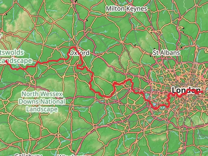
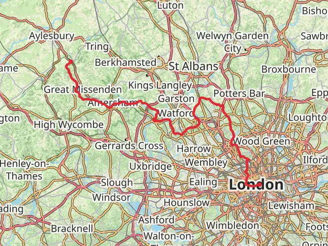
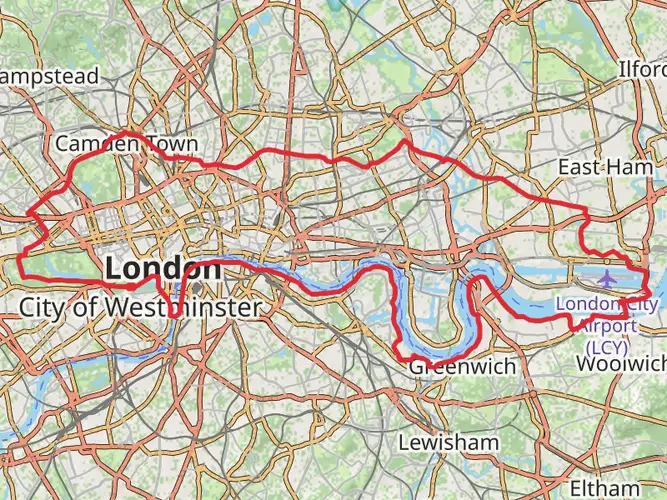
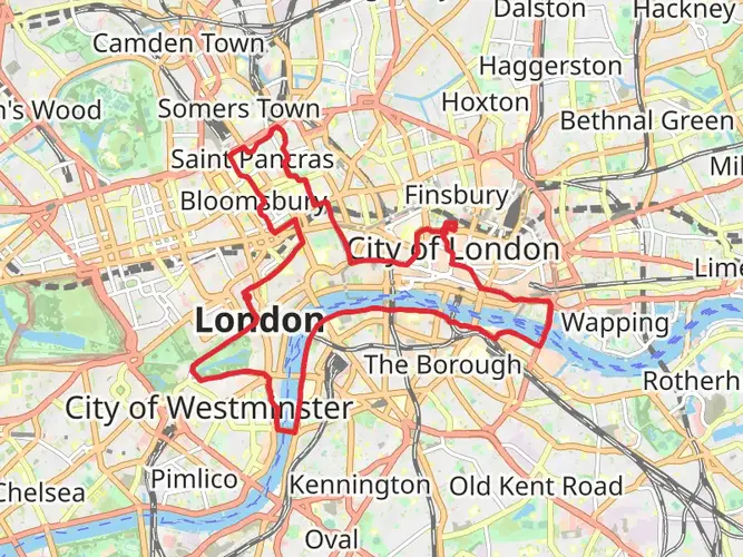
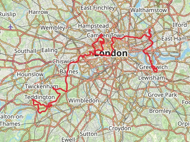
Starting just southeast of London, near the historic town of Westminster, 1066 Harold’s Way stretches for approximately 158 km (98 miles) with a total elevation gain of about 2,900 metres (9,514 feet). This point-to-point route traces the legendary march of King Harold II from London to the Battle of Hastings, weaving through the heart of southern England’s countryside, ancient woodlands, and charming villages.
Getting There
The trailhead is easily accessible by public transport. From central London, take a train from London Charing Cross or London Bridge to Greenwich or Blackheath—both are well-served by National Rail and the Docklands Light Railway (DLR). For those arriving by car, parking is available at Greenwich Park, a short walk from the official start near the Royal Observatory.
Route Overview and Terrain
The path leads southeast, passing through Kent and East Sussex, and finishes at Battle Abbey, the site of the famous 1066 clash. The terrain is varied, with rolling hills, river valleys, and stretches of ancient woodland. Expect a mix of paved paths, bridleways, and rural tracks, with some sections prone to mud after rain. The total ascent is spread over the length of the trail, with the steepest climbs found in the High Weald Area of Outstanding Natural Beauty.
Historical Highlights
The route is steeped in history, following the supposed route taken by King Harold’s army. Early on, you’ll pass through Greenwich, home to the Prime Meridian and the Cutty Sark. At around 32 km (20 miles), Rochester Castle and Cathedral offer a glimpse into Norman England. Continuing southeast, the trail skirts the North Downs, with panoramic views and chalk grasslands rich in wildflowers.
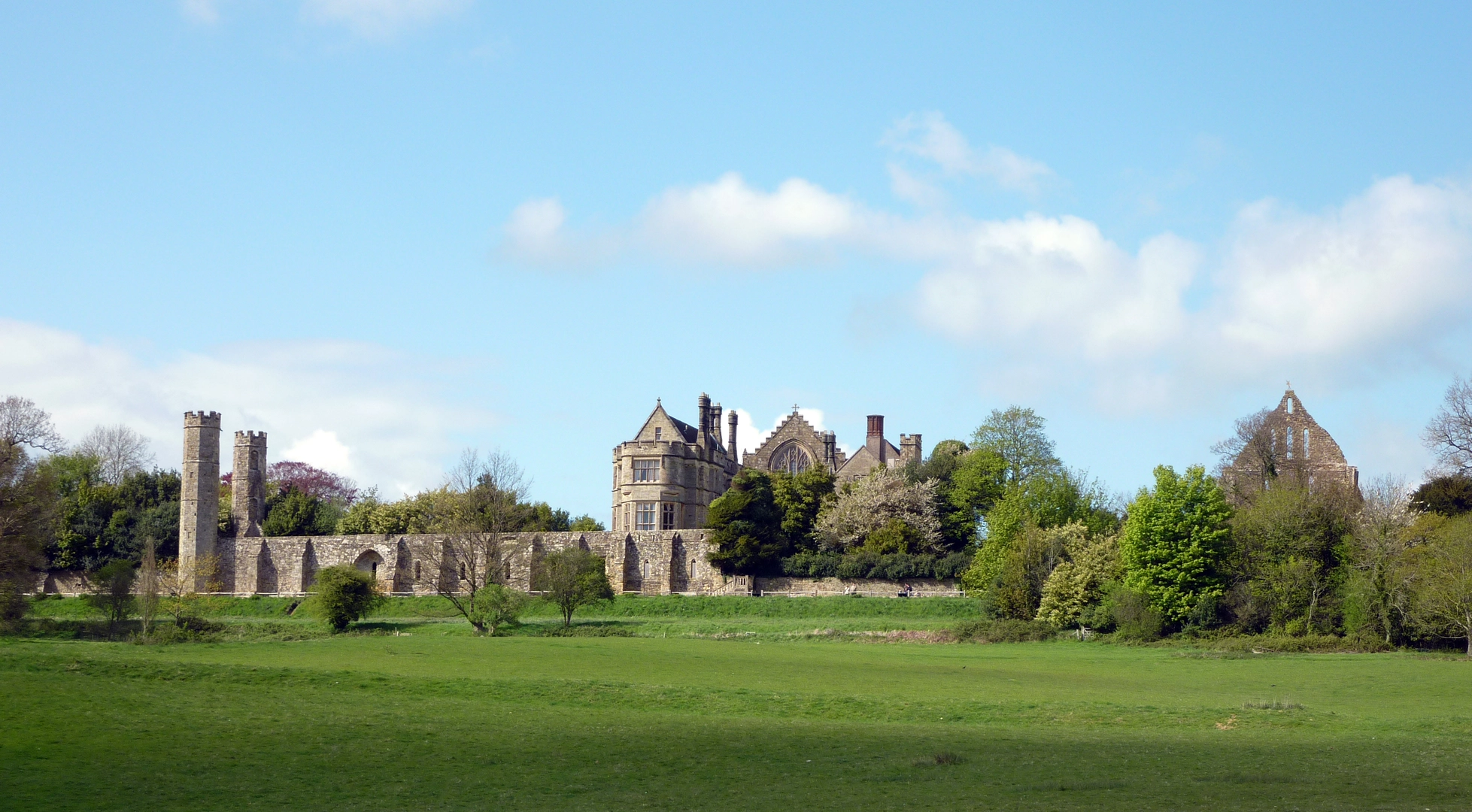
At about 80 km (50 miles), the trail enters the High Weald, a medieval landscape of ancient woods, sunken lanes, and timber-framed villages. Notable stops include the picturesque village of Goudhurst and the moated manor of Scotney Castle. The final approach to Battle, at around 150 km (93 miles), brings you to the site of the Battle of Hastings, where you can explore the abbey ruins and battlefield.
Nature and Wildlife
The trail passes through several Sites of Special Scientific Interest (SSSIs), including the Darent Valley and the Ashdown Forest. Look out for roe deer, foxes, and a variety of woodland birds such as nuthatches and woodpeckers. In spring and summer, the meadows are alive with butterflies and wildflowers, while autumn brings vibrant foliage to the beech and oak woods.
Navigation and Waymarking
Waymarking is intermittent, so reliable navigation is essential. HiiKER provides detailed maps and GPS tracks for the entire route, which are highly recommended for staying on course, especially in remote or wooded sections.
Accommodation and Resupply
There are numerous options for overnight stays, from traditional inns and B&Bs in villages like Tonbridge and Tenterden to campsites and small hotels. Larger towns along the route offer supermarkets and outdoor stores for resupply. Plan ahead, as some rural stretches have limited services.
Preparation and Safety
Given the moderate difficulty, a reasonable level of fitness is required. Waterproof boots are advisable due to muddy sections, and trekking poles can help with the undulating terrain. Carry sufficient water and snacks, especially on longer stretches between villages. Mobile signal is generally good, but some wooded or remote areas may have patchy coverage.
This trail offers a unique blend of English history, scenic countryside, and wildlife, making it a rewarding journey for those prepared for its length and varied terrain.

What to expect?
Activity types
Comments and Reviews
User comments, reviews and discussions about the 1066 Harold's Way, England.
5.0
average rating out of 5
1 rating(s)