Download
Preview
Add to list
More
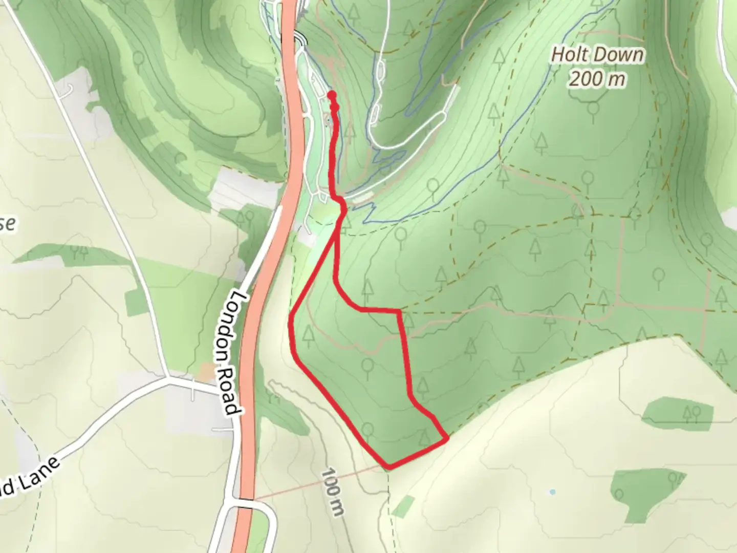
3.0 km
~44 min
87 m
Loop
“Explore a scenic 3 km loop in Hampshire, blending natural beauty with rich historical landmarks.”
Starting near Hampshire, England, this 3 km (approximately 1.86 miles) loop trail offers a delightful mix of natural beauty and historical intrigue. With no significant elevation gain, this trail is accessible to a wide range of hikers, though it is rated as medium difficulty due to some uneven terrain and potentially muddy sections after rain.### Getting There To reach the trailhead, you can drive or use public transport. If driving, set your GPS to the nearest known address: The Queen's Head, Sheet, Petersfield, Hampshire GU32 2AN. There is limited parking available near the pub. For those using public transport, the nearest train station is Petersfield, which is about 2 miles (3.2 km) from the trailhead. From the station, you can take a local bus or a taxi to reach the starting point.### Trail Navigation For navigation, it is highly recommended to use the HiiKER app, which provides detailed maps and real-time updates. The trail is well-marked, but having a reliable navigation tool will enhance your experience.### Key Sections and Landmarks
Woodland Path
The initial section of the trail takes you through a serene woodland area. Here, you will be surrounded by towering oak and beech trees, providing ample shade and a sense of tranquility. Keep an eye out for local wildlife such as deer, foxes, and a variety of bird species. This section is relatively flat and easy to navigate.#### Staunton Way Junction At approximately 1 km (0.62 miles) into the hike, you will reach a junction with the Staunton Way. This is a good spot to take a short break and enjoy the surroundings. The Staunton Way is named after Sir George Staunton, a notable figure in the region's history, known for his contributions to botany and his role in the East India Company.#### Open Fields and Meadows Continuing along the trail, you will transition from dense woodland to open fields and meadows. This section offers panoramic views of the Hampshire countryside. During spring and summer, the meadows are often filled with wildflowers, attracting butterflies and bees. This is a great spot for photography and bird-watching.#### Historical Significance As you make your way back towards the starting point, you will pass by several historical landmarks. One notable site is the remnants of an old Roman road, which once connected the region to larger Roman settlements. This part of the trail offers a glimpse into the area's rich history, making it a fascinating experience for history enthusiasts.### Final Stretch The last section of the trail loops back through a mixed woodland area, eventually leading you back to the trailhead near The Queen's Head pub. This is a perfect place to relax and enjoy a meal or a drink after your hike.### Wildlife and Flora Throughout the trail, you will encounter a diverse range of flora and fauna. The woodland areas are home to ancient trees, while the open fields support a variety of grasses and wildflowers. Wildlife sightings are common, so keep your camera ready.### Preparation Tips - Wear sturdy hiking boots, especially if it has rained recently, as the trail can get muddy. - Bring water and snacks, as there are no facilities along the trail. - Check the weather forecast and dress appropriately. - Use the HiiKER app for navigation to ensure you stay on track.This trail offers a perfect blend of natural beauty and historical significance, making it a rewarding experience for hikers of all levels.

What to expect?
Activity types
Comments and Reviews
User comments, reviews and discussions about the Short Woodland Trail and Stauntan Way, England.
4.5
average rating out of 5
2 rating(s)