Download
Preview
Add to list
More
11.7 km
~2 hrs 48 min
282 m
Loop
“The Clanfield Woods Loop is a scenic 12 km trail with wildlife, historic sites, and South Downs views.”
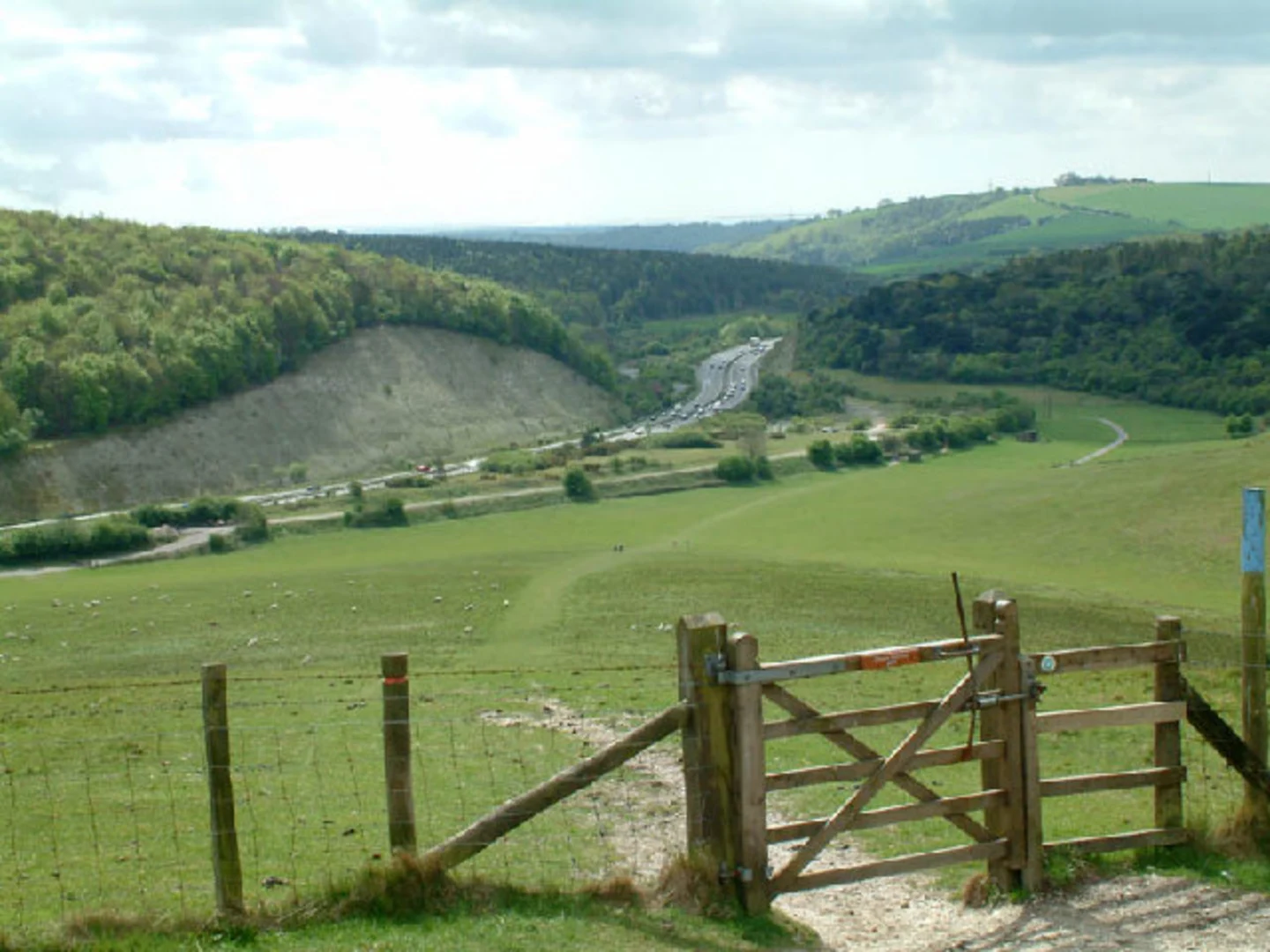
Starting near Hampshire, England, the Clanfield Woods Loop is a delightful 12 km (7.5 miles) trail with an elevation gain of approximately 200 meters (656 feet). This loop trail is rated as medium difficulty, making it suitable for moderately experienced hikers.### Getting There To reach the trailhead, you can drive or use public transport. If driving, set your GPS to Clanfield, Hampshire. There is a small parking area near the village where you can leave your car. For those using public transport, the nearest train station is Petersfield. From Petersfield, you can take a local bus or taxi to Clanfield, which is about 8 km (5 miles) away.### Trail Overview The trail begins in the charming village of Clanfield, known for its picturesque cottages and historic church. As you start your hike, you'll immediately be immersed in the lush greenery of Clanfield Woods. The first section of the trail is relatively flat, allowing you to ease into the hike while enjoying the serene woodland atmosphere.### Key Landmarks and Points of Interest - Clanfield Church: Approximately 1 km (0.6 miles) from the start, you'll pass by the historic St. James Church, dating back to the 12th century. It's worth taking a moment to appreciate the architecture and the peaceful churchyard. - Woodland Wildlife: As you continue, keep an eye out for local wildlife. The woods are home to a variety of birds, including woodpeckers and owls, as well as deer and foxes. Early morning or late afternoon hikes offer the best chances for wildlife sightings. - Elevated Views: Around the 5 km (3.1 miles) mark, you'll begin a gradual ascent. The elevation gain here is about 100 meters (328 feet) over the next 2 km (1.2 miles). This section offers stunning views of the South Downs National Park, especially on clear days. - Ancient Trees: Midway through the hike, you'll encounter several ancient oak and beech trees. These giants have stood for centuries and add a sense of timelessness to the trail.### Navigation and Terrain The trail is well-marked, but it's always a good idea to have a reliable navigation tool. HiiKER is an excellent app for this purpose, providing detailed maps and real-time GPS tracking. The terrain varies from flat woodland paths to more rugged, uneven sections, especially during the ascent. Good hiking boots are recommended to navigate the occasional muddy patches and rocky areas.### Historical Significance The region around Clanfield has a rich history. The South Downs have been inhabited since prehistoric times, and you'll find evidence of ancient settlements and agricultural practices throughout the hike. The trail itself passes near several old farmsteads and boundary markers that date back to medieval times.### Final Stretch As you descend back towards Clanfield, the trail becomes easier, allowing you to relax and enjoy the final 3 km (1.9 miles) through open fields and meadows. The loop brings you back to the village, where you can explore local pubs and cafes to refresh yourself after the hike.This trail offers a perfect blend of natural beauty, wildlife, and historical intrigue, making it a rewarding experience for any hiker.

What to expect?
Activity types
Comments and Reviews
User comments, reviews and discussions about the Clanfield Woods Loop, England.
average rating out of 5
0 rating(s)