Download
Preview
Add to list
More
7.2 km
~1 hrs 38 min
116 m
Loop
“The Westcote Loop is a picturesque, moderately challenging 7 km trail through the historic and lush Cotswolds.”
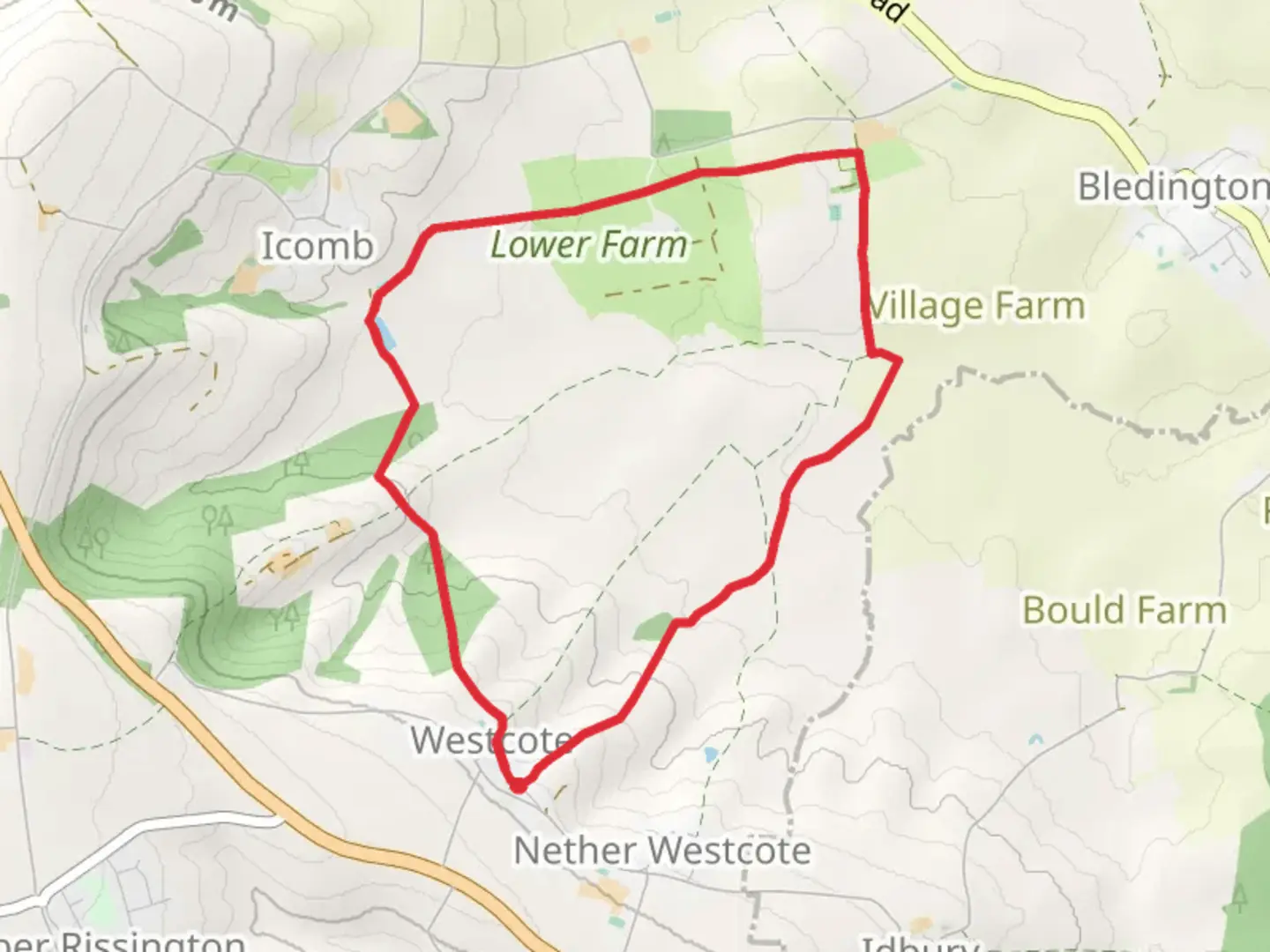
Starting near the picturesque village of Westcote in Gloucestershire, England, the Westcote Loop is a delightful 7 km (approximately 4.3 miles) trail with an elevation gain of around 100 meters (328 feet). This loop trail offers a moderate challenge, making it suitable for hikers with some experience.### Getting There To reach the trailhead, you can drive or use public transport. If driving, head towards Westcote, which is easily accessible from the A40. There is limited parking available near the village. For those using public transport, the nearest train station is Kingham, located about 4 miles (6.4 km) away. From Kingham, you can take a taxi or a local bus to Westcote.### Trail Overview The trail begins near the village center, where you can find a quaint church and a few charming cottages. As you start your hike, you'll be greeted by the rolling hills and lush greenery that characterize the Cotswolds. The initial part of the trail is relatively flat, allowing you to ease into the hike.### Points of Interest - Westcote Church: Approximately 0.5 km (0.3 miles) from the start, you'll pass by the historic St. Mary's Church, a beautiful example of medieval architecture. Take a moment to appreciate the craftsmanship and the serene churchyard. - Cotswold Stone Walls: As you continue, you'll notice the iconic Cotswold stone walls that line the fields. These dry stone walls are a significant part of the region's heritage and have been used for centuries to mark boundaries and contain livestock.### Nature and Wildlife The trail meanders through a mix of open fields, woodlands, and hedgerows. Keep an eye out for local wildlife, including deer, foxes, and a variety of bird species. In spring and summer, the fields are often adorned with wildflowers, adding a splash of color to your hike.### Midpoint and Elevation Gain Around the 3.5 km (2.2 miles) mark, you'll encounter a gentle ascent that takes you to the highest point of the trail. The elevation gain here is about 50 meters (164 feet), offering panoramic views of the surrounding countryside. This is a great spot to take a break and enjoy the scenery.### Historical Significance The Cotswolds region is steeped in history, and the Westcote Loop is no exception. The area has been inhabited since the Neolithic period, and you may come across remnants of ancient settlements and agricultural practices. The trail also passes near several old farmsteads, some of which date back to the 17th century.### Navigation To ensure you stay on track, it's advisable to use a reliable navigation tool like HiiKER. The app provides detailed maps and real-time updates, helping you navigate the trail with ease.### Final Stretch As you descend back towards Westcote, the trail takes you through more open fields and pastures. The final 2 km (1.2 miles) are relatively flat, making for a pleasant and leisurely end to your hike. You'll eventually loop back to the village, where you can relax and perhaps visit a local pub for a well-deserved refreshment.The Westcote Loop offers a perfect blend of natural beauty, historical intrigue, and moderate physical challenge, making it a rewarding experience for any hiker.

What to expect?
Activity types
Comments and Reviews
User comments, reviews and discussions about the Westcote Loop, England.
4.83
average rating out of 5
6 rating(s)