Download
Preview
Add to list
More
19.0 km
~1 day 0 hrs
986 m
Point-to-Point
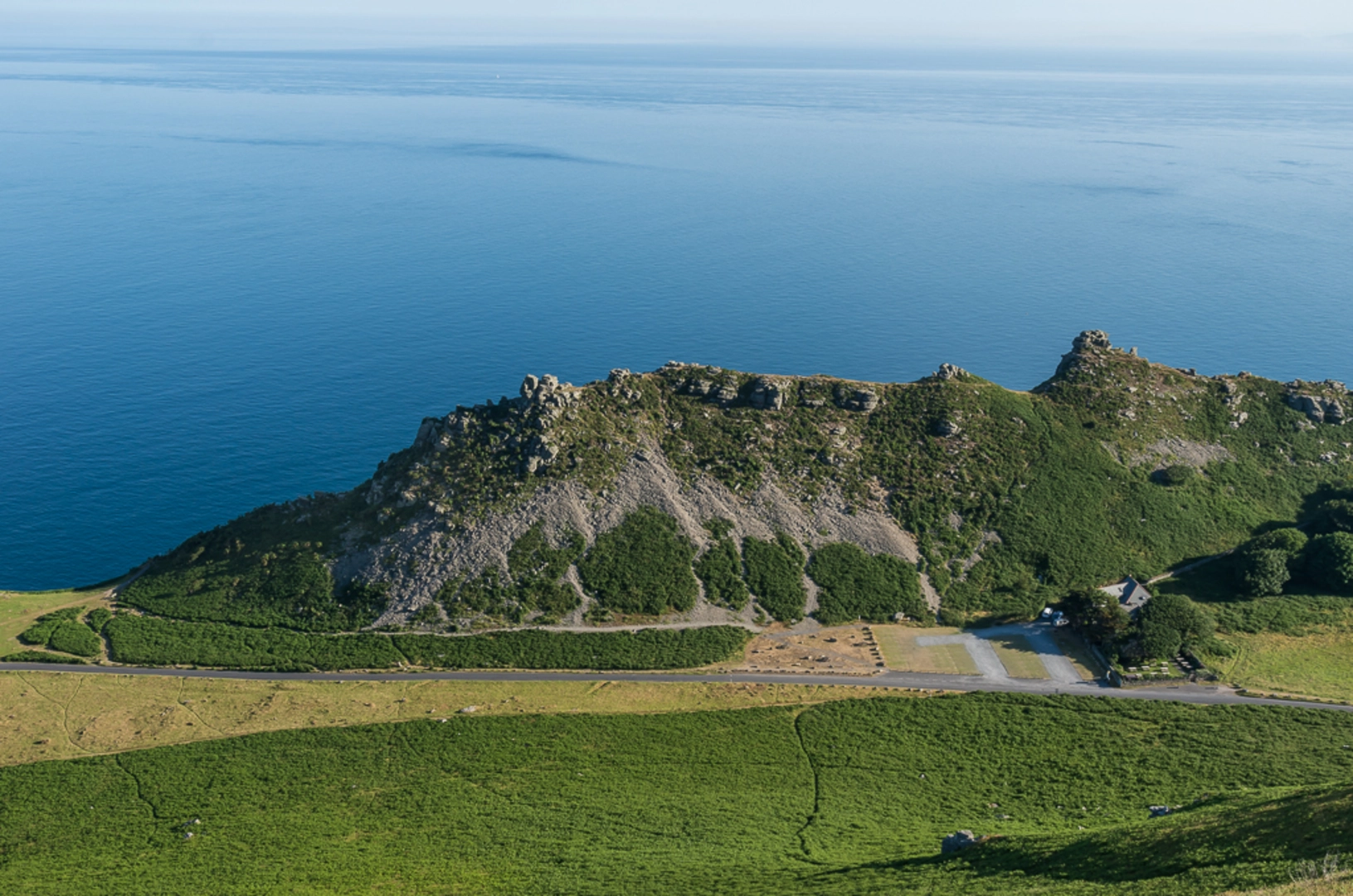
“Explore the stunning North Devon coastline on a 19 km hike, featuring dramatic cliffs, woodland, and historical landmarks.”
Starting near Devon, England, this 19 km (approximately 12 miles) point-to-point trail offers a medium difficulty hike with an elevation gain of around 900 meters (approximately 2,950 feet). The trailhead is accessible by car or public transport, with the nearest significant landmark being the town of Lynton. From Lynton, you can take a local bus or taxi to the trailhead.
Initial Ascent and Valley of Rocks
The hike begins with a steady ascent, gaining elevation quickly as you make your way towards the Valley of Rocks. This section is characterized by rugged terrain and dramatic cliffs, offering stunning views of the North Devon coastline. The Valley of Rocks is a geological marvel, known for its unusual rock formations and wild goats that roam freely. Keep an eye out for the "Devil's Cheesewring," a notable rock formation that resembles a stack of cheese wheels.
Mid-Trail: Woodland and Wildlife
As you continue, the trail transitions into Croscombe Wood, a dense woodland area that provides a stark contrast to the open cliffs of the Valley of Rocks. This section is relatively flat, allowing for a more leisurely pace. The woods are home to a variety of wildlife, including deer, foxes, and numerous bird species. During spring and early summer, the forest floor is carpeted with bluebells, adding a splash of color to your hike.
Historical Significance
The region is steeped in history, with evidence of human activity dating back to the Bronze Age. Along the trail, you'll encounter remnants of ancient settlements and old stone walls that once marked property boundaries. The area was also significant during the medieval period, serving as a route for traders and pilgrims.
Final Descent and Croscombe Village
The final section of the trail involves a descent into the village of Croscombe. This part of the hike can be challenging due to the steep and sometimes slippery path, so take your time and use trekking poles if necessary. Croscombe is a picturesque village with charming cottages and a historic church dating back to the 12th century. It's an ideal spot to rest and reflect on your journey.
Navigation and Safety
For navigation, it's highly recommended to use the HiiKER app, which provides detailed maps and real-time updates. The trail is well-marked, but having a reliable navigation tool will ensure you stay on track. Always check the weather forecast before setting out, as conditions can change rapidly, especially along the coast.
Getting There
To reach the trailhead, you can drive to Lynton, where parking is available. If using public transport, take a train to Barnstaple and then a bus to Lynton. From Lynton, local buses or taxis can take you to the starting point of the hike.

What to expect?
Activity types
Comments and Reviews
User comments, reviews and discussions about the The Valley of Rocks and Croscombe Wood, England.
4.25
average rating out of 5
4 rating(s)