Download
Preview
Add to list
More
16.5 km
~3 hrs 59 min
421 m
Loop
“Experience Derbyshire's rich tapestry of history and nature on the scenic Buxton reservoir loop hike.”
Embarking on the Buxton, Burbage and Errwood Reservoir Loop, hikers will traverse approximately 16 kilometers (about 10 miles) of varied terrain with an elevation gain of around 400 meters (roughly 1,300 feet). This loop trail, nestled in the heart of Derbyshire, England, offers a medium difficulty rating and is a delightful challenge for those with some hiking experience.
Getting to the Trailhead
The trailhead is conveniently located near the town of Buxton, which is accessible by public transport. Buses run regularly from surrounding cities to Buxton, and from there, hikers can catch a local bus or taxi to the starting point. For those driving, parking is available near the trailhead. Using a navigation tool like HiiKER can help in pinpointing the exact starting location and in planning the route to get there.
The Journey Begins
Setting out from the trailhead, hikers will be greeted by the serene beauty of the Peak District National Park. The path meanders through a mixture of lush woodlands and open moorlands, offering a tapestry of greenery and wildlife. Birdwatchers will be delighted by the variety of birds that call this area home, including skylarks and curlews.
Historical Significance
As the trail unfolds, it reveals the rich history of the region. The area around Errwood Reservoir is particularly steeped in history, with the remnants of Errwood Hall and its once-grand estate. The hall was built in the 19th century and now lies in ruins, but it provides a glimpse into the past and the lives of those who once resided there.
Landmarks and Scenery
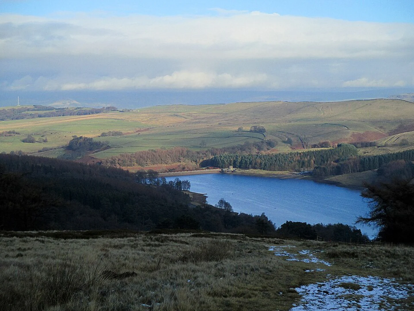
The loop ensures that hikers will encounter the stunning Errwood and Fernilee Reservoirs, both of which are significant landmarks along the route. These reservoirs are not only crucial for water supply but also serve as picturesque spots for a rest or a picnic. The trail offers several vantage points with breathtaking views of the surrounding valleys and hills.
Navigating the Trail
Throughout the hike, the elevation gain is gradual, with some steeper sections that contribute to the medium difficulty rating. It's advisable to use HiiKER to track progress along the trail and to ensure that all the notable sights are experienced. The app can also assist in identifying the various flora and fauna encountered along the way.
Preparation and Planning
Before setting out, hikers should be prepared with appropriate footwear, as the terrain can be rocky and uneven in places. Weather in the Peak District can be unpredictable, so layered clothing and waterproof gear are recommended. It's also wise to carry enough water and snacks to stay energized throughout the hike.
Access and Amenities
The trail is well-marked, but there are sections where the path can become less distinct, so paying attention to trail markers is important. There are limited amenities on the trail itself, so hikers should plan accordingly. Restrooms and refreshments can be found in the towns near the trailhead before and after the hike.
By taking the time to prepare and plan, hikers can fully enjoy the natural beauty, historical significance, and the rewarding challenge that the Buxton, Burbage and Errwood Reservoir Loop offers.

What to expect?
Activity types
Comments and Reviews
User comments, reviews and discussions about the Buxton, Burbage and Errwood Reservoir Loop, England.
5.0
average rating out of 5
1 rating(s)