Download
Preview
Add to list
More
18.5 km
~5 hrs 16 min
945 m
Loop
“Embark on a scenic, moderately challenging 19 km hike around Ennerdale Water, featuring stunning peaks and rich history.”
Starting your adventure near Ennerdale Water in Cumberland, England, this 19 km (approximately 11.8 miles) loop trail offers a moderately challenging hike with an elevation gain of around 900 meters (2,950 feet). The trailhead is conveniently accessible by car, with parking available near Ennerdale Water. For those using public transport, the nearest significant landmark is the town of Cleator Moor, from where you can catch a local bus or taxi to the trailhead.
Initial Ascent and Great Borne
The hike begins with a gradual ascent through lush woodlands and open fields, providing a serene start to your journey. As you climb towards Great Borne, the terrain becomes steeper and more rugged. At approximately 4 km (2.5 miles) into the hike, you'll reach the summit of Great Borne, standing at 616 meters (2,021 feet). From here, you can enjoy panoramic views of Ennerdale Water and the surrounding fells.
Starling Dodd
Continuing along the ridge, the trail leads you towards Starling Dodd. This section is characterized by undulating terrain and offers a mix of grassy paths and rocky outcrops. After another 3 km (1.9 miles), you'll reach the summit of Starling Dodd at 633 meters (2,077 feet). The views here are equally impressive, with vistas stretching towards the Lake District's central fells.
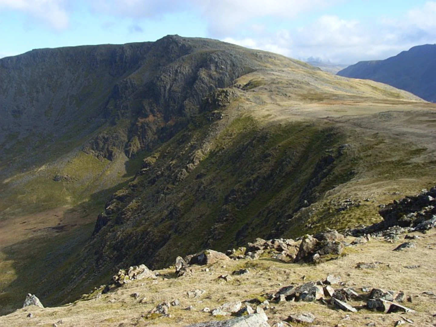
High Stile Range
The next segment of the hike takes you along the High Stile range, a series of peaks that offer some of the most breathtaking scenery in the Lake District. The trail here is more exposed, so be prepared for potentially windy conditions. After about 2 km (1.2 miles), you'll reach the summit of High Stile, the highest point on this loop at 807 meters (2,648 feet). The views from here are nothing short of spectacular, encompassing the entire Ennerdale Valley and beyond.
Descent and Return to Ennerdale Water
The descent begins as you make your way down from High Stile towards the shores of Ennerdale Water. This part of the trail is less strenuous but requires careful footing due to loose rocks and steep sections. After descending for approximately 5 km (3.1 miles), you'll find yourself back near the water's edge. The final stretch of the hike takes you along the scenic shoreline of Ennerdale Water, offering a peaceful and flat walk back to the trailhead.
Historical Significance and Wildlife
The Ennerdale Valley is steeped in history, with evidence of ancient settlements and Roman roads. The area is also part of the Wild Ennerdale project, an initiative aimed at rewilding the valley to restore its natural habitats. As you hike, keep an eye out for red squirrels, deer, and a variety of bird species, including peregrine falcons and ospreys.
Navigation and Safety
Given the varied terrain and potential for rapidly changing weather conditions, it's advisable to use a reliable navigation tool like HiiKER to stay on track. Ensure you have appropriate gear, including sturdy hiking boots, weather-appropriate clothing, and sufficient water and snacks.
This loop trail offers a rewarding experience for those looking to explore the natural beauty and historical richness of the Lake District.

What to expect?
Activity types
Comments and Reviews
User comments, reviews and discussions about the Great Borne, Starling Dodd and High Sile Loop from Ennerdale Water, England.
4.67
average rating out of 5
3 rating(s)