Download
Preview
Add to list
More
12.6 km
~3 hrs 21 min
509 m
Loop
“Embark on a scenic 13 km hike near Cumberland, blending rolling hills, historical sites, and diverse wildlife.”
Starting your adventure near the charming town of Cumberland, England, the Gavel Fell, Blake Fell, and Sharp Knoll Loop offers a delightful 13 km (8 miles) journey with an elevation gain of approximately 500 meters (1,640 feet). This loop trail is rated medium in difficulty, making it suitable for moderately experienced hikers.
Getting There
To reach the trailhead, you can drive or use public transport. If driving, head towards the village of Lamplugh, which is the nearest significant landmark. From there, follow local roads to the designated parking area near the trailhead. For those using public transport, the nearest major bus stop is in Lamplugh, from where you can either walk or take a short taxi ride to the trailhead.
Trail Overview
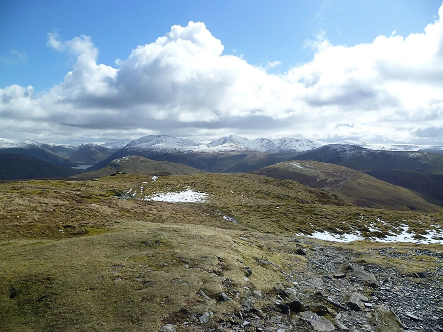
The loop begins with a gentle ascent through lush meadows and pastures, offering panoramic views of the surrounding countryside. As you progress, the trail becomes steeper, leading you towards Gavel Fell. At approximately 3 km (1.9 miles) into the hike, you'll reach the summit of Gavel Fell, standing at 526 meters (1,726 feet). Here, you can enjoy sweeping views of the Lake District's rolling hills and valleys.
Blake Fell
Continuing along the ridge, the trail takes you towards Blake Fell, the highest point of the loop at 573 meters (1,880 feet). This section is around 5 km (3.1 miles) from the start. The ascent is moderately challenging but rewards you with stunning vistas of Ennerdale Water and the surrounding fells. Keep an eye out for local wildlife, including red squirrels and various bird species.
Sharp Knoll
Descending from Blake Fell, the trail leads you to Sharp Knoll, a smaller but equally picturesque peak. This section is less steep, allowing for a more relaxed pace. At around 8 km (5 miles) into the hike, you'll find yourself at the summit of Sharp Knoll, offering a unique perspective of the landscape below.
Historical Significance
The region is steeped in history, with ancient stone walls and remnants of old farmsteads dotting the landscape. These features offer a glimpse into the area's agricultural past, dating back to the medieval period. The trail also passes near old mining sites, a testament to the region's industrial heritage.
Navigation and Safety
Given the varied terrain and potential for rapidly changing weather conditions, it's advisable to use a reliable navigation tool like HiiKER to stay on track. The trail is well-marked, but having a digital map can provide additional peace of mind.
Flora and Fauna
Throughout the hike, you'll encounter a diverse range of flora, from heather-covered moorlands to ancient woodlands. In spring and summer, the meadows burst into color with wildflowers, attracting butterflies and bees. The area is also home to various bird species, including skylarks and kestrels, making it a haven for birdwatchers.
Final Stretch
The final leg of the loop takes you through serene woodlands and along babbling brooks, gradually descending back towards the trailhead. This section is around 5 km (3.1 miles) and offers a peaceful end to your hike, with ample opportunities to spot deer and other woodland creatures.
Prepare adequately with appropriate gear, water, and snacks, and enjoy the natural beauty and historical richness of the Gavel Fell, Blake Fell, and Sharp Knoll Loop.

What to expect?
Activity types
Comments and Reviews
User comments, reviews and discussions about the Gavel Fell, Blake Fell and Sharp Knoll Loop, England.
4.67
average rating out of 5
3 rating(s)