Download
Preview
Add to list
More
5.7 km
~1 hrs 20 min
122 m
Loop
“Step into a tapestry of ancient earthworks, wildflower meadows, and sweeping Bedfordshire views on this scenic loop.”
Starting from the car park near Sharpenhoe Clappers, just off Sharpenhoe Road in Central Bedfordshire, this 6 km (about 3.7 miles) loop offers a moderate challenge with roughly 100 metres (328 feet) of elevation gain. The trailhead is easily accessible by car, with parking available at the National Trust Sharpenhoe Clappers site. For those using public transport, the nearest railway station is Harlington, about 3 miles (4.8 km) away; from there, local taxis or a scenic walk along country lanes can bring you to the start.
Getting Oriented and Early Highlights
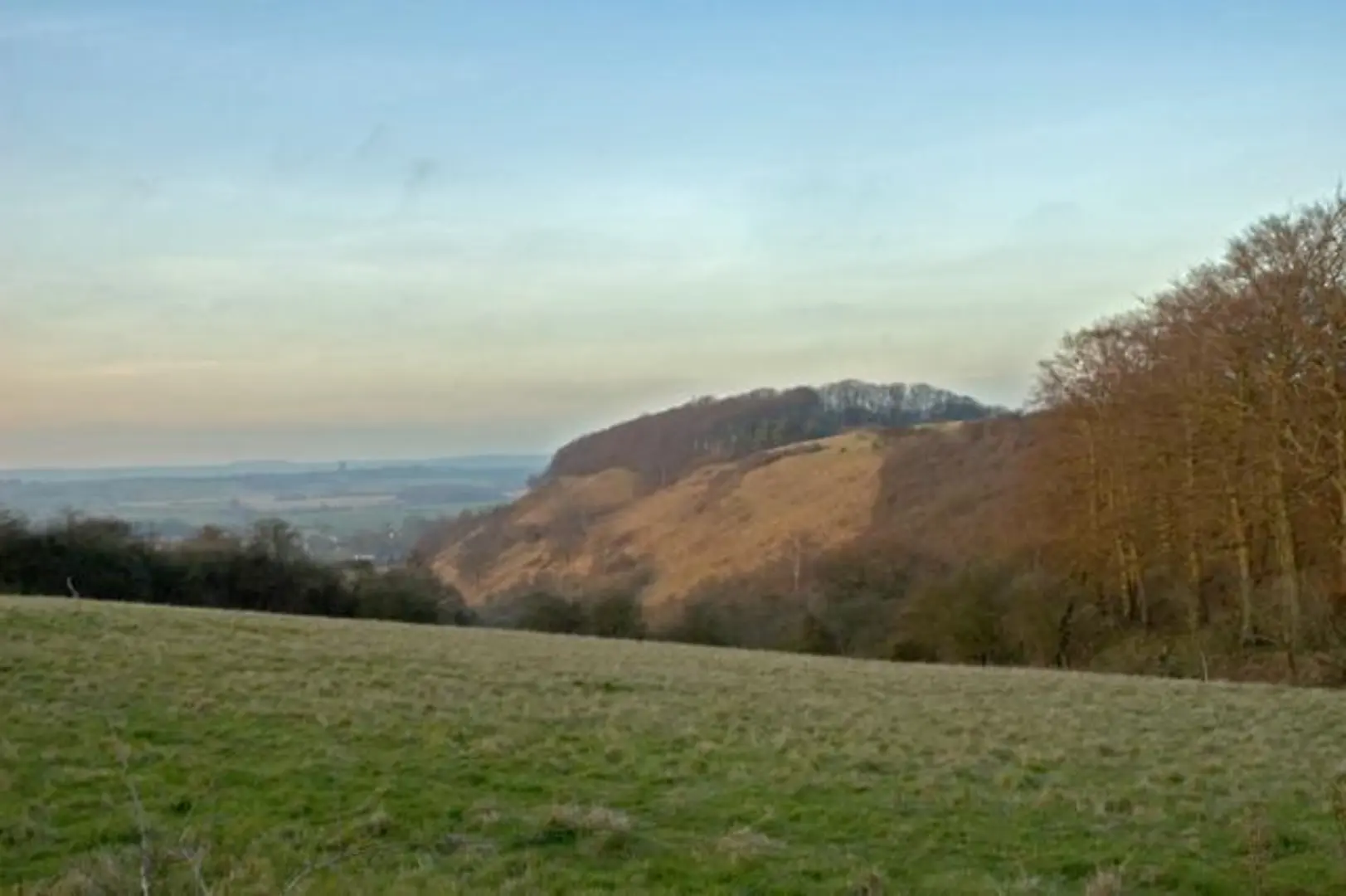
The route begins by ascending gently through ancient beech woodland, a remnant of the once-vast Chiltern forest. Early on, you’ll notice the distinctive chalk grassland that makes this area a Site of Special Scientific Interest. The first kilometre (0.6 miles) brings you to the Sharpenhoe Clappers earthworks, an Iron Age hill fort dating back over 2,000 years. The ramparts are still visible, and the elevated position offers sweeping views across the Bedfordshire plain.
Landmarks and Nature
After exploring the hill fort, the path skirts the edge of the escarpment, providing panoramic vistas toward the north and west. On clear days, you can spot the distant spire of St Mary’s Church in Harlington and the rolling fields of the Vale of Bedford. The chalk grassland here is home to rare wildflowers such as the bee orchid and clustered bellflower, especially vibrant in late spring and early summer. Birdwatchers should keep an eye out for red kites and skylarks, while the wooded sections may reveal muntjac deer or foxes.
Mid-Loop Features and Navigation
Around the halfway mark, the trail descends gently through open meadows and hedgerows, passing close to the hamlet of Streatley. This section can be muddy after rain, so waterproof boots are recommended. The route is well-marked, but carrying the HiiKER app ensures you stay on track, especially where the path crosses farmland and minor roads.
Historical and Cultural Context
Sharpenhoe Clappers is steeped in history, not only for its Iron Age fort but also as part of the ancient Chilterns landscape shaped by centuries of grazing and woodland management. The name “Clappers” refers to the medieval rabbit warrens once maintained here, a reminder of the area’s agricultural past. Interpretive signs along the route provide further insight into the region’s heritage.
Final Stretch and Return
The final section climbs back up through mixed woodland, with occasional benches offering a chance to rest and enjoy the scenery. The loop closes as you return to the car park, having experienced a blend of history, wildlife, and classic English countryside. The entire circuit typically takes 1.5 to 2.5 hours to complete, depending on pace and stops for sightseeing or picnics.

Comments and Reviews
User comments, reviews and discussions about the Sharpenhoe Clappers Loop, England.
4.5
average rating out of 5
4 rating(s)