Download
Preview
Add to list
More
12.7 km
~3 hrs 5 min
328 m
Loop
“The West Vale to Norland Loop is a rewarding 13 km hike featuring natural beauty, history, and diverse wildlife.”
Starting near Calderdale, England, the West Vale to Norland Loop via Norland Moor Local Nature Reserve is a captivating 13 km (8 miles) loop trail with an elevation gain of around 300 meters (984 feet). This medium-difficulty hike offers a blend of natural beauty, historical landmarks, and diverse wildlife, making it a rewarding experience for outdoor enthusiasts.
Getting There
To reach the trailhead, you can either drive or use public transport. If driving, head towards West Vale, Calderdale, and look for parking near the local shops or residential areas. For those using public transport, the nearest significant landmark is the West Vale Post Office, where several bus routes from Halifax and surrounding areas stop. From there, it's a short walk to the trailhead.
Trail Overview
The loop begins in West Vale, a quaint village that serves as a perfect starting point. As you set off, you'll gradually ascend through a mix of woodland and open fields. The initial part of the trail is relatively gentle, allowing you to ease into the hike.
Norland Moor Local Nature Reserve
Around the 3 km (1.8 miles) mark, you'll enter the Norland Moor Local Nature Reserve. This expansive moorland is a highlight of the hike, offering panoramic views of the Calder Valley. The terrain here is more rugged, with heather and gorse dominating the landscape. Keep an eye out for local wildlife, including skylarks and kestrels, which are commonly seen in this area.
Historical Significance
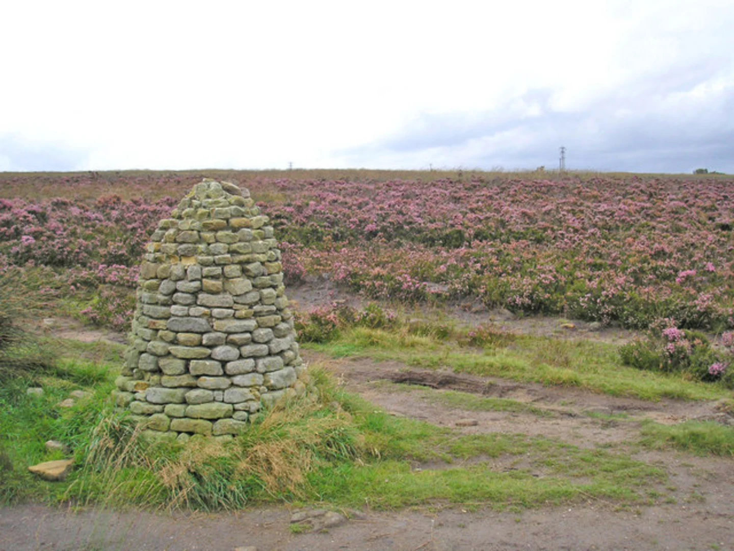
Norland Moor has a rich history, with evidence of ancient settlements and old quarry workings. As you traverse the moor, you'll come across several stone cairns and remnants of old boundary markers. These historical features add an intriguing layer to your hike, providing a glimpse into the area's past.
Navigation and Waypoints
Navigating the trail is straightforward, but it's always wise to have a reliable navigation tool like HiiKER to ensure you stay on track. Key waypoints include the Norland Moor trig point, which is the highest point of the hike at approximately 300 meters (984 feet) elevation. From here, you'll have a 360-degree view of the surrounding countryside, making it an ideal spot for a rest and some photos.
Descending Back to West Vale
After exploring the moor, the trail begins to descend back towards West Vale. This section is a mix of open fields and woodland paths, offering a different perspective of the landscape. The descent is gradual, making it a pleasant end to the hike.
Flora and Fauna
Throughout the hike, you'll encounter a variety of flora and fauna. In spring and summer, the fields are dotted with wildflowers, while the woodlands provide a habitat for deer and various bird species. The diversity of plant and animal life adds to the trail's appeal, making each season a unique experience.
Practical Tips
- Wear sturdy hiking boots, as the terrain can be uneven, especially on the moor.
- Bring sufficient water and snacks, as there are limited facilities along the trail.
- Check the weather forecast before setting out, as conditions on the moor can change rapidly.
- Use HiiKER for navigation to ensure you stay on the correct path and make the most of your hike.
This trail offers a perfect blend of natural beauty, historical intrigue, and moderate challenge, making it an excellent choice for a day hike in the Calderdale area.

What to expect?
Activity types
Comments and Reviews
User comments, reviews and discussions about the West Vale to Norland Loop via Norland Moor Local Nature Reserve, England.
4.33
average rating out of 5
6 rating(s)