Download
3D Flyover
Add to list
More
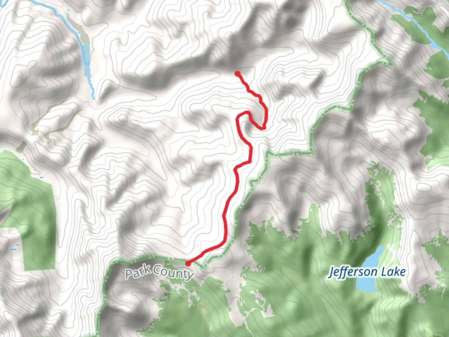
7.8 km
~2 hrs 21 min
478 m
Point-to-Point
“Embark on a historic, medium-difficulty hike through Summit County's diverse terrains and breathtaking vistas.”
The Glacier Ridge and Georgia Pass trail, nestled in the heart of Summit County, Colorado, offers hikers an invigorating journey through diverse landscapes with a total distance of approximately 8 kilometers (about 5 miles) and an elevation gain of around 400 meters (roughly 1,300 feet). This point-to-point trail is rated as medium difficulty, making it accessible to hikers with a reasonable level of fitness and experience.
Getting to the Trailhead To reach the trailhead, you can drive or take public transportation to the vicinity of Summit County. If driving, navigate towards Breckenridge, a well-known town in the area, and follow the signs leading to the trailhead, which is situated near the outskirts of the town. Public transport options may include local buses that service the region, dropping you off close to the starting point. It's advisable to check the latest schedules and routes on the Summit County public transport website or use HiiKER to pinpoint the exact location and plan your route.
The Hike Itself As you embark on the Glacier Ridge and Georgia Pass trail, you'll traverse through a mix of dense forests, open meadows, and alpine terrain. The initial segment of the trail gradually ascends through a coniferous forest, where the scent of pine and the sound of rustling leaves accompany your steps. After about 2 kilometers (1.2 miles), the forest canopy opens up to reveal expansive meadows dotted with wildflowers during the summer months.
Historical Significance and Landmarks The region holds historical significance, with the Georgia Pass being a notable landmark along the trail. This pass was once a vital route for the Ute Native Americans and later for miners during the Colorado Gold Rush in the 19th century. As you approach the pass, located roughly halfway through the hike, you'll find yourself walking in the footsteps of history, with the possibility of spotting remnants from the mining era.
Flora and Fauna The diverse ecosystems along the trail support a variety of wildlife. Keep an eye out for mule deer, elk, and if you're fortunate, you might catch a glimpse of a moose in the wetter areas. Birdwatchers can also delight in the presence of mountain songbirds and birds of prey circling overhead.
Navigation and Preparation Navigating the trail should be straightforward with the use of HiiKER, which provides detailed maps and GPS coordinates to keep you on the right path. It's essential to be prepared for sudden weather changes, as mountain conditions can be unpredictable. Bring layers of clothing, adequate water, and snacks for energy. Also, consider the altitude and pace yourself to avoid altitude sickness.
Final Ascent and Georgia Pass The final ascent to Georgia Pass is the most challenging part of the hike, with steeper inclines and rocky terrain. As you reach the pass, at an elevation of around 3,600 meters (11,800 feet), you'll be rewarded with panoramic views of the surrounding Rocky Mountains. Take a moment to enjoy the scenery before you continue on the descent or turn back, depending on your chosen route.
Remember to leave no trace, respect the natural environment, and enjoy the beauty and history that the Glacier Ridge and Georgia Pass trail has to offer.

What to expect?
Activity types
Comments and Reviews
User comments, reviews and discussions about the Glacier Ridge and Georgia Pass, Colorado.
4.5
average rating out of 5
6 rating(s)