Download
3D Flyover
Add to list
More
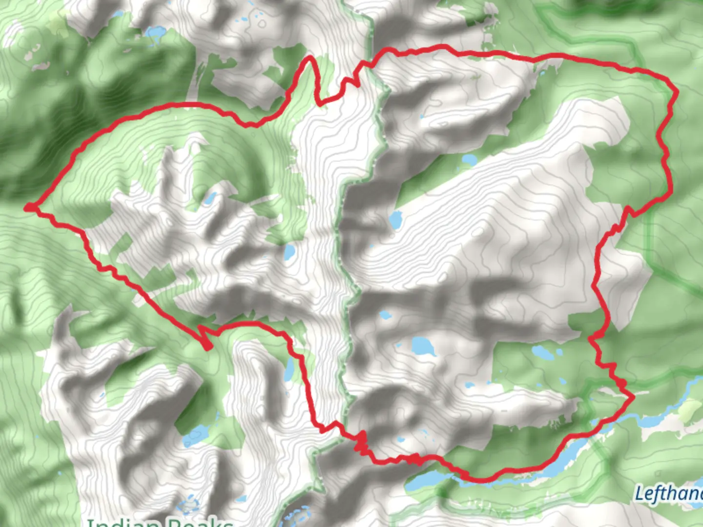
41.1 km
~2 days
2067 m
Loop
“Embark on a scenic 25.5-mile trek through Colorado's Rockies, encompassing wildflower meadows, wildlife, waterfalls, and historic passes.”
The Beaver Creek, Buchanan Pass and Cascade Creek Loop Trail is a captivating journey nestled in the heart of the Colorado wilderness, near Boulder County. This 41-kilometer (approximately 25.5 miles) loop trail offers an immersive experience into the rugged landscape of the Rocky Mountains, with an elevation gain of around 2000 meters (about 6562 feet), presenting a medium difficulty that appeals to hikers with a moderate level of fitness and experience.
Getting to the Trailhead
To reach the trailhead, hikers can drive to the designated parking area located near the Camp Dick Campground, which is accessible via the Peak to Peak Highway (CO-72). From Boulder, take CO-119 to Nederland, then head south on CO-72 until you reach the turnoff for the Middle St. Vrain Road (County Road 92), which leads to the campground. Public transportation options are limited in this area, so driving or carpooling is recommended.
Navigating the Trail
The loop can be tackled in either direction, but many choose to begin with the Beaver Creek section, which gradually ascends through dense forests of pine and aspen. Hikers can utilize the HiiKER app to navigate the trail, ensuring they stay on the correct path and can anticipate upcoming changes in terrain or elevation.
Natural Highlights and Landmarks
As you progress along the trail, you'll encounter a variety of natural landmarks. The first segment takes you through lush meadows dotted with wildflowers during the spring and summer months. Keep an eye out for wildlife such as elk, deer, and the occasional moose, which are known to inhabit the area.
Upon reaching Buchanan Pass, you'll be treated to panoramic views of the Indian Peaks Wilderness. This area holds historical significance as it was once used by Native American tribes and later by settlers and miners. The pass itself is named after a prospector who sought riches in the surrounding mountains.
Descending from the pass, the trail intersects with Cascade Creek, where the sound of rushing water accompanies you. This section is particularly scenic, with waterfalls and the opportunity to spot beavers at work in their natural habitat.
Preparation and Safety
Given the trail's length and elevation gain, it's essential to be well-prepared. Carry sufficient water, high-energy snacks, and a reliable map or GPS device. Weather in the mountains can change rapidly, so pack layers and rain gear. It's also wise to inform someone of your hiking plans and expected return time.
Seasonal Considerations
The best time to hike this loop is from June to September when the snow has melted, and the trail is most accessible. However, even in summer, snowfields may linger at higher elevations, so check current trail conditions before setting out. During the fall, the aspen groves turn a brilliant gold, offering a spectacular display for leaf-peepers.
Leave No Trace
As with any wilderness area, it's crucial to follow Leave No Trace principles. Pack out all trash, stay on designated trails to protect fragile alpine vegetation, and camp only in established sites if you plan to turn your hike into an overnight adventure.
By respecting these guidelines and coming prepared, hikers can fully enjoy the beauty and challenge of the Beaver Creek, Buchanan Pass and Cascade Creek Loop Trail, a true gem in Colorado's extensive network of hiking trails.

What to expect?
Activity types
Comments and Reviews
User comments, reviews and discussions about the Beaver Creek, Buchanan Pass and Cascade Creek Loop Trail, Colorado.
average rating out of 5
0 rating(s)