Download
Preview
Add to list
More
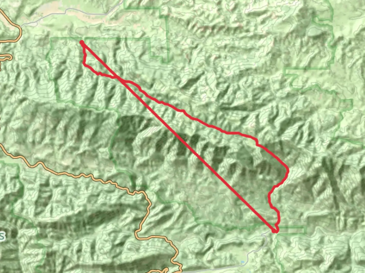
58.0 km
~3 day
2170 m
Point-to-Point
“Explore Ventura County's diverse landscapes and history on this challenging yet rewarding trail adventure.”
Nestled in the scenic landscapes of Ventura County, California, the Reyes Creek to Sespe River Trail offers a captivating journey through diverse terrains and rich history. Spanning approximately 58 kilometers (about 36 miles) with an elevation gain of around 2100 meters (approximately 6890 feet), this point-to-point trail is a medium-difficulty adventure that promises both challenge and reward.### Getting ThereTo reach the trailhead, head towards the Reyes Creek Campground, located near Lockwood Valley Road. If you're driving, take the CA-33 N from Ventura, which will lead you through the picturesque Los Padres National Forest. Public transport options are limited, so driving is the most convenient way to access the trailhead. Ensure your vehicle is equipped for rugged terrain, as the roads can be rough in certain sections.### Trail Highlights#### Diverse LandscapesThe trail begins at Reyes Creek Campground, where you'll be greeted by the serene sounds of the creek. As you embark on your journey, the trail meanders through lush forests, open meadows, and rocky outcrops. The initial section offers a gentle ascent, allowing you to acclimate to the elevation gain gradually. Keep an eye out for the vibrant wildflowers that dot the landscape, especially during spring.#### Wildlife and NatureThis region is home to a variety of wildlife, including deer, black bears, and an array of bird species. As you hike, listen for the calls of the California quail or spot the occasional golden eagle soaring above. The trail's diverse ecosystems provide ample opportunities for wildlife observation, so bring binoculars if you're a keen birdwatcher.#### Historical SignificanceThe area surrounding the trail is steeped in history, with roots tracing back to the Chumash people, who once inhabited these lands. As you traverse the trail, consider the historical significance of the region and the ancient paths that have been walked for centuries. The Sespe Wilderness, through which the trail passes, is one of the last remaining wild areas in Southern California, offering a glimpse into the past.### Navigational TipsGiven the trail's length and varying terrain, it's crucial to have a reliable navigation tool. HiiKER is an excellent resource for detailed maps and real-time trail updates. Ensure your device is fully charged, and consider carrying a portable charger for longer hikes.### Key LandmarksAround the halfway point, you'll encounter the Sespe River, a perfect spot to rest and enjoy the tranquil surroundings. The river is a vital water source, so take the opportunity to refill your water bottles. Remember to treat the water before drinking.As you approach the trail's end, the landscape opens up to reveal sweeping views of the surrounding mountains and valleys. The final descent towards the Sespe River is steep, so take care with your footing, especially if the trail is wet or muddy.### Preparation and SafetyGiven the trail's medium difficulty, it's essential to prepare adequately. Wear sturdy hiking boots, pack layers for changing weather conditions, and carry sufficient food and water. Be mindful of the weather forecast, as conditions can change rapidly in the mountains. Always inform someone of your hiking plans and expected return time.The Reyes Creek to Sespe River Trail is a remarkable journey through some of California's most beautiful and untouched landscapes. With careful preparation and respect for the natural environment, hikers can enjoy a truly unforgettable experience.

What to expect?
Activity types
Comments and Reviews
User comments, reviews and discussions about the Reyes Creek to Sespe River Trail, California.
average rating out of 5
0 rating(s)