Download
Preview
Add to list
More
42.6 km
~2 day
1467 m
Out and Back
“Embark on a serene yet rigorous journey through Sierra Nevada's splendor, culminating in Mount Lyell's majestic summit.”
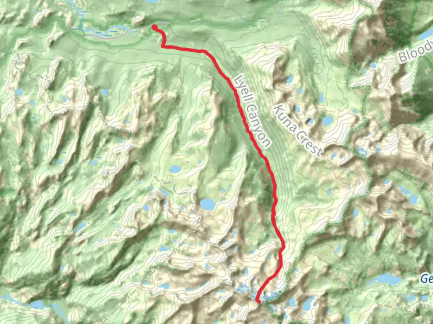
Embarking on the Mount Lyell via Pacific Crest Trail (PCT) journey, hikers will traverse approximately 43 kilometers (around 27 miles) with an elevation gain of roughly 1400 meters (about 4600 feet). This out-and-back trail, nestled near Tuolumne County, California, is rated as medium difficulty, offering a blend of challenging and rewarding experiences.
Getting to the Trailhead
The trailhead is accessible by car, located near the Tioga Pass Entrance Station of Yosemite National Park. For those relying on public transportation, the YARTS (Yosemite Area Regional Transportation System) provides seasonal services to Yosemite National Park, where you can then use the park's shuttle system to reach the trailhead.
The Journey Begins
Setting out from the trailhead, hikers will be greeted by the expansive meadows and towering peaks of the Sierra Nevada. The initial segment of the trail is a gentle ascent through the Lyell Canyon, following the Lyell Fork of the Tuolumne River. This area is a mosaic of lush meadows and clear streams, with the river providing a serene soundtrack to the hike.
Ascending Toward Donohue Pass
As you progress, the trail becomes steeper, leading toward Donohue Pass, which sits at an elevation of approximately 11,056 feet (3370 meters). This section of the trail offers panoramic views of the surrounding peaks and valleys. The pass itself is a significant landmark, marking the boundary between Yosemite National Park and the Ansel Adams Wilderness.
Mount Lyell's Approach
Beyond Donohue Pass, the trail becomes more rugged and remote. Hikers will navigate through rocky terrain and past alpine lakes, each offering unique vistas and opportunities for rest. The approach to Mount Lyell, the highest peak in Yosemite National Park, is a challenging climb, but the effort is rewarded with breathtaking views from the summit.
Flora and Fauna
Throughout the hike, the diverse ecosystems of the Sierra Nevada are on full display. Hikers can expect to see a variety of plant life, from wildflowers to ancient whitebark pines. The area is also home to wildlife such as mule deer, pikas, and if lucky, hikers might spot the elusive Sierra Nevada bighorn sheep.
Historical Significance
The region holds historical significance as part of the PCT, a trail that spans from Mexico to Canada and has been a path for explorers and adventurers for decades. Additionally, the area around Mount Lyell has been important for scientific research, particularly in the fields of geology and glaciology.
Navigation and Preparation
Hikers should prepare for varying weather conditions and be equipped with appropriate gear for both warm and cold climates. Navigation can be managed using the HiiKER app, which provides detailed maps and trail information to ensure you stay on the right path.
Safety and Leave No Trace
As with any backcountry adventure, safety is paramount. Hikers should be aware of their surroundings, especially when it comes to wildlife and rapidly changing mountain weather. It's also important to practice Leave No Trace principles, preserving the natural beauty of the trail for future generations.
By preparing adequately and respecting the environment, hikers can look forward to an unforgettable experience on the Mount Lyell via Pacific Crest Trail, surrounded by the majestic beauty of the High Sierra.

What to expect?
Activity types
Comments and Reviews
User comments, reviews and discussions about the Mount Lyell via Pacific Crest Trail, California.
average rating out of 5
0 rating(s)