Download
Preview
Add to list
More
42.9 km
~2 day
1819 m
Out and Back
“Explore stunning landscapes and historical paths on this challenging yet rewarding Sierra Nevada adventure.”
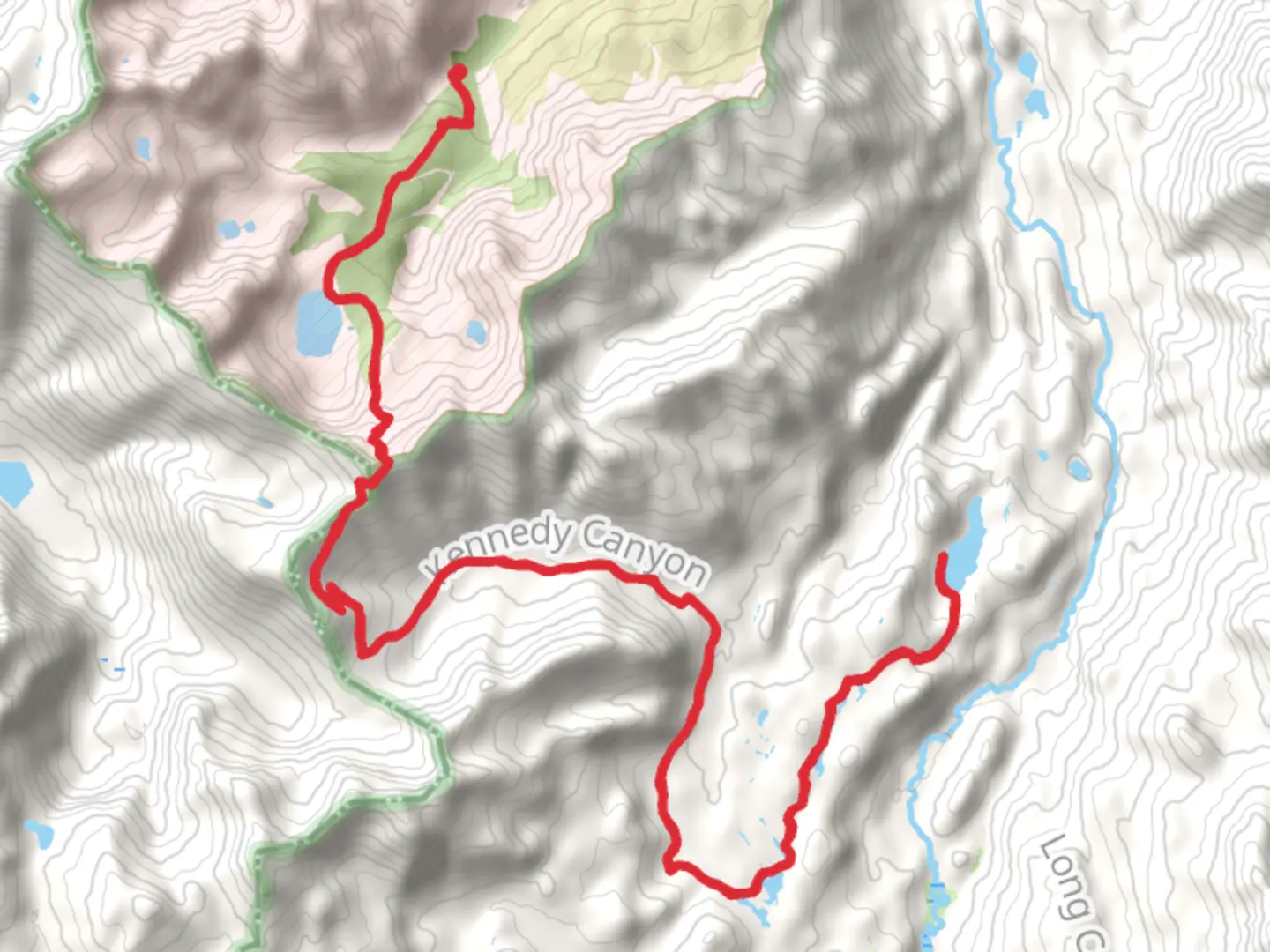
Nestled in the scenic Mono County, California, the Fremont Lake via Leavitt Lake Road trail offers a captivating journey through diverse landscapes. This out-and-back trail stretches approximately 43 kilometers (about 27 miles) with an elevation gain of around 1800 meters (5905 feet), making it a moderately challenging adventure for hikers.
Getting There
To reach the trailhead, head towards Mono County, California. If you're driving, take U.S. Route 395, which runs north-south through the eastern Sierra Nevada. From there, you'll find Leavitt Lake Road, a rugged path that leads to the trailhead. Be prepared for a bumpy ride, as the road can be rough and is best suited for vehicles with high clearance. For those relying on public transport, the nearest major hub is in Mammoth Lakes, where you can arrange for a taxi or shuttle service to the trailhead.
Trail Highlights
The journey begins near Leavitt Lake, a serene alpine lake surrounded by towering peaks. As you set off, the trail meanders through lush meadows dotted with wildflowers during the warmer months. Keep an eye out for mule deer and the occasional black bear, both of which are native to the region.
Ascending Through the Sierra Nevada
The trail gradually ascends through the Sierra Nevada, offering panoramic views of the surrounding mountains. At approximately 10 kilometers (6.2 miles) in, you'll reach a series of switchbacks that climb steeply, gaining significant elevation. This section can be strenuous, so take your time and enjoy the breathtaking vistas.
Historical Significance
This area is steeped in history, with the Sierra Nevada serving as a critical route during the California Gold Rush. The nearby Sonora Pass, one of the highest mountain passes in the Sierra Nevada, was a key passage for pioneers seeking fortune in the mid-1800s. As you hike, imagine the determination and resilience of those early travelers.
Reaching Fremont Lake
Around the 21.5-kilometer (13.4-mile) mark, you'll arrive at Fremont Lake, a pristine body of water nestled in a glacial basin. The lake is named after John C. Frémont, an explorer and military officer who played a significant role in the westward expansion of the United States. The tranquil setting is perfect for a rest, with opportunities for fishing or simply soaking in the natural beauty.
Wildlife and Flora
Throughout the hike, you'll encounter a variety of flora and fauna. The higher elevations are home to hardy alpine plants, while the lower meadows burst with color in spring and summer. Birdwatchers will delight in spotting species such as the Clark's nutcracker and mountain bluebird.
Navigation and Safety
Given the trail's length and elevation gain, it's crucial to be well-prepared. Use HiiKER to download offline maps and track your progress. Weather in the Sierra Nevada can change rapidly, so pack layers and be ready for sudden shifts in temperature. Ensure you have enough water and snacks, as the trail is remote with limited access to supplies.
Embarking on the Fremont Lake via Leavitt Lake Road trail promises an unforgettable experience, blending natural beauty with a touch of history. Whether you're drawn by the challenge or the serene landscapes, this trail offers a rewarding adventure for those prepared to tackle its rugged terrain.

What to expect?
Activity types
Comments and Reviews
User comments, reviews and discussions about the Fremont Lake via Leavitt Lake Road, California.
average rating out of 5
0 rating(s)