Download
Preview
Add to list
More
42.6 km
~2 day
1783 m
Loop
“Embark on a challenging trek through Ballarat's rugged loop, blending breathtaking vistas with rich history.”
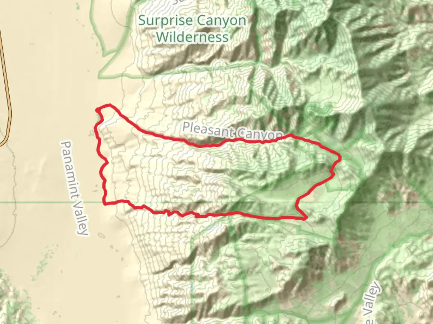
Nestled in the rugged terrain of Inyo County, California, the Ballarat - Slims Peak Loop offers a challenging yet rewarding adventure for seasoned hikers. This 43 km (approximately 27 miles) loop trail boasts an elevation gain of around 1700 meters (about 5577 feet), making it a demanding trek that promises breathtaking views and a deep dive into the natural and historical richness of the region.### Getting ThereTo reach the trailhead, head towards the historic ghost town of Ballarat, located in the Panamint Valley. If you're driving, take the Ballarat Road off Highway 178. The nearest significant landmark is the Ballarat General Store, which serves as a convenient point to park your vehicle and gather any last-minute supplies. For those relying on public transport, the closest major hub is Ridgecrest, California. From there, you may need to arrange a taxi or rideshare service to reach Ballarat, as public transport options are limited in this remote area.### Trail Highlights#### Historical SignificanceBallarat itself is a fascinating starting point, once a bustling supply town during the late 19th-century mining boom. As you begin your hike, take a moment to explore the remnants of this ghost town, including old buildings and mining equipment that whisper tales of the past. This area was a pivotal supply hub for miners seeking fortune in the nearby Panamint Range.#### Natural Beauty and WildlifeAs you ascend towards Slims Peak, the trail offers a diverse array of landscapes. The lower sections are characterized by arid desert terrain, dotted with hardy shrubs and cacti. Keep an eye out for the local wildlife, including desert bighorn sheep and various bird species that thrive in this harsh environment.The climb becomes more strenuous as you approach the higher elevations, where the trail meanders through rocky outcrops and offers panoramic views of the surrounding valleys and distant mountain ranges. The stark beauty of the desert landscape is complemented by the occasional splash of color from wildflowers, especially in the spring months.#### Key LandmarksAround the halfway point, approximately 21.5 km (13.4 miles) into the hike, you'll reach Slims Peak. This summit provides a stunning vantage point, rewarding your efforts with sweeping vistas that stretch across the Panamint Valley and beyond. It's an ideal spot to rest, refuel, and soak in the expansive views before beginning your descent.### Trail Navigation and SafetyGiven the trail's difficulty rating, it's crucial to be well-prepared. Ensure you have adequate water, as sources are scarce along the route. Weather conditions can vary significantly, with scorching temperatures in the summer and potentially chilly winds at higher elevations. Use the HiiKER app to navigate the trail accurately, as some sections can be tricky to follow due to the rugged terrain and lack of clear signage.### Final StretchThe descent back towards Ballarat offers a different perspective, with the late afternoon sun casting long shadows across the desert floor. As you complete the loop, take a moment to reflect on the journey through this remote and captivating landscape, where history and nature intertwine to create an unforgettable hiking experience.

What to expect?
Activity types
Comments and Reviews
User comments, reviews and discussions about the Ballarat - Slims Peak Loop, California.
average rating out of 5
0 rating(s)