Download
Preview
Add to list
More
41.7 km
~2 days
1736 m
Out and Back
“Discover breathtaking views and rich history on the challenging Freel Peak hike in the Sierra Nevada.”
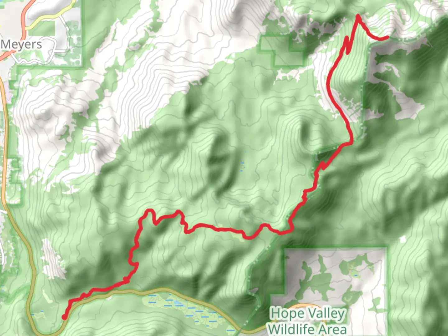
Nestled in the stunning Sierra Nevada range, the Freel Peak via Tahoe Rim Trail offers an exhilarating adventure for seasoned hikers. This challenging out-and-back trail spans approximately 42 kilometers (about 26 miles) with an elevation gain of around 1,700 meters (5,577 feet). The trailhead is conveniently located near El Dorado County, California, making it accessible for those eager to explore the breathtaking landscapes of the Lake Tahoe Basin.
Getting There
For those traveling by car, the trailhead can be accessed via Highway 50, turning onto Pioneer Trail and then onto Oneidas Street. Parking is available near the trailhead, but it can fill up quickly, especially during peak hiking seasons. If you prefer public transport, the nearest major hub is South Lake Tahoe, which is serviced by several bus routes. From there, a short taxi or rideshare journey will bring you to the trailhead.
Trail Overview
The Freel Peak via Tahoe Rim Trail is renowned for its diverse terrain and panoramic views. As you embark on this journey, you'll traverse through lush forests, alpine meadows, and rocky ridges. The trail is well-marked, but it's advisable to use the HiiKER app for navigation to ensure you stay on course, especially in areas where the path may become less distinct.
Significant Landmarks and Natural Features
One of the highlights of this trail is the ascent to Freel Peak, the highest point in the Lake Tahoe Basin at 3,318 meters (10,886 feet). The summit offers unparalleled views of Lake Tahoe, Carson Valley, and the surrounding peaks. Along the way, hikers will encounter the serene Star Lake, a perfect spot for a rest and to soak in the tranquil beauty of the high Sierra.
The trail also passes through the Tahoe Rim Trail Association's designated wilderness areas, where hikers can experience the pristine natural environment. Keep an eye out for local wildlife, including mule deer, black bears, and a variety of bird species. The flora is equally impressive, with wildflowers blooming in the summer months and ancient Jeffrey pines dotting the landscape.
Historical Significance
The region surrounding Freel Peak is steeped in history. The Washoe people, the area's original inhabitants, have a deep cultural connection to the land. As you hike, consider the historical significance of the trails that were once used by Native American tribes for hunting and trading. The Tahoe Rim Trail itself is a testament to modern conservation efforts, designed to protect and showcase the natural beauty of the Lake Tahoe Basin.
Trail Conditions and Preparation
Given its difficulty rating, this trail is best suited for experienced hikers. The elevation gain is significant, and the weather can change rapidly, so it's crucial to be well-prepared. Ensure you have adequate water, food, and clothing layers to accommodate varying temperatures. Trekking poles can be beneficial for the steeper sections, and sturdy hiking boots are a must.
Before setting out, check local weather forecasts and trail conditions. Snow can linger on the higher elevations well into the summer months, and thunderstorms are common in the afternoons. Always practice Leave No Trace principles to preserve the natural beauty of the area for future generations.

What to expect?
Activity types
Comments and Reviews
User comments, reviews and discussions about the Freel Peak via Tahoe Rim Trail, California.
average rating out of 5
0 rating(s)