Download
Preview
Add to list
More
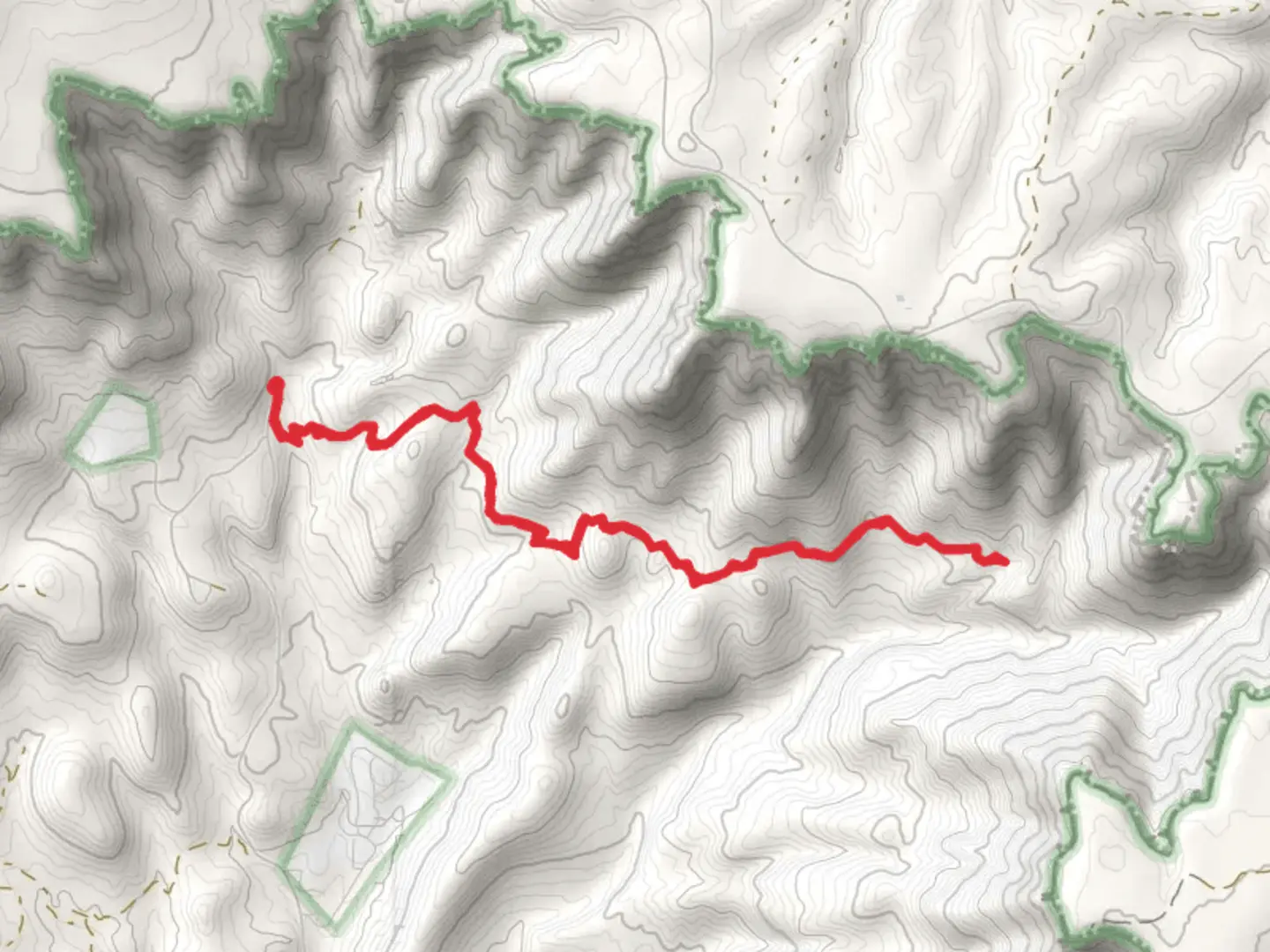
12.4 km
~3 hrs 21 min
521 m
Out and Back
“Embark on a moderately challenging 12 km hike through diverse landscapes, rich history, and stunning vistas in Gila County.”
Starting your adventure near Gila County, Arizona, the Tonto Creek and Dick Williams Creek via Highline Trail offers a captivating journey through diverse landscapes. This out-and-back trail spans approximately 12 kilometers (7.5 miles) with an elevation gain of around 500 meters (1,640 feet), making it a moderately challenging hike suitable for those with some hiking experience.
Getting There
To reach the trailhead, you can drive or use public transport. If driving, head towards the town of Payson, Arizona. From Payson, take AZ-260 E for about 16 miles until you reach the turnoff for Forest Road 289. Follow this road for approximately 2 miles to reach the trailhead. For those using public transport, the nearest major bus station is in Payson, from where you can arrange a taxi or rideshare to the trailhead.
Trail Overview
The trail begins with a gentle ascent through a mixed forest of ponderosa pines and oak trees. Early on, you'll cross Tonto Creek, a serene waterway that provides a refreshing start to your hike. The first 2 kilometers (1.2 miles) are relatively easy, with a gradual elevation gain of about 100 meters (328 feet).
Significant Landmarks and Nature
As you continue, the trail becomes steeper, climbing another 200 meters (656 feet) over the next 3 kilometers (1.9 miles). This section offers stunning views of the Mogollon Rim, a prominent geological feature that stretches across central Arizona. Keep an eye out for wildlife such as mule deer, elk, and various bird species, including the striking Steller's jay.
Historical Significance
The Highline Trail itself is steeped in history, originally established in the late 1800s as a route for cattle drives. The area around Tonto Creek and Dick Williams Creek has been inhabited for thousands of years, with evidence of Native American settlements. The trail passes near several ancient ruins and petroglyphs, offering a glimpse into the region's rich cultural heritage.
Navigation and Safety
Around the 6-kilometer (3.7-mile) mark, you'll reach the junction where Tonto Creek meets Dick Williams Creek. This is a great spot to take a break and enjoy the tranquil surroundings. The trail then follows Dick Williams Creek for another 2 kilometers (1.2 miles), with a final elevation gain of 200 meters (656 feet) before reaching the turnaround point.
For navigation, it's highly recommended to use the HiiKER app, which provides detailed maps and real-time GPS tracking to ensure you stay on course. The trail is well-marked, but having a reliable navigation tool is always a good idea.
Flora and Fauna
The return journey offers a different perspective, with the descent providing opportunities to spot different flora and fauna. The diverse plant life includes wildflowers in the spring and vibrant foliage in the fall, making this trail a year-round attraction.
Final Stretch
As you make your way back to the trailhead, take the time to appreciate the changing light and shadows cast by the towering trees and rugged terrain. The descent is easier on the legs, allowing you to enjoy the natural beauty without the strain of the initial climb.
This trail offers a perfect blend of natural beauty, historical significance, and moderate physical challenge, making it a rewarding experience for any hiker.

What to expect?
Activity types
Comments and Reviews
User comments, reviews and discussions about the Tonto Creek and Dick Williams Creek via Highline Trail, Arizona.
4.57
average rating out of 5
14 rating(s)