Segelsen Road
Mt. Baker-Snoqualmie National Forest · Snohomish County, Washington
24.8 km
~1 day 2 hrs
1363 m
“Embark on a scenic, moderately challenging 25 km hike with breathtaking views and rich historical landmarks.”
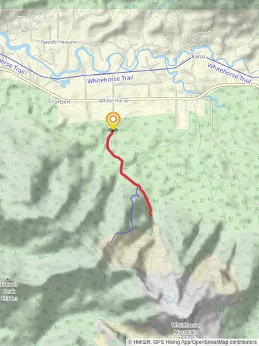
Starting near Snohomish County, Washington, this 25 km (15.5 miles) out-and-back trail offers a moderate challenge with an elevation gain of approximately 1300 meters (4265 feet). The trailhead is accessible by car, with parking available nearby. For those using public transport, the nearest significant landmark is the town of Granite Falls, from where you can arrange a taxi or rideshare to the trailhead.
### Trail Overview
The trail begins with a gentle ascent through dense forest, characterized by towering Douglas firs and western hemlocks. The first 3 km (1.9 miles) are relatively easy, with an elevation gain of about 200 meters (656 feet). This section is ideal for warming up and getting accustomed to the terrain. Keep an eye out for local wildlife such as black-tailed deer and various bird species, including the Steller's jay and the northern flicker.
### Mid-Trail Landmarks
Around the 5 km (3.1 miles) mark, you'll encounter a small, picturesque creek. This is a great spot to take a short break and enjoy the serene surroundings. The trail then begins to climb more steeply, gaining another 400 meters (1312 feet) over the next 4 km (2.5 miles). As you ascend, the forest starts to thin out, offering glimpses of the surrounding mountains and valleys.
At approximately 9 km (5.6 miles), you'll reach a significant landmark: an old, abandoned fire lookout tower. This structure dates back to the early 20th century and offers a fascinating glimpse into the region's history of forest management and fire prevention. The views from this point are spectacular, providing a panoramic vista of the Cascade Range.
### Final Ascent and Summit
The final 3.5 km (2.2 miles) to the summit are the most challenging, with an elevation gain of about 700 meters (2297 feet). The trail becomes rockier and more exposed, so be prepared for some scrambling. As you approach the summit, the vegetation changes to alpine meadows, dotted with wildflowers in the spring and summer months. The summit itself offers breathtaking 360-degree views, making the strenuous climb well worth the effort.
### Navigation and Safety
Given the trail's moderate difficulty and varying terrain, it's advisable to use a reliable navigation tool like HiiKER to stay on track. Weather conditions can change rapidly, especially at higher elevations, so be sure to check the forecast and pack accordingly. Essential gear includes sturdy hiking boots, layered clothing, plenty of water, and high-energy snacks.
### Flora and Fauna
Throughout the hike, you'll encounter a diverse range of flora and fauna. In addition to the towering conifers, look for understory plants like salal, Oregon grape, and sword fern. Wildlife sightings may include black bears, so it's crucial to carry bear spray and know how to use it. Smaller mammals like chipmunks and squirrels are also common, as are various species of butterflies and insects.
### Historical Significance
The region around Snohomish County has a rich history, with indigenous peoples having lived in the area for thousands of years. The trail itself passes through lands traditionally used by the Snohomish and other Coast Salish tribes. The abandoned fire lookout tower serves as a reminder of the early 20th-century efforts to manage and protect these forests from wildfires.
### Getting There
To reach the trailhead by car, head towards Granite Falls, Washington. From there, follow the Mountain Loop Highway until you reach the designated parking area near the trailhead. If using public transport, take a bus or train to Granite Falls and then arrange for a taxi or rideshare to the trailhead. Ensure you have a reliable means of communication, as cell service can be spotty in this remote area.
Reviews
User comments, reviews and discussions about the Segelsen Road, Washington.
5.0
average rating out of 5
1 rating(s)


