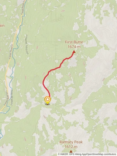
Cub Creek Road and Buck Mountain Loop
Okanogan-Wenatchee National Forest · Okanogan County, Washington
15.3 km
~4 hrs 5 min
619 m
“Explore the challenging and scenic Cub Creek Road and Buck Mountain Loop in Washington's Methow Valley.”
Starting your adventure near Okanogan County, Washington, the Cub Creek Road and Buck Mountain Loop is a captivating 15 km (approximately 9.3 miles) loop trail with an elevation gain of around 600 meters (about 1,968 feet). This trail is rated as medium difficulty, making it suitable for hikers with some experience and a good level of fitness.
### Getting There To reach the trailhead, you can drive or use public transport. If driving, head towards the Methow Valley area, specifically near the town of Winthrop, WA. The nearest significant landmark is the Methow Valley State Airport. From Winthrop, take the West Chewuch Road north for about 10 miles until you reach Cub Creek Road. Public transport options are limited, so driving is the most convenient way to access the trailhead.
### Trail Navigation For navigation, it is highly recommended to use HiiKER, which provides detailed maps and real-time GPS tracking to ensure you stay on the right path.
### Trail Description The trail begins with a gentle ascent through a mixed forest of pine and fir trees. As you progress, the path becomes steeper, offering a moderate challenge. After about 3 km (1.9 miles), you will reach the first significant viewpoint, providing panoramic views of the Methow Valley and the surrounding mountains.
### Flora and Fauna The trail is rich in biodiversity. In the spring and summer months, you will encounter a variety of wildflowers, including lupines and Indian paintbrush. Wildlife is abundant; keep an eye out for deer, black bears, and a variety of bird species such as eagles and hawks.
### Historical Significance The region has a rich history, with the Methow Valley being home to the Methow people for thousands of years. As you hike, you may come across remnants of old homesteads and logging operations from the early 20th century, offering a glimpse into the area's past.
### Key Landmarks Around the 7 km (4.3 miles) mark, you will reach Buck Mountain, the highest point of the trail. The summit offers breathtaking 360-degree views, making it a perfect spot for a rest and some photography. The elevation gain to this point is approximately 400 meters (1,312 feet).
### Descent and Return The descent begins after Buck Mountain, where the trail loops back towards Cub Creek Road. The path down is less steep but requires careful footing, especially in wet conditions. The final stretch of the trail takes you through a serene meadow, often filled with grazing deer and the occasional coyote sighting.
### Final Stretch As you near the end of the loop, the trail flattens out, making for a pleasant and easy walk back to the trailhead. This section is about 2 km (1.2 miles) and offers a relaxing end to your hike, with the sounds of Cub Creek accompanying you.
This trail offers a mix of challenging climbs, rewarding views, and a rich natural and historical tapestry, making it a must-visit for any hiking enthusiast.
Reviews
User comments, reviews and discussions about the Cub Creek Road and Buck Mountain Loop, Washington.
4.0
average rating out of 5
9 rating(s)


