Juniper Peak via Juniper Ridge Trail
8.9 km
~2 hrs 44 min
580 m
“Embark on a scenic, moderately challenging 9 km hike through lush forests to panoramic Juniper Peak.”
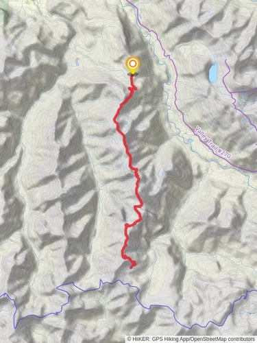
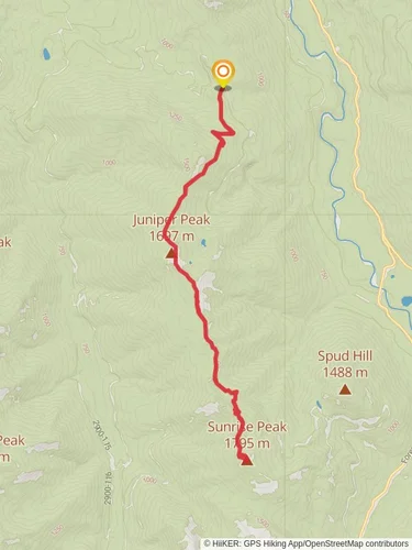
Starting your adventure near Lewis County, Washington, the Juniper Peak via Juniper Ridge Trail offers a captivating journey through the Pacific Northwest's lush landscapes. This out-and-back trail spans approximately 9 kilometers (5.6 miles) with an elevation gain of around 500 meters (1,640 feet), making it a moderately challenging hike suitable for those with some experience.
### Getting There To reach the trailhead, you can drive or use public transport. If driving, head towards the nearest significant landmark, the town of Randle, Washington. From Randle, take Forest Road 23 south for about 20 miles until you reach the Juniper Ridge Trailhead. For those relying on public transport, the nearest bus stop is in Randle, from where you can arrange a taxi or rideshare to the trailhead.
### Trail Overview The trail begins with a gentle ascent through dense forest, where you'll be greeted by towering Douglas firs and western hemlocks. As you progress, the trail becomes steeper, and the forest canopy opens up, offering glimpses of the surrounding valleys and distant peaks.
### Key Landmarks and Points of Interest - 1.5 km (0.9 miles) In: You'll encounter a small, serene creek. This is a great spot to take a short break and enjoy the soothing sounds of flowing water. - 3 km (1.9 miles) In: The trail starts to climb more steeply, and you'll notice the vegetation changing. Here, the forest gives way to alpine meadows filled with wildflowers during the spring and summer months. - 4.5 km (2.8 miles) In: As you approach Juniper Peak, the trail becomes rockier. Keep an eye out for mountain goats, which are often seen grazing on the slopes.
### Historical Significance The region around Juniper Peak has a rich history. It was traditionally inhabited by the Cowlitz Tribe, who used the area for hunting and gathering. The trail itself was part of a network of paths used by early settlers and loggers in the late 19th and early 20th centuries. Remnants of old logging camps can still be found if you know where to look.
### Wildlife and Flora The trail is home to a diverse range of wildlife. Besides mountain goats, you might spot black bears, deer, and various bird species such as the northern spotted owl and the Steller's jay. The flora is equally impressive, with seasonal displays of lupines, Indian paintbrush, and beargrass.
### Navigation and Safety Given the moderate difficulty of the trail, it's essential to come prepared. Use HiiKER for accurate trail maps and real-time navigation. The trail is well-marked, but weather conditions can change rapidly, especially at higher elevations. Always carry sufficient water, snacks, and layers of clothing to adapt to changing temperatures.
### Final Ascent The final push to Juniper Peak is the most challenging part of the hike, with a steep and rocky path leading to the summit. Once you reach the peak, you'll be rewarded with panoramic views of the Cascade Range, including Mount Rainier and Mount St. Helens on clear days. Take some time to soak in the breathtaking scenery before beginning your descent.
This trail offers a perfect blend of natural beauty, historical intrigue, and moderate physical challenge, making it a must-visit for any hiking enthusiast exploring the Pacific Northwest.
Reviews
User comments, reviews and discussions about the Juniper Peak via Juniper Ridge Trail, Washington.
5.0
average rating out of 5
9 rating(s)


