5.6 km
~1 hrs 8 min
9 m
“Explore the scenic, accessible 6 km Airport Levee Trail near Chehalis-Centralia Airport, perfect for birdwatching and history buffs.”
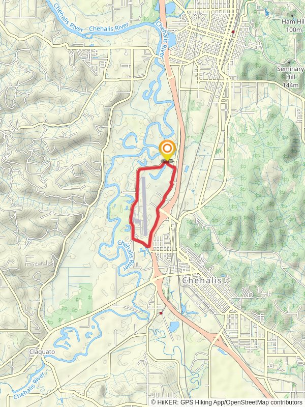
Starting near Lewis County, Washington, the Airport Levee Trail is a loop trail that spans approximately 6 km (around 3.7 miles) with virtually no elevation gain, making it an accessible hike for many. The trailhead is conveniently located near the Chehalis-Centralia Airport, which serves as a significant landmark for those unfamiliar with the area.
### Getting There For those driving, the trailhead can be accessed via I-5, taking exit 79 towards Chamber Way. From there, follow signs to the Chehalis-Centralia Airport. Ample parking is available near the airport. If you prefer public transport, the Twin Transit bus service offers routes that stop near the airport, making it a convenient option for those without a car.
### Trail Navigation The loop trail is well-marked and easy to follow. For precise navigation, using the HiiKER app is recommended. The app provides real-time GPS tracking and detailed maps to ensure you stay on course.
### What to Expect The trail meanders along the levee, offering scenic views of the surrounding wetlands and the Chehalis River. The flat terrain makes it an ideal hike for families and those looking for a leisurely walk. Despite the lack of elevation gain, the trail is rated as medium difficulty due to its length and the potential for muddy conditions, especially after rain.
### Flora and Fauna The wetlands are a haven for birdwatchers. Keep an eye out for herons, egrets, and various species of ducks. The area is also home to small mammals like beavers and otters, which can often be seen near the water. The trail is lined with native vegetation, including willows and cottonwoods, providing ample shade during the warmer months.
### Historical Significance The Chehalis-Centralia Airport, adjacent to the trail, has historical significance dating back to World War II. Originally built as a training base for military pilots, the airport has since been converted for civilian use. The levee itself was constructed to protect the surrounding areas from flooding, a testament to the region's efforts in managing its waterways.
### Points of Interest Approximately 2 km (1.2 miles) into the hike, you'll come across a small observation deck that offers panoramic views of the wetlands. This is an excellent spot for a break and some birdwatching. Another 1 km (0.6 miles) further, you'll find a historical marker detailing the construction of the levee and its importance to the local community.
### Preparation Tips Given the trail's proximity to wetlands, it's advisable to wear waterproof footwear, especially during the rainy season. Bring binoculars if you're interested in birdwatching, and don't forget insect repellent, as mosquitoes can be prevalent. The trail is exposed in some sections, so sun protection is also recommended.
### Final Stretch As you complete the loop, the trail will bring you back to the starting point near the airport. This final section offers views of the airfield, where you might catch a glimpse of small aircraft taking off or landing, adding a unique element to your hike.
Reviews
User comments, reviews and discussions about the Airport Levee Trail, Washington.
5.0
average rating out of 5
6 rating(s)


