Tuscarora Trail trail stages
stage 1
Sterretts Gap to Flat Rock Section
stage 2
Flat Rock Section to Blue Mountain
Starting at: Landisburg, Cumberland County, 17040
Ending at: Newville, Cumberland County, 17241
Distance: 20.4 km
Elevation gain: 680 m
Duration: 05:12:54
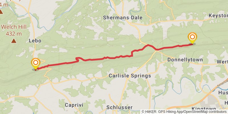
stage 3
Blue Mountain to Amberson Ridge
Starting at: Newville, Cumberland County, 17241
Ending at: Upper Mifflin, Cumberland County, 17240
Distance: 13.1 km
Elevation gain: 579 m
Duration: 03:34:56
stage 4
Amberson Ridge to Knob Mountain
Starting at: Upper Mifflin, Cumberland County, 17240
Ending at: Blain, Perry County, 17006
Distance: 12.4 km
Elevation gain: 720 m
Duration: 03:41:02
stage 5
Knob Mountain to Cowans Gap
Starting at: Blain, Perry County, 17006
Ending at: Fannett Township, Franklin County, 17262
Distance: 16.4 km
Elevation gain: 374 m
Duration: 03:54:33
stage 6
Cowans Gap to Tuscarora Summit
Starting at: Fannett Township, Franklin County, 17262
Ending at: Todd, Fulton County, 17233
Distance: 24.7 km
Elevation gain: 667 m
Duration: 06:03:02
stage 7
Tuscarora Summit to The Lockings
Starting at: Todd, Fulton County, 17233
Ending at: Peters, Franklin County, 17236
Distance: 14.8 km
Elevation gain: 666 m
Duration: 04:03:39
stage 8
The Lockings to Licking Creek
Starting at: Peters, Franklin County, 17236
Ending at: Warren, Franklin County, 17236
Distance: 22.0 km
Elevation gain: 461 m
Duration: 05:10:31
stage 9
Licking Creek to C&O Canal
Starting at: Warren, Franklin County, 17236
Ending at: Pecktonville, Washington County, 21750
Distance: 13.2 km
Elevation gain: 221 m
Duration: 03:00:57
stage 10
C&O Canal to Potomac
Starting at: Pecktonville, Washington County, 21750
Ending at: Hancock, Washington County, 21750
Distance: 12.1 km
Elevation gain: 24 m
Duration: 02:27:25
stage 11
Potomac to Sleepy Creek
Starting at: Hancock, Washington County, 21750
Ending at: Berkeley Springs, Morgan County, 25411
Distance: 15.2 km
Elevation gain: 368 m
Duration: 03:38:48
stage 12
Sleepy Creek to Shockeys Knob
Starting at: Berkeley Springs, Morgan County, 25411
Ending at: Hedgesville, Berkeley County, 25427
Distance: 28.8 km
Elevation gain: 1213 m
Duration: 07:46:26
stage 13
Shockeys Knob to Gainesborro
Starting at: Hedgesville, Berkeley County, 25427
Distance: 19.2 km
Elevation gain: 410 m
Duration: 04:31:20
stage 14
Gainesborro to Devils Backbone
Starting at: Siler, Winchester, Frederick County, 22603
Ending at: Lake Holiday, Frederick County, 22637
Distance: 17.1 km
Elevation gain: 392 m
Duration: 04:04:36
stage 15
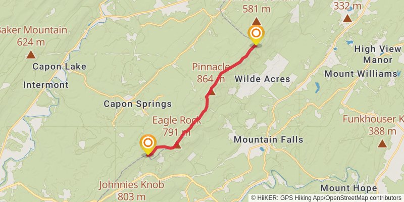
Devils Backbone to Capon Springs Ridgeline
Starting at: Lake Holiday, Frederick County, 22637
Ending at: Shawneeland, Hampshire County, 22637
Distance: 16.0 km
Elevation gain: 873 m
Duration: 04:38:47
stage 16
Capon Springs Ridgeline to County Line
Ending at: Capon Springs, Hampshire County, 26823
Distance: 9.9 km
Elevation gain: 193 m
Duration: 02:18:32
stage 17
County Line to Sugar Knob
Starting at: Star Tannery, Hampshire County, 22654
Ending at: Wardensville, Hardy County, 26851
Distance: 17.5 km
Elevation gain: 606 m
Duration: 04:30:14
stage 18
Sugar Knob to Fetzer Gap
Starting at: Wardensville, Hardy County, 26851
Ending at: Maurertown, Shenandoah County, 22644
Distance: 23.8 km
Elevation gain: 1055 m
Duration: 06:30:34
stage 19
Fetzer Gap to Massanutten West
Starting at: Maurertown, Shenandoah County, 22644
Ending at: Maurertown, Shenandoah County, 22652
Distance: 28.1 km
Elevation gain: 824 m
Duration: 06:58:57
stage 20
Massanutten West to Massanutten East
Starting at: Maurertown, Shenandoah County, 22652
Ending at: Strasburg, Shenandoah County, 22652
Distance: 12.1 km
Elevation gain: 440 m
Duration: 03:09:04
stage 21
Massanutten East to Mathew Arm
Starting at: Dilbeck, Strasburg, Shenandoah County, 22652
Ending at: Bentonville, Warren County, 22610
Distance: 23.4 km
Elevation gain: 961 m
Duration: 06:17:02
stage 22
Mathews Arm to Sterretts Gap
Starting at: Bentonville, Warren County, 22610
Ending at: Rileyville, Rappahannock County, 22650
Distance: 11.9 km
Elevation gain: 1048 m
Duration: 04:07:27