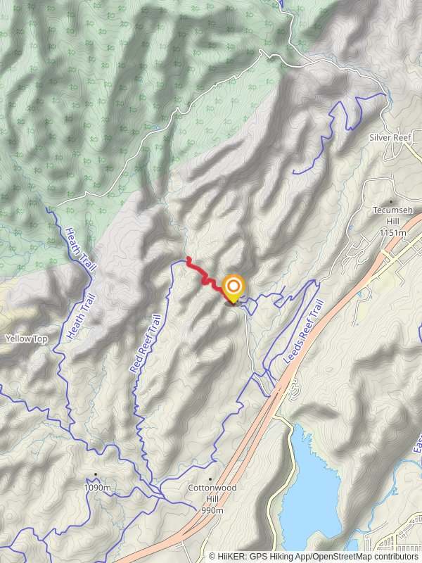
Quail Creek via Red Reef Trail
3.6 km
~1 hrs 2 min
197 m
“Embark on the Quail Creek via Red Reef Trail for a scenic, historical 4 km adventure in Utah.”
Starting your adventure near Washington County, Utah, the Quail Creek via Red Reef Trail offers a captivating 4 km (approximately 2.5 miles) out-and-back journey with an elevation gain of around 100 meters (328 feet). This medium-difficulty trail is perfect for those looking to experience the natural beauty and historical significance of the region.
### Getting There To reach the trailhead, you can drive or use public transport. If driving, head towards Red Cliffs Recreation Area, located off Interstate 15. The nearest significant landmark is the Red Cliffs Campground. For those using public transport, the nearest bus stop is in the town of Leeds, Utah, from where you can take a short taxi ride to the trailhead.
### Trail Overview The trail begins at the Red Cliffs Campground, a well-known starting point for various hikes in the area. As you set off, you'll immediately notice the striking red rock formations that give the region its name. The first section of the trail is relatively flat, making it an excellent warm-up for the more challenging parts ahead.
### Key Landmarks and Natural Features About 1 km (0.6 miles) into the hike, you'll encounter the first significant landmark: a series of small waterfalls and pools. These are particularly stunning after a rainfall, as the water cascades down the red rocks, creating a picturesque scene. This area is also a great spot for a short break and some photography.
Continuing along the trail, you'll start to gain elevation. The next 1.5 km (0.9 miles) will take you through a series of switchbacks, offering panoramic views of the surrounding landscape. Keep an eye out for native wildlife, including desert lizards, jackrabbits, and various bird species. The flora is equally captivating, with an array of desert plants such as yucca, sagebrush, and prickly pear cactus.
### Historical Significance The region is rich in history, with evidence of Native American habitation dating back thousands of years. Petroglyphs can be found on some of the rock faces along the trail, offering a glimpse into the lives of the ancient peoples who once roamed this land. These historical markers are a reminder of the cultural significance of the area and should be treated with respect.
### Navigation and Safety Given the trail's moderate difficulty, it's advisable to use a reliable navigation tool like HiiKER to keep track of your progress and ensure you stay on the correct path. The trail is well-marked, but having a digital map can provide extra peace of mind.
### Final Stretch As you approach the 2 km (1.25 miles) mark, you'll reach the turnaround point near Quail Creek. This area offers a serene setting for a rest before heading back. The return journey follows the same path, allowing you to enjoy the stunning scenery from a different perspective.
### Preparation Tips Ensure you bring plenty of water, especially during the hotter months, as the desert environment can be quite unforgiving. Sturdy hiking boots are recommended due to the rocky terrain. Sunscreen and a hat are also essential to protect against the strong sun.
This trail offers a perfect blend of natural beauty, historical intrigue, and moderate physical challenge, making it a rewarding experience for hikers of all levels.
Reviews
User comments, reviews and discussions about the Quail Creek via Red Reef Trail, Utah.
5.0
average rating out of 5
12 rating(s)


