3.6 km
~55 min
119 m
“Explore the scenic, medium-difficulty Slickrock Practice Loop, offering panoramic views and rich historical landmarks.”
Starting near Grand County, Utah, the Slickrock Practice Loop is a 4 km (2.5 miles) loop trail with an elevation gain of approximately 100 meters (328 feet). This trail is rated as medium difficulty, making it suitable for hikers with some experience.
### Getting There To reach the trailhead, you can drive or use public transportation. If driving, head towards the Sand Flats Recreation Area, which is the nearest significant landmark. The trailhead is located within this area. For those using public transport, the nearest bus stop is in Moab, Utah. From Moab, you can take a taxi or rideshare service to the Sand Flats Recreation Area.
### Trail Navigation The Slickrock Practice Loop is well-marked, but it's always a good idea to have a reliable navigation tool. HiiKER is an excellent app for this purpose, providing detailed maps and real-time tracking to ensure you stay on course.
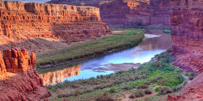
### What to Expect The trail begins with a gentle ascent, offering panoramic views of the surrounding desert landscape. The terrain is primarily slickrock, a type of sandstone that provides excellent traction but can be challenging to navigate due to its uneven surface. As you progress, you'll encounter a series of small hills and valleys, contributing to the overall elevation gain.
### Landmarks and Points of Interest Around the 1 km (0.6 miles) mark, you'll come across a natural rock formation known as "The Fin." This narrow ridge of rock offers a great vantage point for photos and a brief rest. Continuing along the trail, you'll pass through a series of small canyons and open plains, each offering unique views of the rugged landscape.
### Flora and Fauna The area is home to a variety of desert plants, including sagebrush, juniper, and various types of cacti. Wildlife is abundant, with frequent sightings of lizards, jackrabbits, and occasionally, desert bighorn sheep. Birdwatchers will also enjoy spotting species such as the golden eagle and peregrine falcon.
### Historical Significance The Slickrock Practice Loop is located in a region rich in Native American history. The area was once inhabited by the Ancestral Puebloans, and you may come across petroglyphs and other archaeological remnants along the trail. These ancient artworks offer a glimpse into the lives of the people who once called this harsh landscape home.
### Final Stretch As you near the end of the loop, the trail descends gradually back towards the trailhead. This section offers a final opportunity to take in the expansive views of the surrounding mesas and buttes. The descent is relatively easy, allowing you to finish your hike on a relaxed note.
### Preparation Tips Given the desert environment, it's crucial to bring plenty of water, sunscreen, and a hat. The trail is exposed with little shade, so plan to hike early in the morning or late in the afternoon to avoid the midday heat. Proper footwear is essential due to the slickrock terrain, and trekking poles can be helpful for maintaining balance on uneven surfaces.
By following these guidelines and being well-prepared, you'll have a rewarding experience exploring the Slickrock Practice Loop.
Reviews
User comments, reviews and discussions about the Slickrock Practice Loop, Utah.
0.0
average rating out of 5
0 rating(s)


