14.3 km
~3 hrs 24 min
323 m
“Embark on the captivating Slickrock Loop Trail for a moderately challenging, scenic 14 km adventure near Moab, Utah.”
Starting your adventure near Grand County, Utah, the Slickrock Loop Trail offers a captivating 14 km (approximately 8.7 miles) journey through some of the most stunning landscapes in the region. With an elevation gain of around 300 meters (approximately 984 feet), this loop trail is rated as medium difficulty, making it accessible for most hikers with a moderate level of fitness.
### Getting There
To reach the trailhead, you can drive or use public transportation. If driving, head towards the town of Moab, Utah, which is the nearest significant landmark. From Moab, take the Sand Flats Road east for about 10 miles until you reach the Slickrock Bike Trail parking area. This is where your hike begins. For those relying on public transport, the nearest bus stop is in Moab, and from there, you may need to arrange a taxi or rideshare to the trailhead.
### Trail Navigation
Using HiiKER for navigation is highly recommended as the trail can be tricky to follow in some sections. The app will help you stay on course and provide real-time updates on your location.
### Trail Highlights
#### Initial Ascent
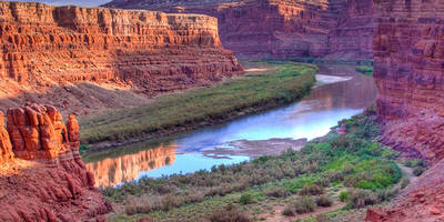
The trail starts with a gradual ascent, gaining about 150 meters (492 feet) in the first 3 km (1.9 miles). This section offers panoramic views of the surrounding canyons and mesas. Keep an eye out for the unique rock formations that give the trail its name.
#### Mid-Section and Wildlife
Around the 5 km (3.1 miles) mark, you'll reach a plateau that offers a relatively flat and easy walk for the next 4 km (2.5 miles). This area is rich in wildlife; you might spot desert bighorn sheep, lizards, and various bird species. The flora is equally fascinating, with juniper trees and sagebrush dotting the landscape.
#### Historical Significance
As you continue, you'll come across several ancient petroglyphs etched into the rock faces. These are remnants of the Native American tribes that once inhabited this region. Take a moment to appreciate these historical artifacts, but remember to respect and preserve them for future generations.
#### Final Descent
The last 3 km (1.9 miles) of the trail involve a descent back to the trailhead. This section can be a bit steep, so take your time and watch your footing. The descent offers stunning views of the La Sal Mountains in the distance, providing a perfect backdrop to end your hike.
### Practical Tips
- Water: Ensure you carry enough water, as there are no reliable water sources along the trail. - Footwear: Sturdy hiking boots are recommended due to the rocky terrain. - Weather: Check the weather forecast before you go. The trail can be extremely hot in the summer and icy in the winter. - Permits: No permits are required for this trail, but it's always good to check for any updates or changes in regulations.
### Final Thoughts
The Slickrock Loop Trail is a rewarding hike that offers a mix of natural beauty, wildlife, and historical significance. Whether you're a seasoned hiker or a casual adventurer, this trail provides an unforgettable experience in the heart of Utah's rugged landscape.
Reviews
User comments, reviews and discussions about the Slickrock Loop Trail, Utah.
5.0
average rating out of 5
20 rating(s)


