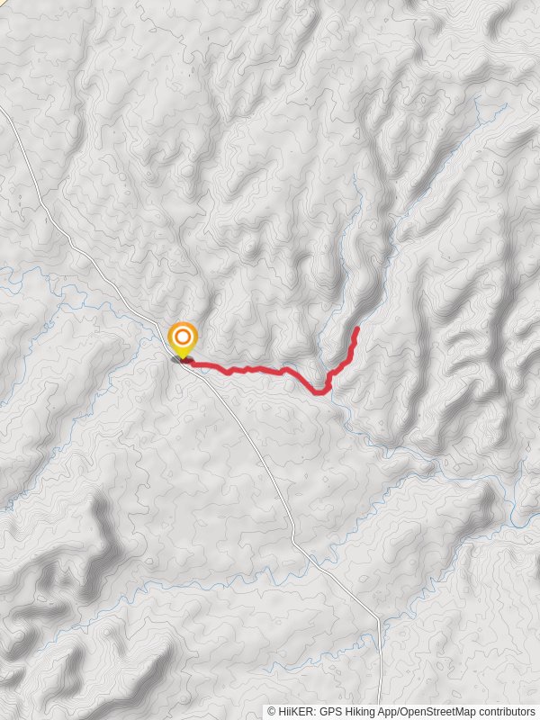
8.2 km
~1 hrs 59 min
206 m
“Embark on the Big Horn Canyon Trail to experience Utah's colorful canyons, ancient petroglyphs, and diverse wildlife!”
Starting your adventure near Garfield County, Utah, the Big Horn Canyon Trail offers an 8 km (approximately 5 miles) out-and-back journey with an elevation gain of around 200 meters (656 feet). This medium-difficulty trail is perfect for those looking to experience the rugged beauty of Utah's canyon landscapes.
### Getting There To reach the trailhead, you can drive or use public transport. If you're driving, head towards the town of Escalante, Utah. From Escalante, take the Scenic Byway 12 east for about 5 miles until you reach the turnoff for Hole-in-the-Rock Road. Follow this road for approximately 20 miles until you reach the trailhead. For those using public transport, the nearest major city with bus services is Salt Lake City. From there, you can rent a car or use a shuttle service to reach Escalante and then proceed to the trailhead.
### Trail Overview The trail begins with a gentle descent into the canyon, offering panoramic views of the surrounding sandstone cliffs. As you make your way down, you'll notice the vibrant colors of the rock formations, ranging from deep reds to bright oranges. The first 2 km (1.2 miles) are relatively easy, with a gradual decline that allows you to take in the scenery without too much effort.
### Significant Landmarks At around the 3 km (1.9 miles) mark, you'll come across a natural arch known as the Big Horn Arch. This impressive formation is a great spot for photos and a short rest. Continuing on, the trail becomes a bit steeper as you descend further into the canyon. Keep an eye out for petroglyphs etched into the canyon walls, remnants of the Native American tribes that once inhabited this area.
### Flora and Fauna The canyon is home to a variety of plant and animal life. You might spot desert wildflowers such as Indian paintbrush and yucca, especially in the spring. Wildlife is abundant, with chances to see mule deer, jackrabbits, and even the occasional bighorn sheep. Birdwatchers will also enjoy the sight of hawks and eagles soaring above the canyon.
### Historical Significance The Big Horn Canyon area has a rich history. The petroglyphs you see along the trail are believed to be created by the Fremont people, who lived in the region over a thousand years ago. These ancient artworks provide a glimpse into the lives and beliefs of these early inhabitants.
### Navigation and Safety Given the remote nature of the trail, it's essential to be well-prepared. Download the trail map from HiiKER before you set out, as cell service can be spotty in the canyon. Bring plenty of water, especially during the hotter months, and wear sturdy hiking boots to navigate the rocky terrain. The trail is well-marked, but it's always a good idea to have a physical map as a backup.
### Final Stretch As you approach the 4 km (2.5 miles) mark, the trail levels out, leading you to the turnaround point. Here, you can take a moment to rest and enjoy the serene beauty of the canyon before making your way back. The return journey offers a different perspective, with the changing light casting new shadows and highlights on the canyon walls.
The Big Horn Canyon Trail is a rewarding hike that combines natural beauty, historical intrigue, and a moderate physical challenge. Whether you're an experienced hiker or a curious explorer, this trail offers something for everyone.
Reviews
User comments, reviews and discussions about the Big Horn Canyon Trail, Utah.
4.0
average rating out of 5
22 rating(s)


