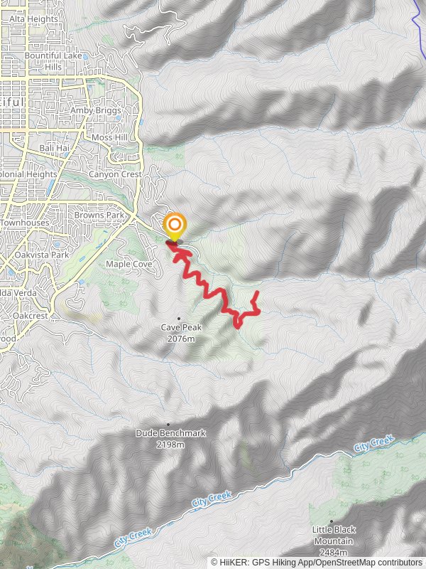
Mueller Park Trail
10.9 km
~3 hrs 2 min
514 m
“Mueller Park Trail offers scenic views, historical intrigue, and moderate challenge through diverse, wildlife-rich landscapes.”
Starting near Davis County, Utah, the Mueller Park Trail is an 11 km (approximately 6.8 miles) out-and-back trail with an elevation gain of around 500 meters (about 1,640 feet). This trail is rated as medium difficulty, making it suitable for moderately experienced hikers.### Getting There
To reach the trailhead, you can drive or use public transportation. If driving, head towards Bountiful, Utah, and navigate to Mueller Park Road. The trailhead is located near the Mueller Park Picnic Area. For those using public transport, the nearest significant landmark is the Bountiful City Park. From there, you can take a local taxi or rideshare service to the trailhead.### Trail Overview
The trail begins with a gentle ascent through a shaded forest of oak, maple, and pine trees. The initial 1.5 km (0.9 miles) offers a relatively easy hike with a gradual elevation gain of about 100 meters (328 feet). This section is perfect for warming up and getting accustomed to the terrain.### Key Landmarks and Sections
- Elephant Rock: At approximately 4.8 km (3 miles) into the hike, you'll encounter Elephant Rock, a prominent and popular resting spot. This natural rock formation offers stunning views of the surrounding valleys and is an excellent place for a break. The elevation gain to this point is around 300 meters (984 feet).
- Wildlife and Flora: As you continue, keep an eye out for local wildlife such as mule deer, wild turkeys, and various bird species. The trail is also rich in wildflowers during the spring and summer months, adding vibrant colors to your hike.- Historical Significance: The area around Mueller Park has historical significance dating back to early settlers in the region. The trail itself was used by Native American tribes and later by pioneers. Remnants of old cabins and historical markers can be found along the way, offering a glimpse into the past.### Final Ascent The last 1.5 km (0.9 miles) of the trail involves a steeper climb, adding another 200 meters (656 feet) to the elevation gain. This section can be more challenging, but the panoramic views from the top are well worth the effort. On clear days, you can see the Great Salt Lake and the distant peaks of the Wasatch Range.### Navigation and Safety For navigation, it's recommended to use the HiiKER app, which provides detailed maps and real-time updates. The trail is well-marked, but having a reliable navigation tool ensures you stay on track. Always carry enough water, snacks, and a first-aid kit. Weather can change rapidly, so check forecasts and be prepared for sudden shifts.### Return Journey The return journey follows the same path, allowing you to revisit the beautiful landscapes and perhaps notice details you missed on the way up. The descent is easier on the legs but still requires caution, especially on steeper sections.This trail offers a mix of natural beauty, historical intrigue, and moderate physical challenge, making it a rewarding experience for those who venture out.
Reviews
User comments, reviews and discussions about the Mueller Park Trail, Utah.
5.0
average rating out of 5
13 rating(s)
Loading reviews...


