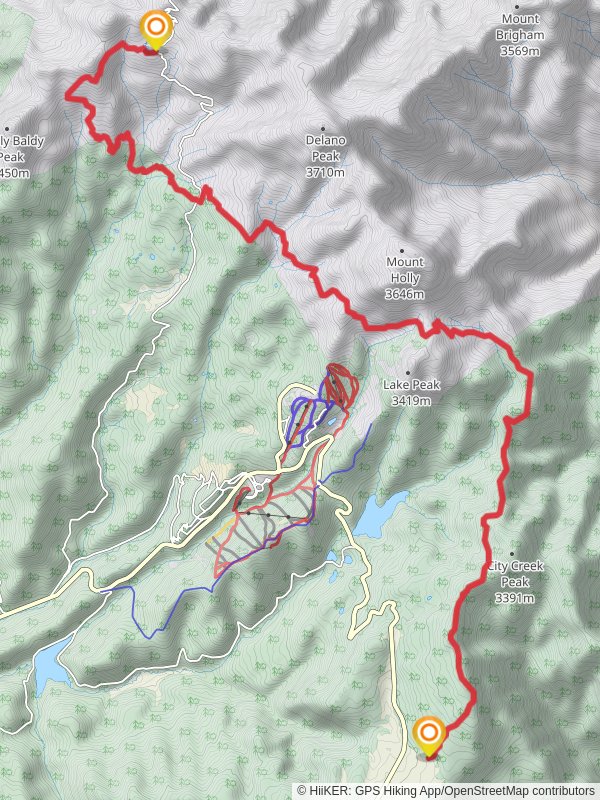
Skyline NRT Trail and Blue Lake Trail
20.9 km
~1 day 0 hrs
1086 m
“Embark on a 21 km journey through diverse terrains, stunning vistas, and historical landmarks near Beaver, Utah.”
Starting near Beaver County, Utah, this 21 km (approximately 13 miles) point-to-point trail offers a captivating journey through diverse landscapes with an elevation gain of around 1000 meters (3280 feet). The trailhead is accessible by car, and the nearest significant landmark is the town of Beaver, Utah. Public transport options are limited, so driving is the most practical way to reach the trailhead.### Trail OverviewThe Skyline NRT Trail and Blue Lake Trail is rated as medium difficulty, making it suitable for hikers with some experience. The trail meanders through a variety of terrains, including dense forests, open meadows, and rocky outcrops. The elevation gain is gradual but consistent, so be prepared for a steady climb.### Key Landmarks and Sections1. Initial Ascent (0-5 km / 0-3 miles):
The trail begins with a moderate ascent through a lush forest of pine and aspen trees. This section is relatively shaded, providing a cool start to your hike. Keep an eye out for deer and other wildlife that frequent this area. The first 5 km (3 miles) will see you gaining approximately 300 meters (984 feet) in elevation.2. Midway Meadows (5-10 km / 3-6 miles):
As you continue, the forest opens up into expansive meadows filled with wildflowers during the spring and summer months. This section is relatively flat, offering a respite from the initial climb. The meadows are a great spot for a break and to take in the panoramic views of the surrounding mountains.3. Blue Lake (10-15 km / 6-9 miles):
Around the 10 km (6 miles) mark, you'll begin a more strenuous ascent towards Blue Lake. The trail becomes rockier and more challenging, with an elevation gain of about 400 meters (1312 feet) over the next 5 km (3 miles). Blue Lake itself is a serene alpine lake, perfect for a longer rest. The clear waters reflect the surrounding peaks, creating a picturesque setting.4. Final Stretch (15-21 km / 9-13 miles):
The last section of the trail involves a descent through a mix of forest and open terrain. This part of the trail can be tricky, especially if the weather has been wet, making the path slippery. The descent is about 300 meters (984 feet) over the final 6 km (4 miles), leading you to the endpoint of the trail.### Historical SignificanceThe region around Beaver County has a rich history, with Native American tribes such as the Paiute having inhabited the area for centuries. The trail itself was used by early settlers and explorers, adding a layer of historical significance to your hike. As you traverse the trail, you may come across old mining sites and remnants of early settlements, offering a glimpse into the past.### Navigation and SafetyGiven the varied terrain and elevation changes, it's crucial to have a reliable navigation tool. HiiKER is highly recommended for this trail, providing detailed maps and real-time updates. Ensure you have adequate water, snacks, and weather-appropriate clothing. The trail can be remote in sections, so it's wise to inform someone of your plans before setting out.### Wildlife and FloraThe trail is home to a diverse range of wildlife, including deer, elk, and various bird species. In the spring and summer, the meadows are adorned with wildflowers such as lupines and Indian paintbrush. Be mindful of your surroundings and respect the natural habitat.This trail offers a rewarding experience for those prepared to tackle its challenges, with stunning landscapes and a touch of historical intrigue.
Reviews
User comments, reviews and discussions about the Skyline NRT Trail and Blue Lake Trail, Utah.
5.0
average rating out of 5
7 rating(s)
Loading reviews...


