16.3 km
~4 hrs 41 min
861 m
“Embark on the invigorating Puffer Lake Trail for stunning landscapes and rich historical insights.”
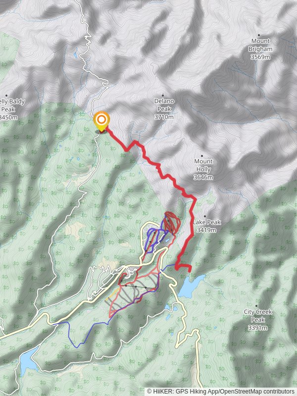
Starting near Beaver County, Utah, the Puffer Lake Trail is an invigorating out-and-back hike that spans approximately 16 kilometers (10 miles) with an elevation gain of around 800 meters (2,625 feet). This trail is rated as medium difficulty, making it suitable for moderately experienced hikers looking for a rewarding challenge.### Getting There
To reach the trailhead, you can drive or use public transport. If you're driving, head towards Beaver County and look for signs directing you to Puffer Lake. The nearest significant landmark is the Eagle Point Resort, located at 150 S W Village Cir, Beaver, UT 84713. From there, it's a short drive to the trailhead. Public transport options are limited, so driving is recommended for convenience.### Trail Overview
The trail begins with a gentle ascent through a dense forest of pine and aspen trees. Early on, you'll notice the crisp, clean air and the sound of rustling leaves, setting a serene tone for your hike. The first 3 kilometers (1.9 miles) are relatively easy, with an elevation gain of about 150 meters (492 feet), making it a good warm-up for the more challenging sections ahead.### Significant Landmarks and Nature
Around the 4-kilometer (2.5-mile) mark, you'll come across a small, picturesque meadow. This is a great spot to take a short break and enjoy the surrounding wildflowers, especially in late spring and early summer. Keep an eye out for local wildlife such as deer, elk, and various bird species. As you continue, the trail becomes steeper, gaining another 300 meters (984 feet) in elevation over the next 4 kilometers (2.5 miles). This section offers stunning views of the Tushar Mountains and the surrounding valleys. Make sure to have your camera ready for some breathtaking shots.### Historical Significance
The region around Puffer Lake has a rich history. The Tushar Mountains were once home to Native American tribes, and later, miners during the 19th-century gold rush. Remnants of old mining operations can still be seen along the trail, adding a historical layer to your hiking experience.### Final Stretch and Puffer Lake
The last 4 kilometers (2.5 miles) of the trail are the most challenging, with an elevation gain of about 350 meters (1,148 feet). The path becomes rocky and narrow, requiring careful footing. However, the effort is well worth it as you approach Puffer Lake. The lake itself is a stunning alpine gem, surrounded by towering peaks and lush greenery. It's an ideal spot for a picnic or a refreshing dip in the cool waters.### Navigation and Safety
For navigation, it's highly recommended to use HiiKER, which provides detailed maps and real-time updates. Ensure you have adequate water, snacks, and weather-appropriate clothing. The trail can be slippery after rain, so good hiking boots are essential.### Return Journey
The return journey follows the same path, offering a different perspective on the landscapes you passed earlier. The descent is easier but still requires caution, especially on the steeper sections.By the end of this hike, you'll have experienced a diverse range of landscapes, from dense forests and open meadows to rocky ascents and serene alpine lakes, all while immersing yourself in the natural beauty and historical richness of the region.
Reviews
User comments, reviews and discussions about the Puffer Lake Trail, Utah.
5.0
average rating out of 5
9 rating(s)
Loading reviews...


