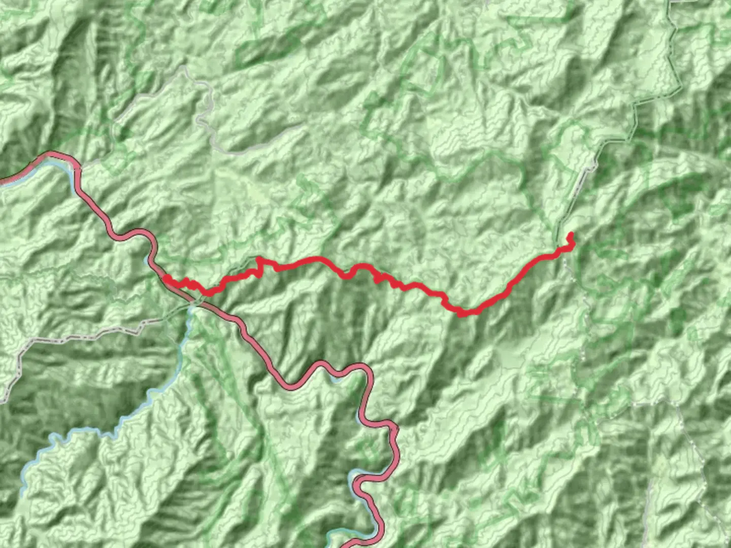
Max Patch Mountain, Wildcat Top and Snowbird Mountain via Appalachian Trail
Download
Preview
Add to list
More
45.2 km
~12 hrs 41 min
2195 m
Out and Back
“Embark on a breathtaking, challenging adventure through the scenic and historic Appalachian Trail's rugged beauty.”
Embarking on the Max Patch Mountain, Wildcat Top, and Snowbird Mountain via the Appalachian Trail offers a challenging yet rewarding adventure through the scenic landscapes of the Appalachian region. This out-and-back trail stretches approximately 45 kilometers (about 28 miles) with an elevation gain of around 2,100 meters (approximately 6,890 feet), making it a demanding trek suitable for experienced hikers.
Getting There
The trailhead is conveniently located near Cocke County, Tennessee. For those traveling by car, the nearest significant landmark is the town of Hartford, Tennessee. From Hartford, head towards Max Patch Road, which will lead you to the trailhead. If you prefer public transport, the closest major city with bus services is Asheville, North Carolina. From Asheville, you can rent a car or arrange for a shuttle service to reach the trailhead.
Trail Highlights
Max Patch Mountain
The journey begins with a climb up Max Patch Mountain, renowned for its expansive bald summit offering panoramic views of the surrounding mountains. This section of the trail is approximately 8 kilometers (5 miles) from the start and involves an elevation gain of about 300 meters (984 feet). The open summit is a perfect spot for a break, allowing hikers to soak in the breathtaking vistas that stretch across the Pisgah National Forest and beyond.
Wildcat Top
Continuing along the Appalachian Trail, hikers will reach Wildcat Top, a lesser-known but equally captivating peak. This section is characterized by dense forests and diverse flora, providing a serene atmosphere. The trail here is rugged, with steep inclines and rocky terrain, demanding careful navigation. HiiKER is an excellent tool to ensure you stay on track through this challenging section.
Snowbird Mountain
The final significant landmark on this trail is Snowbird Mountain, located approximately 22 kilometers (14 miles) from the trailhead. The ascent to Snowbird Mountain is steep, with an elevation gain of around 600 meters (1,968 feet). At the summit, hikers are rewarded with stunning views and a sense of accomplishment. The area is known for its rich biodiversity, including sightings of deer, black bears, and a variety of bird species.
Historical Significance
This trail traverses a section of the iconic Appalachian Trail, a historic footpath that stretches over 3,500 kilometers (2,200 miles) from Georgia to Maine. The region is steeped in history, with the Appalachian Mountains being one of the oldest mountain ranges in the world. The trail itself has been a symbol of conservation and outdoor recreation since its completion in the 1930s.
Preparation and Safety
Given the trail's difficulty rating, hikers should be well-prepared with adequate supplies, including water, food, and appropriate clothing for changing weather conditions. The trail can be remote in sections, so carrying a reliable navigation tool like HiiKER is essential. Additionally, be aware of wildlife and practice Leave No Trace principles to preserve the natural beauty of the area.
This challenging hike offers a unique opportunity to experience the rugged beauty and historical significance of the Appalachian region, making it a must-do for seasoned adventurers.

What to expect?
Activity types
Comments and Reviews
User comments, reviews and discussions about the Max Patch Mountain, Wildcat Top and Snowbird Mountain via Appalachian Trail, Tennessee.
average rating out of 5
0 rating(s)