Download
Preview
Add to list
More
23.3 km
~2 days
1513 m
Multi-Day
“Trek the Appalachian Trail's rugged beauty, steep climbs, and rich history from Davenport Gap to Max Patch.”
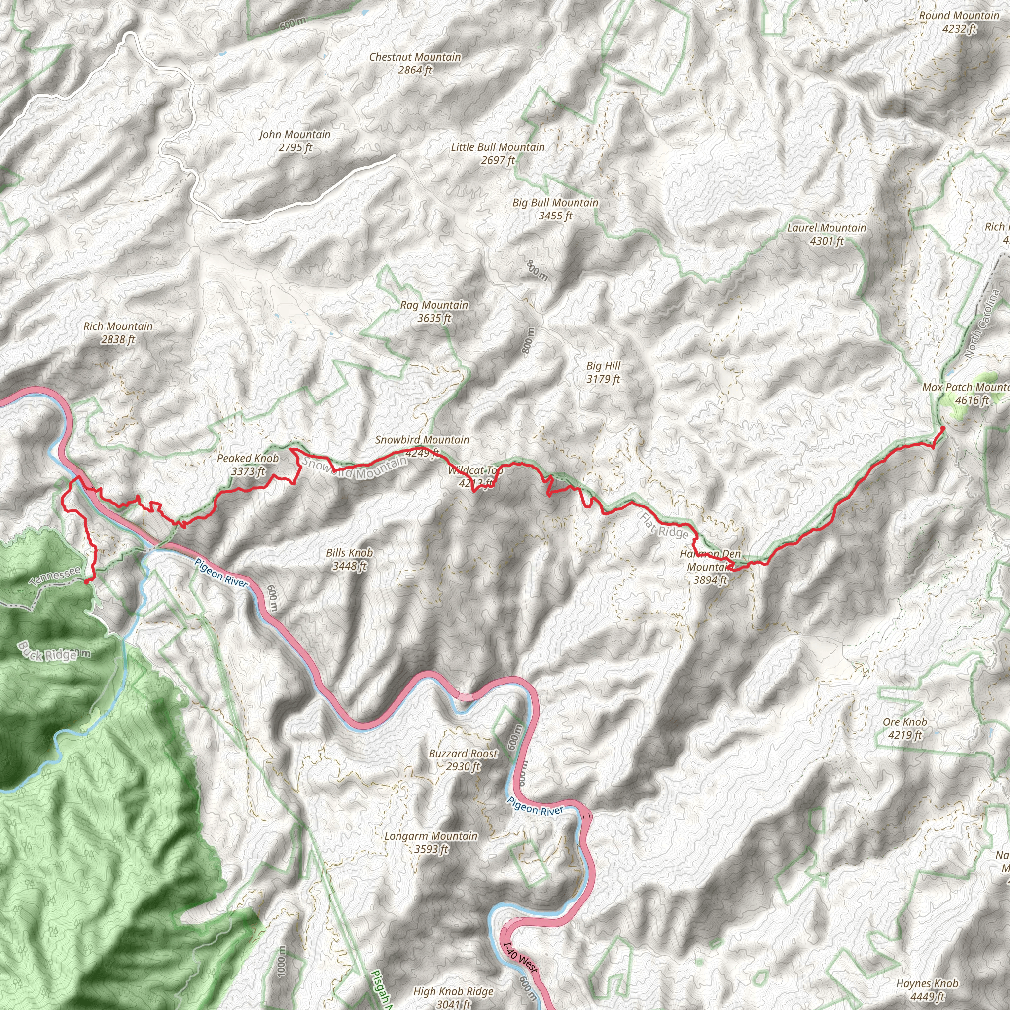
Embarking on the Appalachian Trail from Davenport Gap to Max Patch Road offers a challenging yet rewarding experience, covering approximately 23 kilometers (around 14 miles) with an elevation gain of roughly 1500 meters (about 4900 feet). This point-to-point section hike is situated near Haywood County, North Carolina, and is rated as extra difficult due to its steep ascents and rugged terrain.
Getting to the Trailhead To reach the trailhead near Davenport Gap, hikers can drive to the parking area close to the intersection of Davenport Road and Interstate 40. For those relying on public transportation, options are limited, but regional services may offer routes to nearby towns, from where a taxi or shuttle service can be arranged to the trailhead.
Navigating the Trail The journey begins at Davenport Gap, where the Appalachian Trail crosses under Interstate 40. Hikers will immediately be greeted by the dense canopy of the Pisgah National Forest, which provides a habitat for a diverse array of flora and fauna. The trail is well-marked with the iconic white blazes, and for additional navigation support, the HiiKER app can be used to track progress and ensure you remain on the correct path.
Natural Highlights and Landmarks As you ascend, the forested path will lead you through a series of switchbacks, offering occasional glimpses of the Pigeon River below. At approximately 6 kilometers (about 3.7 miles) in, you'll reach the summit of Snowbird Mountain, a notable landmark where you can pause to enjoy panoramic views of the surrounding landscape.
Continuing on, the trail meanders through a mix of hardwood and coniferous forests, home to wildlife such as black bears, white-tailed deer, and a variety of bird species. Hikers should be aware of their surroundings and knowledgeable about wildlife safety precautions.
Historical Significance This region of the Appalachian Trail is steeped in history, with the trail itself being a monument to the conservation efforts that began in the early 20th century. The trail traverses land that was once inhabited by the Cherokee people, and later by European settlers. The forests around Max Patch were heavily logged in the past, but conservation efforts have allowed the natural beauty to flourish once again.
Reaching Max Patch The final stretch of the hike is a gradual climb to the bald summit of Max Patch, a grassy mountaintop that offers a 360-degree view of the Great Smoky Mountains, the Unaka Range, and the Black Mountains. The summit is approximately 21 kilometers (13 miles) from the start of the hike, leaving a gentle descent to Max Patch Road.
Conclusion of the Hike Upon reaching Max Patch Road, hikers will find themselves at the end of this section. If you've arranged for a shuttle pickup, this is where you'll meet your ride. Otherwise, ensure you have a plan for returning to your starting point or moving on to your next destination.
Preparation and Planning Due to the trail's difficulty and remote nature, it is essential to be well-prepared with adequate supplies, including water, food, and layers for changing weather conditions. A map and compass, along with the HiiKER app, should be part of your navigation toolkit. It's also wise to inform someone of your hiking plan and expected return time.
This section of the Appalachian Trail promises an immersive experience in the wilderness, challenging ascents, and breathtaking vistas that reward the intrepid hiker with a sense of accomplishment and connection to the natural world.
What to expect?
Activity types
Comments and Reviews
User comments, reviews and discussions about the Appalachian Trail Section Hike - Davenport Gap to Max Patch Road, North Carolina.
4.45
average rating out of 5
11 rating(s)

