5.9 km
~1 hrs 54 min
434 m
“Explore the captivating 6 km Teufelsberg Loop via Kreuzweg Burrweiler for stunning views and rich cultural landmarks.”
Starting near Südliche Weinstraße in Germany, the Teufelsberg Loop via Kreuzweg Burrweiler is a captivating 6 km (approximately 3.7 miles) loop trail with an elevation gain of around 400 meters (about 1,312 feet). This trail is rated as medium difficulty, making it suitable for moderately experienced hikers.
### Getting There To reach the trailhead, you can drive or use public transportation. If driving, head towards the village of Burrweiler, which is well-signposted from major roads in the region. Parking is available near the trailhead. For those using public transport, take a train to the nearby town of Landau in der Pfalz and then a local bus to Burrweiler. The bus stop is conveniently located near the start of the trail.
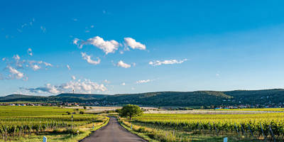
### Trail Overview The trail begins near the picturesque village of Burrweiler, known for its charming vineyards and traditional German architecture. As you start your hike, you'll be greeted by a well-marked path that winds through lush forests and open meadows. The initial section is relatively gentle, allowing you to ease into the hike.
### Key Landmarks and Elevation At approximately 1 km (0.6 miles) into the hike, you'll encounter the Kreuzweg, a series of 14 stations of the cross that are significant to the local community. This section of the trail is not only spiritually enriching but also offers a glimpse into the region's cultural heritage.
Continuing on, the trail begins to ascend more steeply. Around the 2.5 km (1.5 miles) mark, you'll reach a notable elevation gain, offering panoramic views of the surrounding Palatinate Forest and the Rhine Valley. This is a great spot to take a break and soak in the scenery.
### Teufelsberg Summit The highlight of the trail is the Teufelsberg summit, located roughly 3 km (1.9 miles) from the start. At an elevation of about 400 meters (1,312 feet), the summit provides breathtaking views and is an excellent spot for photography. The name "Teufelsberg" translates to "Devil's Mountain," and local legends add a mystical aura to this location.
### Flora and Fauna The trail is rich in biodiversity. As you hike, you'll pass through dense forests of oak and beech trees. Keep an eye out for local wildlife, including deer, foxes, and a variety of bird species. In the spring and summer months, the meadows are adorned with wildflowers, adding vibrant colors to your journey.
### Historical Significance The region around Südliche Weinstraße has a deep historical significance. The trail itself passes near ancient Roman ruins and medieval castles, reflecting the area's long and varied history. The village of Burrweiler, with its traditional half-timbered houses, offers a glimpse into the architectural styles that have been preserved over centuries.
### Navigation and Safety For navigation, it's recommended to use the HiiKER app, which provides detailed maps and real-time updates. The trail is well-marked, but having a reliable navigation tool ensures you stay on track. Wear sturdy hiking boots, as some sections can be rocky and uneven. Carry sufficient water and snacks, especially during warmer months.
### Completing the Loop The descent begins after the summit, leading you back through serene forest paths and eventually returning to the village of Burrweiler. The final stretch is relatively easy, allowing you to cool down and reflect on the beautiful landscapes you've traversed.
This trail offers a perfect blend of natural beauty, cultural landmarks, and historical significance, making it a must-visit for any hiking enthusiast exploring the Südliche Weinstraße region.
Reviews
User comments, reviews and discussions about the Teufelsberg Loop via Kreuzweg Burrweiler, Germany.
0.0
average rating out of 5
0 rating(s)


