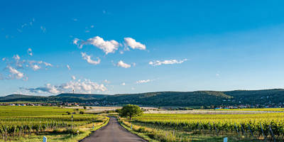
Neuscharfeneck Loop via Pfälzerwald Rot Weiber Balken
13.6 km
~3 hrs 42 min
595 m
“Explore the scenic Pfälzerwald on the 14 km Neuscharfeneck Loop, rich in nature, history, and wildlife.”
Starting near the charming region of Südliche Weinstraße in Germany, the Neuscharfeneck Loop via Pfälzerwald Rot Weiber Balken is a captivating 14 km (8.7 miles) loop trail with an elevation gain of approximately 500 meters (1,640 feet). This medium-difficulty trail offers a blend of natural beauty, historical landmarks, and diverse wildlife, making it a rewarding experience for hikers.
### Getting There To reach the trailhead, you can drive or use public transport. If driving, head towards the Südliche Weinstraße district, where ample parking is available near the trailhead. For those using public transport, take a train to the nearest station in Landau in der Pfalz, and from there, a local bus can take you closer to the starting point. The nearest significant landmark to the trailhead is the village of Ramberg.
### Trail Overview The trail begins with a gentle ascent through the lush Pfälzerwald forest, known for its dense canopy of mixed deciduous and coniferous trees. Early on, you’ll encounter the first significant landmark, the ruins of Neuscharfeneck Castle, approximately 3 km (1.9 miles) into the hike. This medieval castle, dating back to the 13th century, offers panoramic views of the surrounding forest and vineyards. The castle's strategic location once served as a defensive stronghold, and its ruins provide a glimpse into the region's storied past.
### Flora and Fauna As you continue, the trail meanders through diverse ecosystems. The Pfälzerwald is home to a variety of wildlife, including deer, wild boar, and numerous bird species. Keep an eye out for the European green woodpecker and the black woodpecker, both of which are commonly seen in this area. The forest floor is often carpeted with wildflowers in the spring and summer, adding vibrant colors to your hike.
### Midway Point Around the halfway mark, at approximately 7 km (4.3 miles), you’ll reach the Rot Weiber Balken, a notable red sandstone rock formation. This natural landmark is a great spot for a rest and offers another opportunity for stunning photographs. The trail here is well-marked, but it's advisable to use the HiiKER app for navigation to ensure you stay on the correct path.
### Elevation and Terrain The trail features a mix of terrains, including forest paths, rocky sections, and open meadows. The elevation gain is gradual but steady, with the most significant climbs occurring in the first half of the hike. The highest point of the trail is near the Neuscharfeneck Castle ruins, offering the most challenging ascent but also the most rewarding views.
### Historical Significance The region is steeped in history, with the Neuscharfeneck Castle being a highlight. Built in the 13th century, the castle played a crucial role in the defense of the Palatinate region. The ruins you see today are a testament to the architectural prowess of the medieval period and offer a tangible connection to the past.
### Final Stretch The final stretch of the trail descends gradually back towards the starting point, passing through serene forested areas and open fields. This section is less strenuous, allowing you to enjoy the tranquility of the Pfälzerwald and reflect on the journey.
### Practical Tips - Wear sturdy hiking boots, as the trail can be rocky and uneven in places. - Bring sufficient water and snacks, especially during warmer months. - Check the weather forecast before heading out, as conditions can change rapidly in the forest. - Use the HiiKER app for real-time navigation and trail updates.
This trail offers a perfect blend of natural beauty, historical intrigue, and moderate physical challenge, making it an ideal choice for hikers looking to explore the scenic Pfälzerwald region.
Reviews
User comments, reviews and discussions about the Neuscharfeneck Loop via Pfälzerwald Rot Weiber Balken, Germany.
0.0
average rating out of 5
0 rating(s)


