11.9 km
~3 hrs 32 min
694 m
“Experience the Rundwanderweg Huettenhohl: a 12 km loop through forests, meadows, and vineyards in Germany.”
Starting your hike near the Südliche Weinstraße in Germany, the Rundwanderweg Huettenhohl is a captivating 12 km (7.5 miles) loop trail with an elevation gain of approximately 600 meters (1,970 feet). This trail is rated as medium difficulty, making it suitable for hikers with some experience and a reasonable level of fitness.
### Getting There To reach the trailhead, you can drive or use public transport. If driving, set your GPS to Südliche Weinstraße, Germany. For those using public transport, the nearest significant landmark is the town of Bad Bergzabern. From there, local buses or a short taxi ride can take you to the trailhead.
### Trail Overview The Rundwanderweg Huettenhohl offers a diverse hiking experience, weaving through dense forests, open meadows, and charming vineyards. The trail is well-marked, but it's always a good idea to have a reliable navigation tool like HiiKER to ensure you stay on track.
### Key Landmarks and Sections
#### Forested Pathways The initial part of the trail takes you through lush, dense forests. This section is relatively shaded, providing a cool and serene environment. Keep an eye out for local wildlife such as deer and various bird species. The forest floor is often carpeted with wildflowers in the spring and summer, adding a splash of color to your hike.
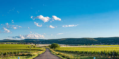
#### Open Meadows and Vineyards As you progress, the trail opens up into expansive meadows and vineyards. This section offers panoramic views of the surrounding countryside. The elevation gain here is gradual, making it a pleasant stretch to catch your breath and enjoy the scenery. The vineyards are particularly beautiful in the autumn when the leaves change color.
#### Historical Significance The region around Südliche Weinstraße is steeped in history. Along the trail, you may come across remnants of old stone walls and ancient farmhouses, some dating back to the medieval period. These historical landmarks provide a glimpse into the area's rich past and are perfect spots for a brief rest and some photography.
### Elevation and Terrain The trail features a total elevation gain of around 600 meters (1,970 feet). The ascent is spread out over the 12 km (7.5 miles), with some steeper sections that require careful footing. The terrain varies from well-trodden paths to rocky outcrops, so sturdy hiking boots are recommended.
### Wildlife and Flora The Rundwanderweg Huettenhohl is home to a variety of wildlife. Besides deer, you might spot foxes, hares, and a plethora of bird species. The flora is equally diverse, with oak, beech, and pine trees dominating the forested areas. In the meadows, look for wildflowers like daisies, poppies, and buttercups.
### Final Stretch The final part of the loop brings you back through a mix of forest and open land, gradually descending towards the trailhead. This section is less strenuous, allowing you to reflect on the hike and enjoy the last of the scenic views.
### Practical Tips - Navigation: Use HiiKER for accurate trail navigation. - Footwear: Sturdy hiking boots are essential due to varied terrain. - Weather: Check the weather forecast before you go, as conditions can change rapidly. - Supplies: Carry enough water and snacks, as there are limited facilities along the trail. - Wildlife: Be respectful of wildlife and maintain a safe distance.
This trail offers a perfect blend of natural beauty, historical intrigue, and moderate physical challenge, making it a rewarding experience for any hiker.
Reviews
User comments, reviews and discussions about the Rundwanderweg Huettenhohl, Germany.
4.0
average rating out of 5
3 rating(s)


