7.6 km
~1 hrs 49 min
183 m
“The Rundwanderweg Theuern offers an 8 km scenic loop with nature, history, and wildlife near Sonneberg.”
Starting near the charming town of Sonneberg, Germany, the Rundwanderweg Theuern is an 8 km (approximately 5 miles) loop trail with an elevation gain of around 100 meters (328 feet). This medium-difficulty trail offers a delightful mix of natural beauty, historical landmarks, and opportunities for wildlife spotting.
### Getting There To reach the trailhead, you can either drive or use public transport. If driving, head towards Sonneberg and look for parking near the town center or designated trail parking areas. For those using public transport, Sonneberg is well-connected by train. From the Sonneberg Hauptbahnhof (main train station), you can take a local bus or taxi to the trailhead.
### Trail Navigation For navigation, it's highly recommended to use the HiiKER app, which provides detailed maps and real-time updates to ensure you stay on track.
### Trail Highlights
#### Nature and Wildlife The trail meanders through a variety of landscapes, including dense forests, open meadows, and gentle hills. Keep an eye out for local wildlife such as deer, foxes, and a variety of bird species. The forested sections are particularly enchanting, with tall trees providing ample shade and a serene atmosphere.
#### Historical Significance One of the key highlights of this trail is its historical significance. The region around Sonneberg has a rich history, particularly in toy manufacturing. As you hike, you may come across old buildings and remnants of the area's industrial past. The town of Theuern itself has historical roots dating back several centuries, and you might find plaques or signs detailing its history along the way.
### Points of Interest
#### Theuern Village Approximately 3 km (1.86 miles) into the hike, you'll reach the quaint village of Theuern. This is a great spot to take a break, explore the local architecture, and perhaps enjoy a snack. The village is known for its traditional German houses and a small church that dates back to the 18th century.
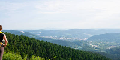
#### Scenic Overlook Around the 5 km (3.1 miles) mark, the trail ascends to a scenic overlook. Here, you can enjoy panoramic views of the surrounding countryside, including the Thuringian Forest in the distance. This spot is perfect for photography and offers a moment of tranquility.
### Trail Conditions and Safety The trail is well-marked and maintained, but it's always wise to be prepared for varying conditions. Wear sturdy hiking boots, especially after rain, as some sections can become muddy. Carry enough water and snacks, and consider bringing a small first-aid kit.
### Final Stretch As you loop back towards Sonneberg, the final 2 km (1.24 miles) are relatively flat and easy, allowing you to cool down and reflect on the hike. The trail eventually leads you back to the starting point, completing a rewarding and enriching loop.
This trail offers a balanced mix of natural beauty, historical intrigue, and moderate physical challenge, making it a perfect day hike for those looking to explore the scenic and historical richness of the Sonneberg region.
Reviews
User comments, reviews and discussions about the Rundwanderweg Theuern, Germany.
4.0
average rating out of 5
1 rating(s)


