Jungfrauenweiher via Schwester-Matthia-Weg and Bergmannsweg
8.4 km
~1 hrs 54 min
136 m
“Explore the lush forests, historical paths, and vibrant wildlife of the 8 km Jungfrauenweiher loop trail.”
Starting your hike near the Rheinisch-Bergischer Kreis in Germany, the Jungfrauenweiher via Schwester-Matthia-Weg and Bergmannsweg trail offers an 8 km (approximately 5 miles) loop with an elevation gain of around 100 meters (328 feet). This medium-difficulty trail is perfect for those looking to explore the natural beauty and historical significance of the region.### Getting There
To reach the trailhead, you can either drive or use public transportation. If driving, set your GPS to the nearest known address: Bergisch Gladbach, a town in the Rheinisch-Bergischer Kreis. For those using public transport, take a train to Bergisch Gladbach station and then a local bus to the trailhead area. The bus routes are well-connected and frequent, making it convenient for hikers.### Trail Overview
The trail begins with a gentle ascent through a lush forest, providing a serene start to your hike. As you progress, you'll encounter the Schwester-Matthia-Weg, a path named after a local historical figure known for her contributions to the community. This section of the trail is relatively flat, making it an excellent opportunity to enjoy the surrounding flora and fauna.### Key Landmarks and Nature
Around the 2 km (1.2 miles) mark, you'll come across the Jungfrauenweiher, a picturesque pond that serves as a perfect spot for a short break. The pond is home to various species of birds and aquatic life, so keep your eyes peeled for wildlife. The area around the pond is also rich in plant life, including native wildflowers and towering trees.Continuing on, you'll transition onto the Bergmannsweg, a path that pays homage to the region's mining history. This part of the trail features several informational plaques detailing the area's mining past, offering a fascinating glimpse into the lives of the miners who once worked here. The terrain becomes slightly more challenging, with a few moderate inclines and rocky sections.### Wildlife and Flora
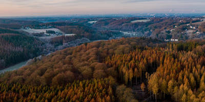
The trail is abundant with wildlife, including deer, foxes, and a variety of bird species. The forested areas are particularly vibrant in spring and autumn, with blooming flowers and colorful foliage enhancing the hiking experience. The diverse ecosystem makes this trail a haven for nature enthusiasts.### Navigation and Safety
For navigation, it's highly recommended to use the HiiKER app, which provides detailed maps and real-time updates. The trail is well-marked, but having a reliable navigation tool ensures you stay on the right path. Wear sturdy hiking boots, as some sections can be rocky and uneven. Carry enough water and snacks, especially if you plan to take your time exploring the historical sites and natural beauty.### Final Stretch
As you near the end of the loop, the trail descends gently back towards the starting point. This final section offers sweeping views of the surrounding landscape, making it a rewarding end to your hike. The entire loop takes around 2-3 hours to complete, depending on your pace and the number of stops you make along the way.This trail offers a perfect blend of natural beauty, historical significance, and moderate physical challenge, making it a must-visit for hikers in the Rheinisch-Bergischer Kreis region.
Reviews
User comments, reviews and discussions about the Jungfrauenweiher via Schwester-Matthia-Weg and Bergmannsweg, Germany.
4.0
average rating out of 5
6 rating(s)
Loading reviews...


