9.1 km
~2 hrs 5 min
160 m
“This 9 km loop near Bergisch Gladbach offers scenic views, historical landmarks, and diverse wildlife.”
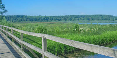
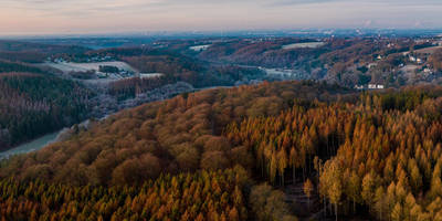
Starting near the Rheinisch-Bergischer Kreis in Germany, this 9 km (approximately 5.6 miles) loop trail offers a moderate challenge with an elevation gain of around 100 meters (328 feet). The trailhead is easily accessible by both public transport and car. If you're taking public transport, the nearest significant landmark is the town of Bergisch Gladbach, which is well-connected by regional trains and buses. From there, local buses can take you closer to the trailhead. For those driving, parking is available near the starting point.### Trail OverviewThe trail begins with a gentle ascent through a mixed forest, where you'll be greeted by the serene sounds of nature. The initial 2 km (1.2 miles) are relatively easy, making it a good warm-up for the more challenging sections ahead. As you hike, keep an eye out for the diverse flora, including oak, beech, and pine trees, which provide ample shade and a cool environment even during warmer months.### Significant Landmarks and Points of InterestAround the 3 km (1.9 miles) mark, you'll come across the first significant landmark: the historic Bergischer Weg. This ancient trade route has been used for centuries and offers a glimpse into the region's rich history. Here, you can take a moment to appreciate the well-preserved cobblestone paths and old signposts that have guided travelers for generations.Continuing along the trail, you'll reach the highest point at approximately 4.5 km (2.8 miles). This section offers panoramic views of the surrounding countryside, including the picturesque villages and rolling hills of the Bergisches Land region. It's an excellent spot for a short break and some photography.### Wildlife and NatureThe trail is home to a variety of wildlife, including deer, foxes, and numerous bird species. Birdwatchers will particularly enjoy the chance to spot woodpeckers, owls, and various songbirds. The underbrush is rich with ferns, wildflowers, and mushrooms, especially in the spring and autumn months.### Navigation and SafetyNavigating the trail is straightforward, but it's always a good idea to have a reliable navigation tool. HiiKER is highly recommended for this purpose, as it provides detailed maps and real-time updates. The trail is well-marked with signs and colored blazes, but having a digital backup ensures you stay on course.### Final StretchThe final 2 km (1.2 miles) of the trail take you through a more open landscape, with meadows and small streams. This section is relatively flat and offers a relaxing end to your hike. As you loop back towards the starting point, you'll pass by several traditional German farmhouses, some of which date back to the 18th century.### Getting BackOnce you complete the loop, you can easily return to Bergisch Gladbach via the same public transport options or head back to your parked car. The town itself is worth a visit, with its charming streets, local eateries, and historical sites.This trail offers a perfect blend of natural beauty, historical significance, and moderate physical challenge, making it an ideal choice for hikers of all levels.
Reviews
User comments, reviews and discussions about the Tuetberg via Bergischer Weg, Germany.
4.0
average rating out of 5
4 rating(s)
Loading reviews...


