6.6 km
~1 hrs 38 min
189 m
“Explore the scenic, historic, and moderately challenging 7 km Hammerweg Rundweg and Bergischer Weg Loop in Germany's Bergisches Land.”
Starting your hike near Rheinisch-Bergischer Kreis, Germany, the Hammerweg Rundweg and Bergischer Weg Loop offers a delightful 7 km (approximately 4.35 miles) journey through the picturesque landscapes of the Bergisches Land region. With an elevation gain of around 100 meters (328 feet), this loop trail is rated as medium difficulty, making it suitable for moderately experienced hikers.
### Getting There To reach the trailhead, you can either drive or use public transport. If driving, set your GPS to the nearest known address: Am Hammer, 51491 Overath, Germany. For those using public transport, take a train to Overath station, which is well-connected from major cities like Cologne. From Overath station, you can catch a local bus or taxi to Am Hammer, which is just a short ride away.
### Trail Navigation For navigation, it's highly recommended to use the HiiKER app, which provides detailed maps and real-time updates to ensure you stay on track.
### Trail Highlights and Landmarks As you embark on the trail, you'll first encounter a serene forested area, rich with deciduous trees like oak and beech. This section is relatively flat, making it a good warm-up for the more undulating terrain ahead. After about 1 km (0.62 miles), you'll start to notice a gradual incline.
### Historical Significance Around the 2 km (1.24 miles) mark, you'll come across remnants of old stone walls and foundations, hinting at the historical significance of the region. This area was once dotted with small settlements and farms dating back to the medieval period. The Bergisches Land region itself has a rich history, having been a significant area for iron and textile industries in the 19th century.
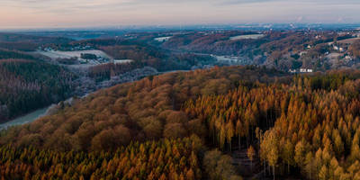
### Scenic Views and Wildlife As you continue, the trail opens up to offer stunning panoramic views of the surrounding hills and valleys. This is a great spot to take a break and soak in the natural beauty. Keep an eye out for local wildlife, including deer, foxes, and a variety of bird species such as woodpeckers and owls.
### Midpoint and Elevation Gain By the time you reach the midpoint of the trail, you'll have gained most of the elevation. This section, around 3.5 km (2.17 miles) in, is the highest point of the loop and offers a fantastic vantage point for photography. The elevation gain here is approximately 50 meters (164 feet) from the trailhead.
### Descending and Returning The descent begins gradually, taking you through more forested areas and past small streams. The sound of flowing water adds a tranquil element to this part of the hike. Around the 5 km (3.11 miles) mark, you'll pass by a charming old mill, which has been converted into a small museum showcasing the region's industrial past.
### Final Stretch The final stretch of the trail is relatively flat and takes you through open meadows and fields. This is a great area to spot wildflowers, especially in the spring and summer months. As you approach the end of the loop, you'll find yourself back at the starting point near Am Hammer, completing your 7 km journey.
This trail offers a perfect blend of natural beauty, historical intrigue, and moderate physical challenge, making it a rewarding experience for any hiker.
Reviews
User comments, reviews and discussions about the Hammerweg Rundweg and Bergischer Weg Loop, Germany.
5.0
average rating out of 5
3 rating(s)


