10.7 km
~2 hrs 25 min
169 m
“Discover scenic beauty and historical intrigue on Germany's 11 km Auersteg Rundweg A2 loop trail.”
Starting near the picturesque Rheinisch-Bergischer Kreis in Germany, this 11 km (approximately 6.8 miles) loop trail offers a delightful mix of natural beauty and historical intrigue. With an elevation gain of around 100 meters (328 feet), the Auersteg Rundweg A2 is estimated to be of medium difficulty, making it accessible for most hikers with a moderate level of fitness.
### Getting There To reach the trailhead, you can either drive or use public transport. If you're driving, set your GPS to the nearest known address: Bergisch Gladbach, a charming town in the Rheinisch-Bergischer Kreis. For those opting for public transport, take a train to Bergisch Gladbach station. From there, local buses can take you closer to the trailhead. Check the latest schedules and routes on local transit websites or apps.
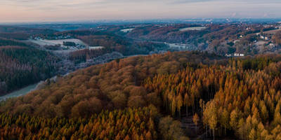
### Trail Highlights and Navigation The trail begins near Bergisch Gladbach and quickly immerses you in the serene landscapes of the region. As you start your hike, you'll notice the lush greenery and well-maintained paths that characterize this area. The trail is well-marked, but it's always a good idea to have a reliable navigation tool like HiiKER to ensure you stay on course.
### Nature and Wildlife As you traverse the loop, you'll encounter a variety of flora and fauna. The dense forests are home to a range of bird species, so keep your eyes peeled for woodpeckers and songbirds. The underbrush is rich with ferns and wildflowers, particularly vibrant in the spring and summer months.
### Historical Significance The Rheinisch-Bergischer Kreis region is steeped in history, and this trail offers glimpses into its past. One of the notable landmarks you'll encounter is the Altenberg Abbey, a former Cistercian monastery with roots dating back to the 12th century. Although the trail doesn't pass directly through the abbey, it's worth a short detour to explore this historical site.
### Points of Interest Around the 5 km (3.1 miles) mark, you'll come across a scenic viewpoint that offers panoramic views of the surrounding countryside. This is an excellent spot to take a break and soak in the natural beauty. Another highlight is the small, tranquil lake located roughly 8 km (5 miles) into the hike. It's a perfect place for a picnic or a moment of reflection.
### Terrain and Conditions The trail features a mix of terrains, including forest paths, open meadows, and some rocky sections. While the elevation gain is moderate, some parts of the trail can be steep and may require careful footing, especially after rain. Good hiking boots are recommended to navigate these sections comfortably.
### Final Stretch As you near the end of the loop, the trail gently descends back towards Bergisch Gladbach. The final kilometers are relatively easy, allowing you to cool down and reflect on the journey. The loop nature of the trail means you'll end up right where you started, making logistics simple.
This trail offers a well-rounded hiking experience with its blend of natural beauty, historical landmarks, and moderate challenge. Whether you're a local or a visitor, the Auersteg Rundweg A2 provides a rewarding day out in the heart of Germany's scenic countryside.
Reviews
User comments, reviews and discussions about the Auersteg Rundweg A2, Germany.
4.0
average rating out of 5
1 rating(s)


