Oberer Schlossweiher and Unterer Schlossweiher via Heuberg Allgaeu Weg
8.7 km
~2 hrs 2 min
181 m
“Explore lush forests, tranquil ponds, and historical sites on this scenic 9 km Ravensburg loop trail.”
Starting near the picturesque town of Ravensburg, Germany, the Oberer Schlossweiher and Unterer Schlossweiher via Heuberg Allgaeu Weg is a delightful 9 km (5.6 miles) loop trail with an elevation gain of approximately 100 meters (328 feet). This trail offers a medium difficulty rating, making it suitable for moderately experienced hikers.
### Getting There
To reach the trailhead, you can either drive or use public transport. If you're driving, set your GPS to Ravensburg, and look for parking near the town center. For those using public transport, Ravensburg is well-connected by train and bus services. The nearest significant landmark to the trailhead is the Ravensburg train station, from where you can either walk or take a short taxi ride to the starting point.
### Trail Overview
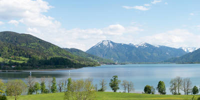
The trail begins near the Ravensburg town center and quickly immerses you in the serene beauty of the Allgäu region. As you start your hike, you'll be greeted by lush forests and the tranquil waters of the Oberer Schlossweiher and Unterer Schlossweiher ponds. These ponds are perfect spots for a brief rest or a picnic, offering stunning reflections of the surrounding trees and sky.
### Key Landmarks and Points of Interest
#### Oberer Schlossweiher
Approximately 2 km (1.2 miles) into the hike, you'll reach the Oberer Schlossweiher. This pond is surrounded by dense forest and offers a peaceful atmosphere. Keep an eye out for various bird species that frequent the area, making it a great spot for birdwatching.
#### Unterer Schlossweiher
Continuing along the trail, you'll come across the Unterer Schlossweiher at around the 4 km (2.5 miles) mark. This pond is slightly larger and equally picturesque. The area around Unterer Schlossweiher is rich in flora, with a variety of wildflowers blooming in the spring and summer months.
### Historical Significance
The region around Ravensburg has a rich history dating back to medieval times. Ravensburg itself was a significant trading center in the Middle Ages, and remnants of its historical significance can be seen in the architecture and layout of the town. The trail passes near several historical landmarks, including old farmhouses and remnants of medieval structures, offering a glimpse into the past.
### Wildlife and Nature
The trail is home to a diverse range of wildlife. Deer, foxes, and various bird species are commonly spotted along the route. The forested areas are rich in biodiversity, with a mix of deciduous and coniferous trees providing a habitat for numerous species. In the spring and summer, the trail is adorned with wildflowers, adding a splash of color to the verdant landscape.
### Navigation
For navigation, it is highly recommended to use the HiiKER app, which provides detailed maps and real-time updates. The trail is well-marked, but having a reliable navigation tool will ensure you stay on track and can fully enjoy the hike without any worries.
### Final Stretch
As you near the end of the loop, the trail gradually descends back towards Ravensburg. The final 2 km (1.2 miles) offer gentle slopes and beautiful views of the town as you make your way back to the starting point. This section is particularly scenic during the late afternoon when the setting sun casts a golden hue over the landscape.
This 9 km loop trail offers a perfect blend of natural beauty, historical intrigue, and moderate physical challenge, making it a must-visit for hikers exploring the Allgäu region.
Reviews
User comments, reviews and discussions about the Oberer Schlossweiher and Unterer Schlossweiher via Heuberg Allgaeu Weg, Germany.
0.0
average rating out of 5
0 rating(s)


